
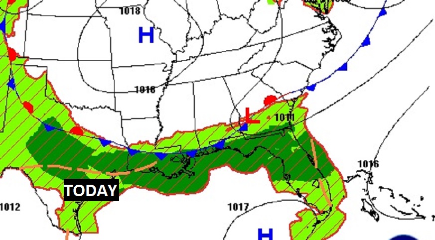
Good Morning! The weather news, for the Holiday Weekend is pretty good depending on where you live. Here in central Alabama, and through much of south Alabama, today and the 4th of July should be dry. Down the coast, though, a stalled front will keep the rain chance quite high, unfortunately.
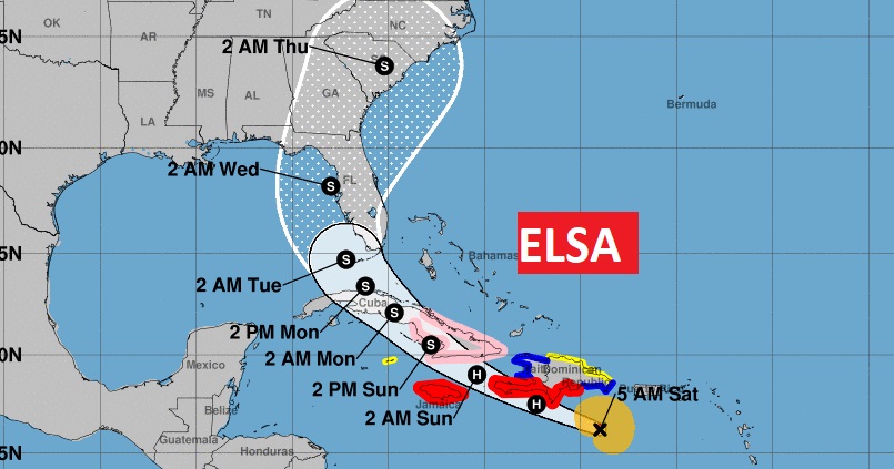
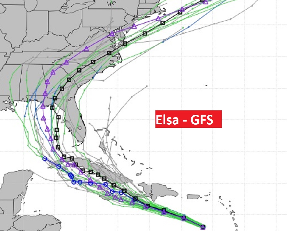
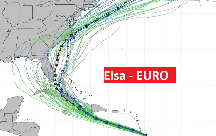
Hurricane Elsa is the big story as we look at the week ahead. There is a a very good chance Elsa will make landfall somewhere in the southeastern U.S. by about Tuesday or Wednesday. But where? When? How strong? I have the latest from the Hurricane Center and we’ll track the various model tracks, below.
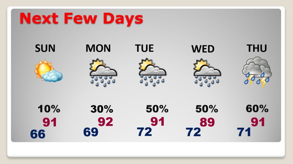
TODAY: Cloudy skies early, give way to a good bit of sunshine. High in the upper 80’s. Humidity will come down a bit by afternoon. You feel an improvement. North wind at 4 to 8. Tonight: Mainly clear and a little more comfortable. Low in the mid 60’s.
4th of July: Lots of sun. Less humid. High 91. Mainly clear Sunday night. Low in the upper 60’s.
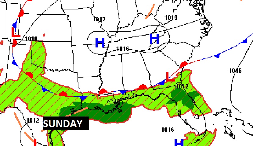
NEXT FEW DAYS: Risk of scattered PM storms return Monday. Rain chances increase Tuesday & Wednesday. I’ll put the Thursday rain chance in the likely range. Uncertainty remains on the future track of Elsa, and it’s potential impact on Alabama. If the track remains EAST of us, the news is certainly better.
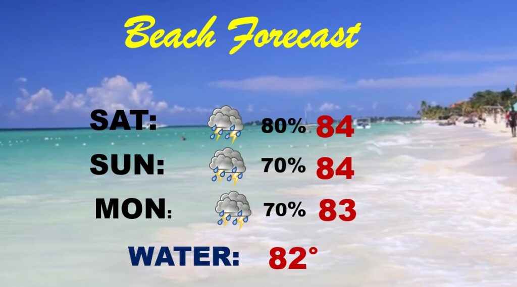
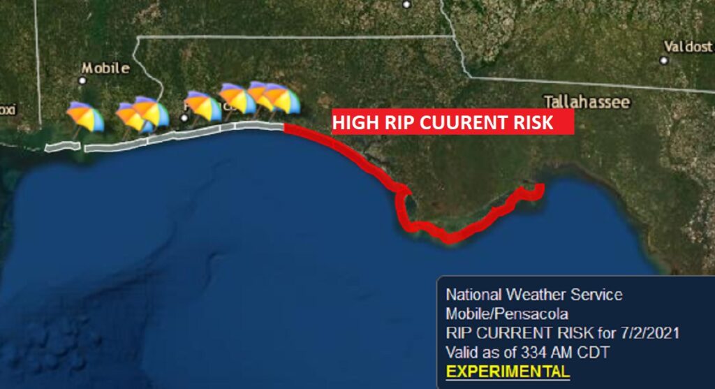
BEACH OUTLOOK: Unfortunately for thousands, who are spending the 4th of July Weekend on the coast, the forecast is not bright. The stalled front near the coast, will keep the rain chance quite high for the entire holiday weekend. High Rip Current Risk is listed from about Destin through Panama City and beyond. RED Flags.
HURRICANE ELSA: At 4AM, fast-moving Elsa was about 190 miles from the Dominican Republic SE coast. The hurricane, now with winds of 75 mph, looks a little less organized this morning, probably due, in part, to it’s incredibly fast movement, WNW at 31 mph. Hurricane Warnings continue for the Dominican Republic, parts of Hatti, and Jamaica. Elsa will be affecting Jamaica and Cuba on Sunday. Depending on Elsa’s track, the high mountains of Hispaniola and Cuba could weaken the storm. But, if it stays south of the Islands, Elsa will maintain its strength. Elsa’s forward motion will slow down over the weekend. The long range track/cone has not changed much. Elsa is expected to interact with Florida by late Monday and Tuesday, then curve northeastward into Georgia and South Carolina on Wednesday. If that track verifies, Alabama would have very little effects from Elsa. But, as you will see below, the ensemble model tracks vary widely from the Gulf to the Atlantic side of Florida. Stay tuned.
.
Greg Budell and I will be in a large Bluewater Broadcasting sprinter vehicle in the Prattville parade this morning at 9AM. I’ll also be at the Biscuits game tonight.
I’ll have a complete video update tomorrow morning. Enjoy your 4th of July!
–Rich