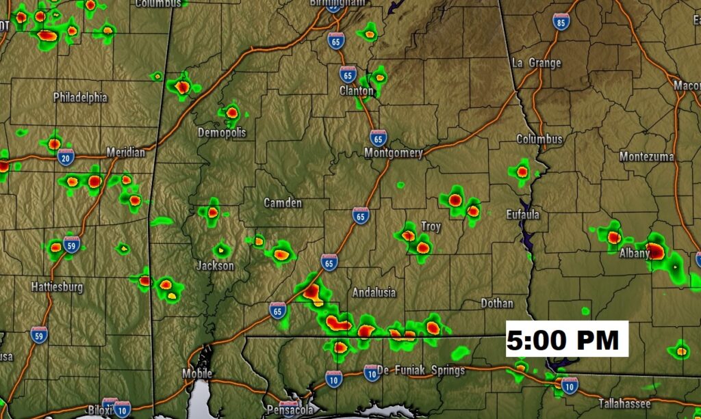
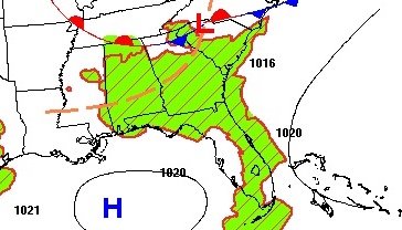
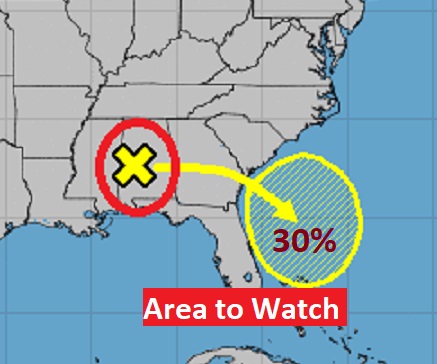
Good Morning! Showers and storms have been frequent and relentless for the last several days. Today, more storms will “fire up” in the daytime heating. But, the storms will be less frequent. Over the next few days there will be fewer storms to go around. Meanwhile, the heat and humidity will build. Over the weekend we will be back in the Triple Digit range on the Heat Index. I have the updated the forecast numbers through the weekend for here and the Gulf Coast Beach. Meanwhile, why does the National Hurricane Center has an “X” right over US? I have the latest on that Area To Watch.
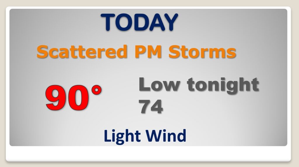
YES there will be storms on the radar again today, but not as many, and not as frequent. Partial sunshine will take us to near 90.
Meanwhile, NHC says that dissipating front over us now, will migrate to the Southeast Coastline. They have now given the Area to Watch a 30% chance of development over the weekend, off the SE coast.
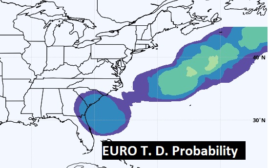
The EURO model also suggests there could be some tropical mischief off the SE coast in the next three days.
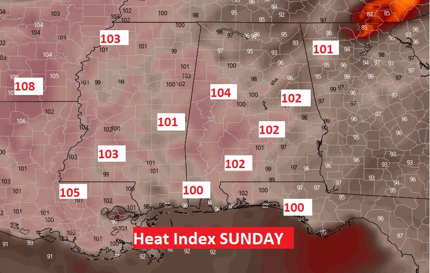
Fewer storms over the next few days will lead to hotter afternoons. We’ll be into the 90’s. By Saturday and Sunday the Heat Index will be at or above 100.
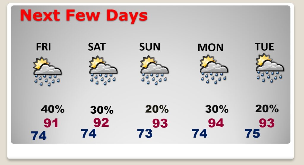
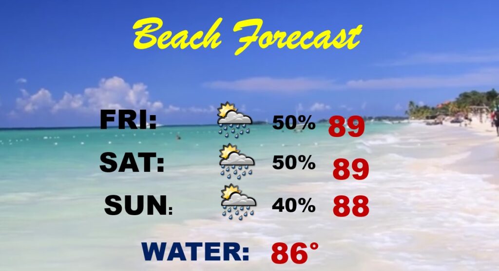
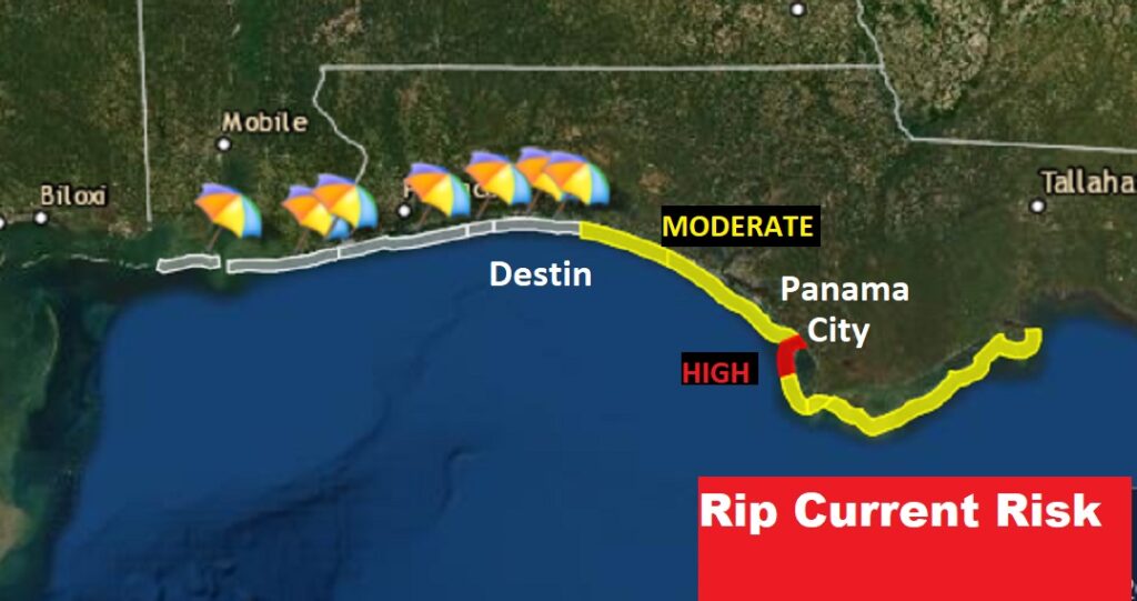
“Hit or Miss” spotty storms will effect the the Beach Forecast this weekend. Pretty routine. Moderate Rip Current risk Destin eastward, and a high risk close to Panama City.