
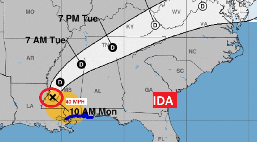
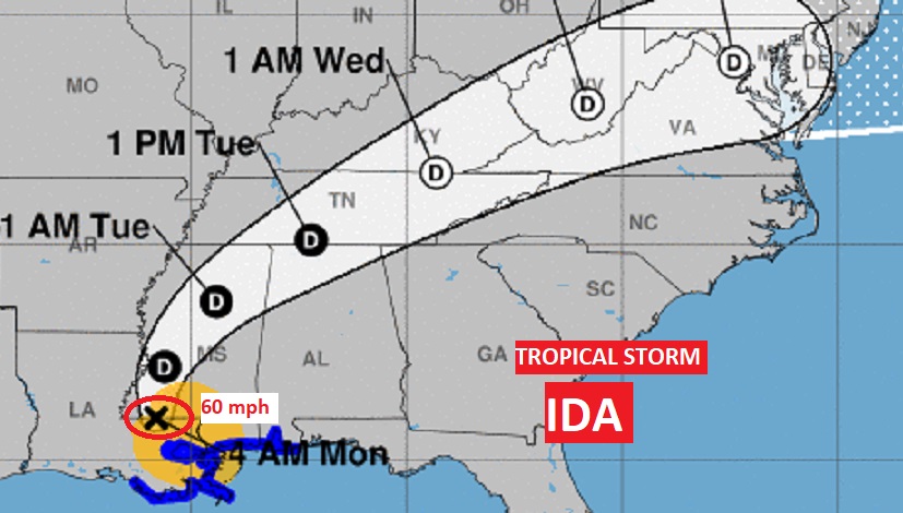
At 1PM Ida is still officially a Tropical Storm with 40 mph winds, located 20 miles WSW of Jackson, MS. Moving NNE at 9 mph. #IDA
5:45 AM UPDATE:
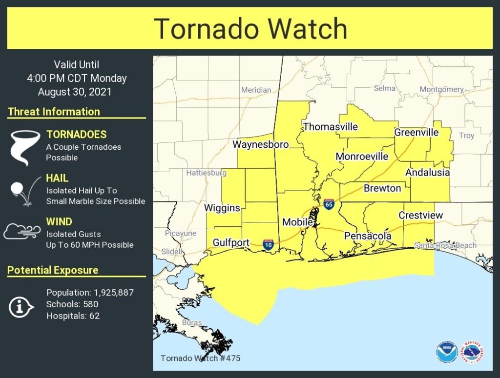
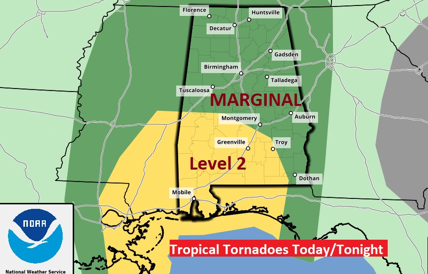
Tornado Watch issued for much of South Central and Southwest Alabama until 4PM. A few tornadoes possible, isolated wind gusts to 60 mph and marble size hail possible in some of the tropical feeder bands from Ida. #alwx
EARLY MORNING UPDATE:
Good Morning! Because of the nature of the weather situation we’re dealing with….I opted to do a blog update instead of a “regular” full blown video. We may do this format again Tuesday morning. Things will probably get back to normal by Wednesday. Here’s a brief video introduction.
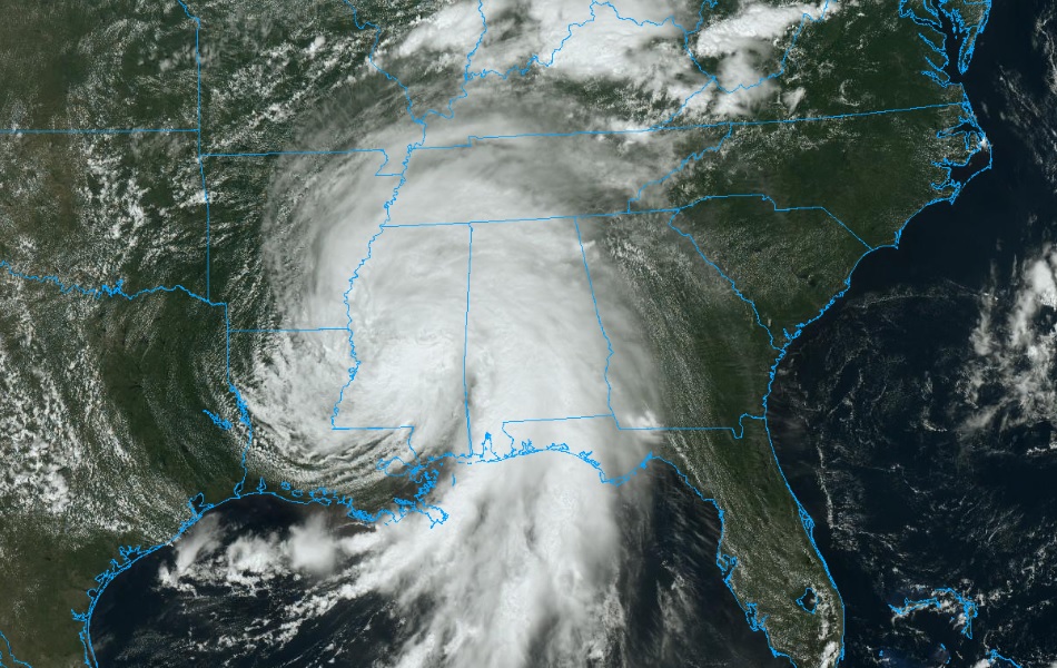
IDA UPDATE: A weakening “IDA”HAS BEEN DOWNGRADED TO A Tropical Storm. It has just crossed the border into SW Mississippi, 95 miles SSW of Jackson, moving slowly north at 8 MPH as it moves through Mississippi all day today. Forward speed picks up by tonight. Ida will have q huge impact on the weather is MS and Alabama today with damaging winds, flash flooding and a relentless threat of tropical tornadoes.
Tropical tornado threat will be present all day today and tonight, and through much of the day Tuesday. Ida’s tropical rainbands will produce squalls that will start to rotate and “drop” tornadoes. These happen quickly, sometimes even before a warning can be issued. Our weather app will instantly alert you when a watch or warning is issued for your location.
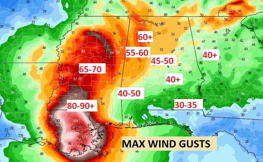
Because of the nature of IDA tropical “feeder bands” rainfall amounts will vary widely. However, this map will help you understand the general distribution. Smallest amounts near the Georgia border, much higher amounts in western Alabama. Highest amounts, of course, near the Alabama coast. This map covers the entire event from now till Wednesday. FLASH FLOOD WATCH continues in effect.
...WIND ADVISORY REMAINS IN EFFECT FROM 10 AM THIS MORNING TO
7 PM CDT TUESDAY…
* WHAT…South winds 10 to 20 mph with gusts up to 40 mph
expected due to Tropical Storm Ida.
* WHERE…All of Central Alabama.
* WHEN…From 10 AM Monday to 7 PM CDT Tuesday.
* IMPACTS…Gusty winds will blow around unsecured objects.
Sporadic trees will be blown down and a few power outages may
result.
TODAY: Periods of extremely heavy tropical downpours at times. Gusty winds 15 to 25 mph, gusting as high as 40 mph. Tropical tornado threat all day and all night. High today 84. Low tonight 74.
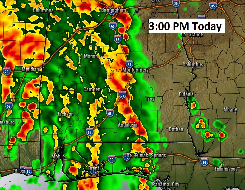
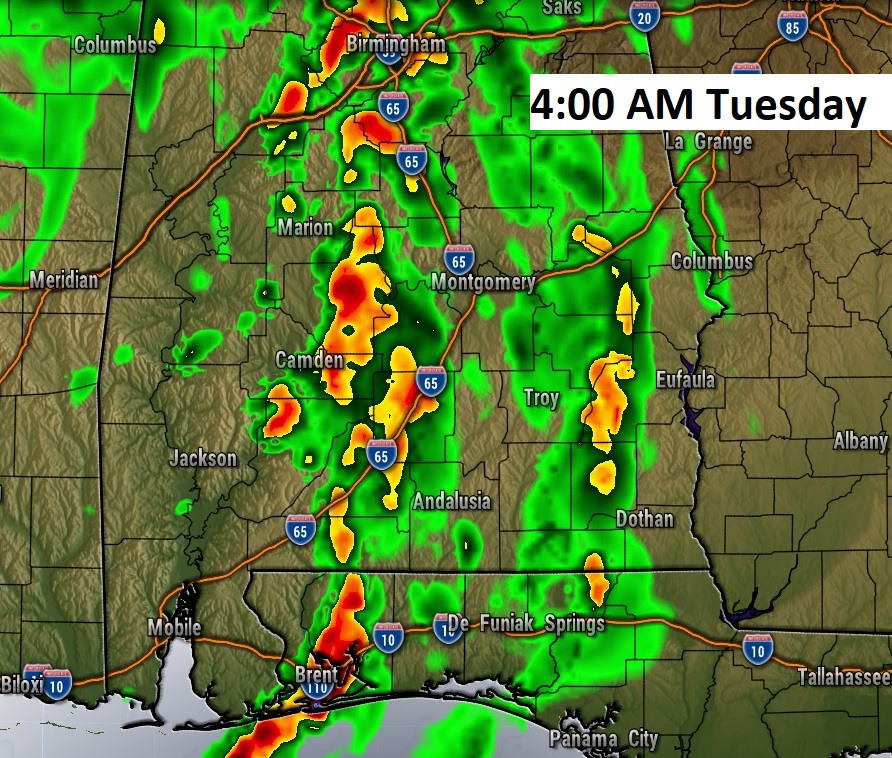
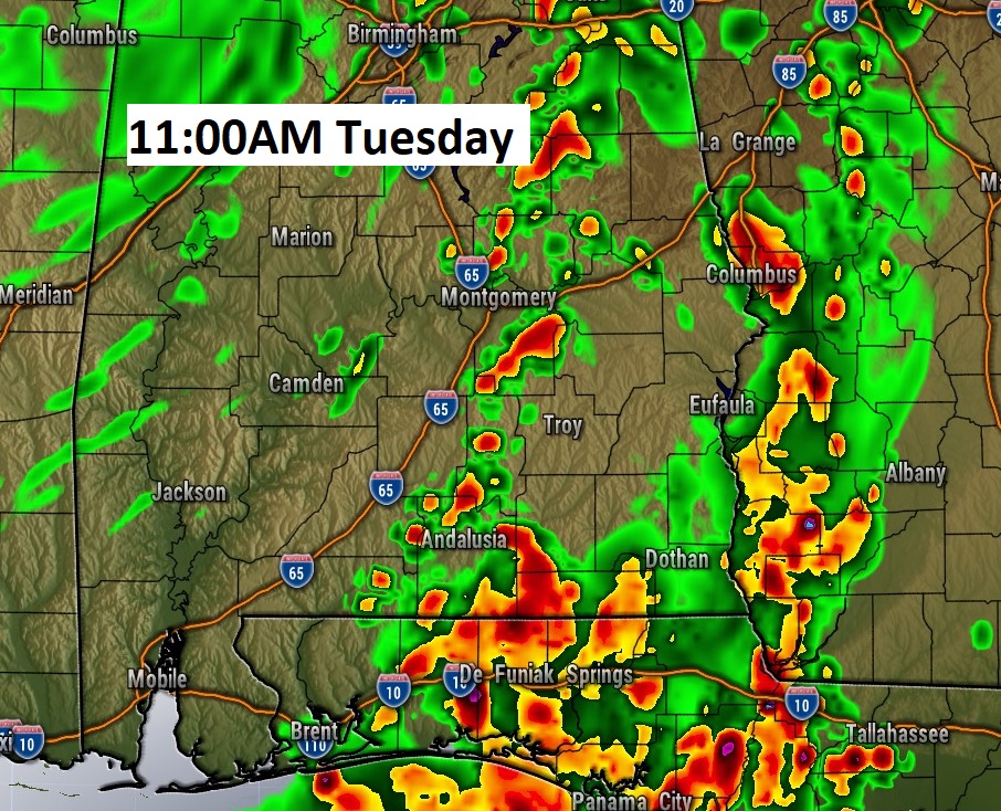
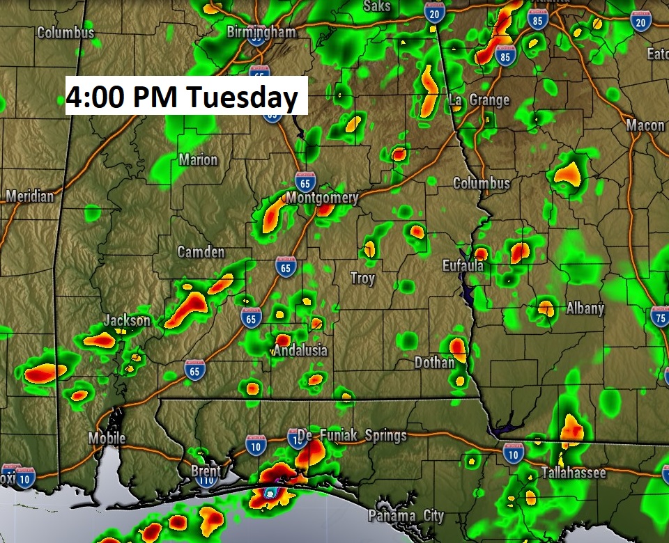
FUTURE RADAR: I just wanted to give you a sense of how long we will be dealing with the “feeder bands” from IDA. Here’s a 38 hour Future radar loop from 5AM this morning until 7PM Tuesday night.. We will be “under the gun” all day today, all night tonight, and much of Tuesday, too. Tropical downpours at times and a relentless threat of tropical tornadoes.
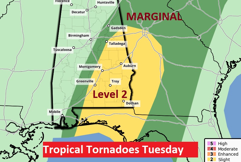
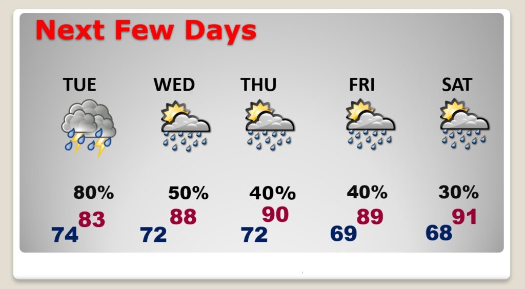
NEXT FEW DAYS: Significant Ida effects continue Tuesday with occasional Tropical Downpours and a tornado risk which will continue through the afternoon. Effects will start to ease Wednesday. Scattered storms. Only widely scattered storms Thursday and Friday as the weather starts to stabilize.
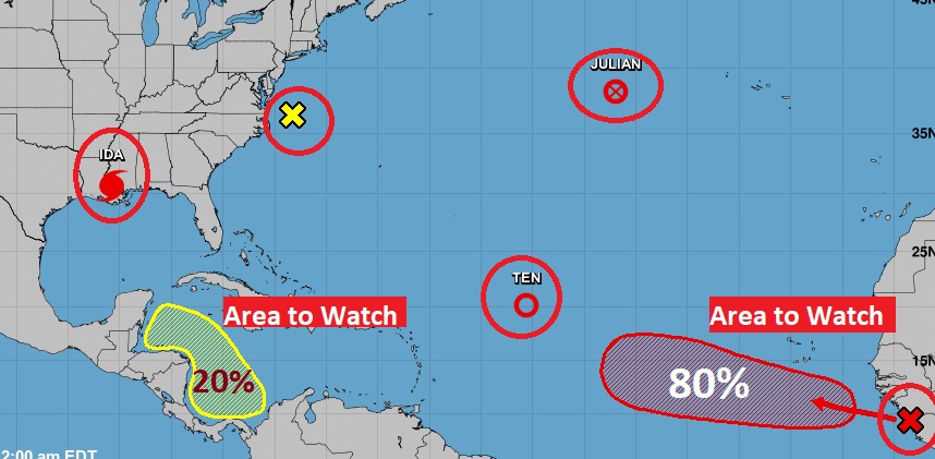
Elsewhere in the Tropics: Out in the Atlantic, there’s tropical storm Julian and T.D. 11. Fish storms. There’s also a couple of Areas to Watch. I would say, the one that most gets our attention would be that “Area” in the western Caribbean. (Because, that’s in our “back yard”). Stay tuned. The next two names on the list is Kate and Larry.
Stay weather aware. Our weather app will keep you on top of the action.
Click below for details. I’ll have updates throughout the day, online, on your app, on the radio and on our continuous Live stream. Not sure about a video or a blog Tuesday morning. We’ll play it by ear.
–Rich