11:30 AM Update”
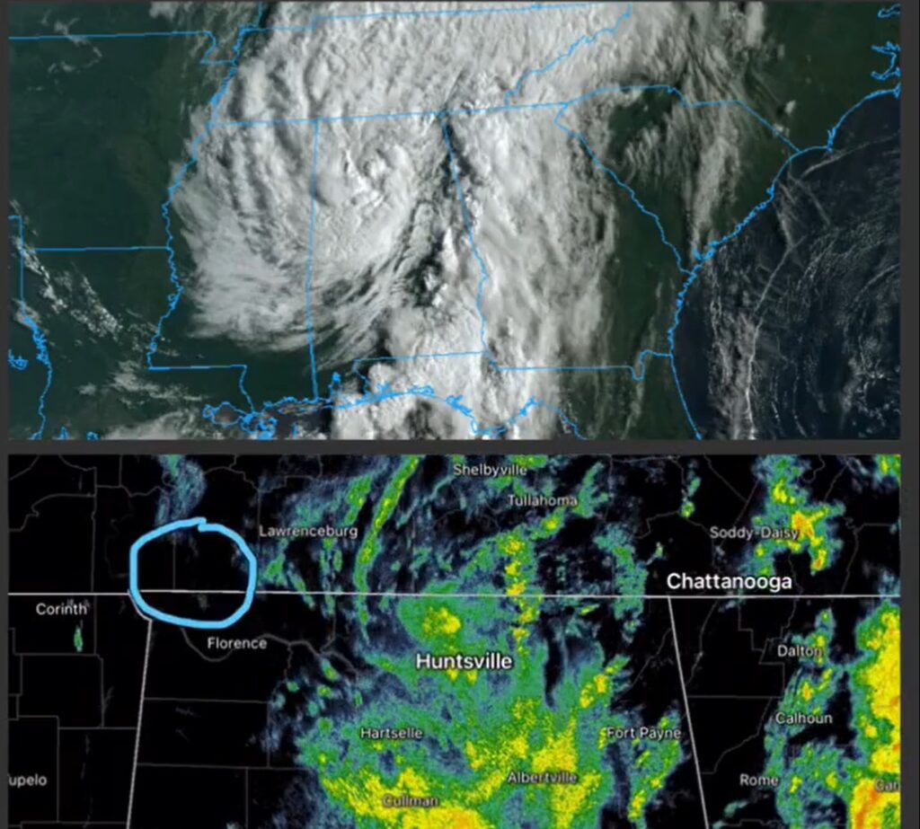
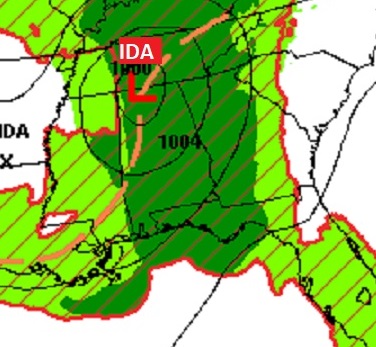
IDA, no longer a depression, is now a remnant low, located near where the borders of MS/TN & AL meet. It’s moving north east at 15 mph with 30 mph winds. Pressure 996 Mbs.
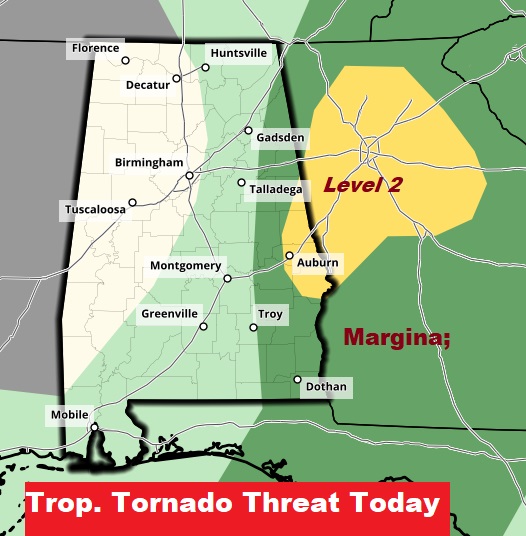
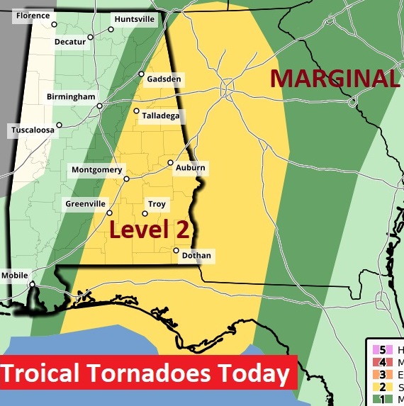
Some really good news here, especially for many of us in the central strip of counties. The Storm Prediction Center has really trimmed back today’s Tropical Tornado Risk to the eastern strip of counties. Level 2 risk now covers a sliver of SE Alabama
EARLY MORNING UPDATE AND VIDEO:
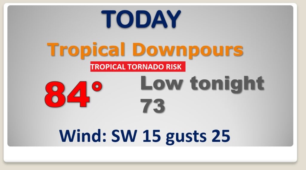
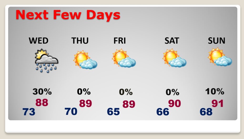
…The Remnants of Ida will skirt NW Alabama today. Ida’s “tropical plume” will dominate our weather today with Heavy Tropical Downpours and the risk for spin up Tropical Tornadoes. Our weather returns to routine tomorrow. And, I have fantastic news about late week and most of the Labor Day Holiday Weekend. You’re going to like it.
Tough day ahead thanks to IDA. Tropical Downpours, Flash Flood Watch. Tropical Tornado Risk. A tornado watch is likely, and there will be multiple tornado warnings.
Things starts to return to routine tomorrow as Ida becomes someone elses problem. Then get ready for NICE stretch of days Thursday through Sunday. No rain. Lots of sun. Lower humidity and the great overnight lows!
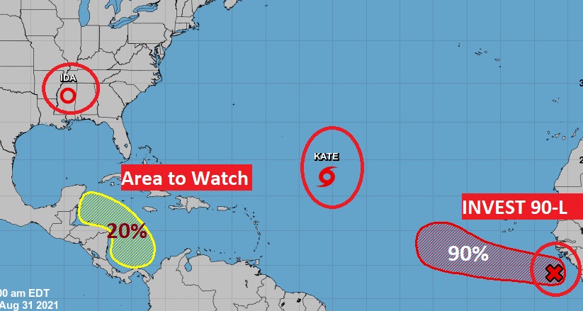
Elsewhere in the tropics….it’s busy.