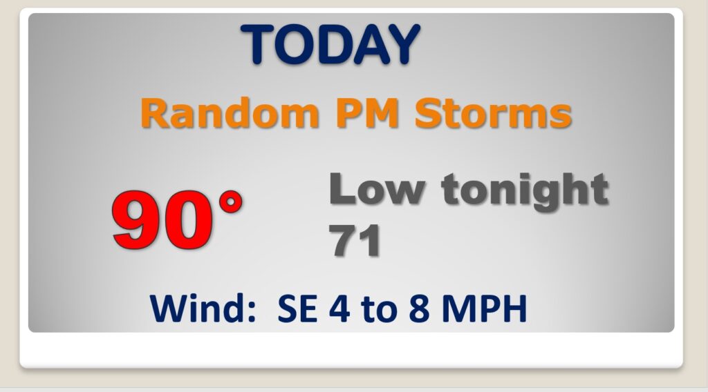
Good morning! Heat, humidity and random storms are back in our forecast. It’s back to summertime business as usual here. As Tropical Storm Nicholas skirts the Texas coast today, we’ll be watching closely, as the system makes a right turn into Louisiana and Mississippi in the coming days. Some of the Nicholas moisture, on the right side of his track, will take our rain chances higher, especially Wednesday through Friday. Will there be a Nicholas tornado threat here in Alabama later in the week? Nicholas is not the only tropical feature with implications for the United States.
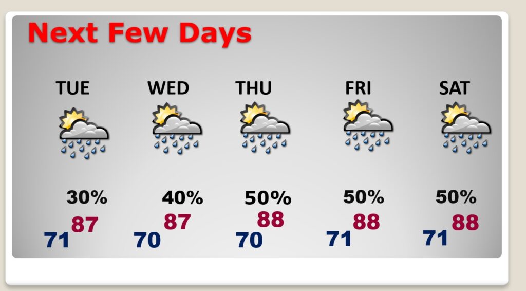
It may be September, but today we are back to a routine summertime normal. Hot, humid, random PM Storms.
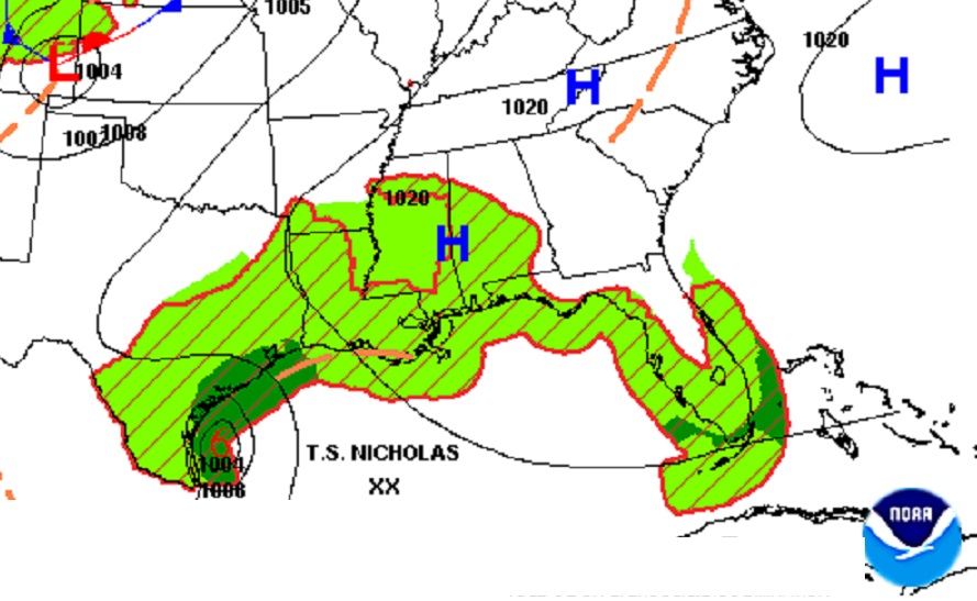
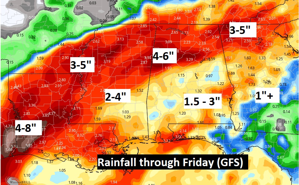
Tropical Storm Nicholas will skirt the Texas coast today and tonight. Eventually the track of, whatever is left of Nicholas, curves right into Louisiana and moves in the direction of Mississippi. Nicholas could bring up to 15″ of rain to parts of TX/LA.
Our rain chances will certainly increase especially Wednesday through Friday on the side of Nicholas. Not sure about the tornado threat yet.
Here’s the GFS expected rainfall through Friday.
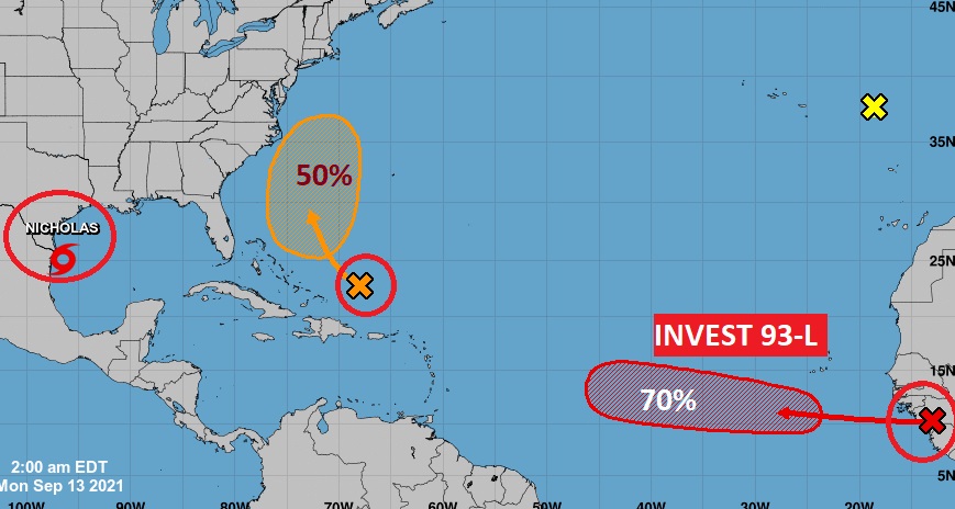
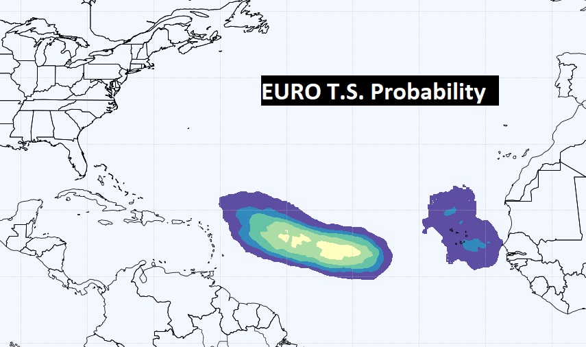
Elsewhere in the tropics…there’s an area of the Southeast US coast that needs to be watched. A depression could form later this week.
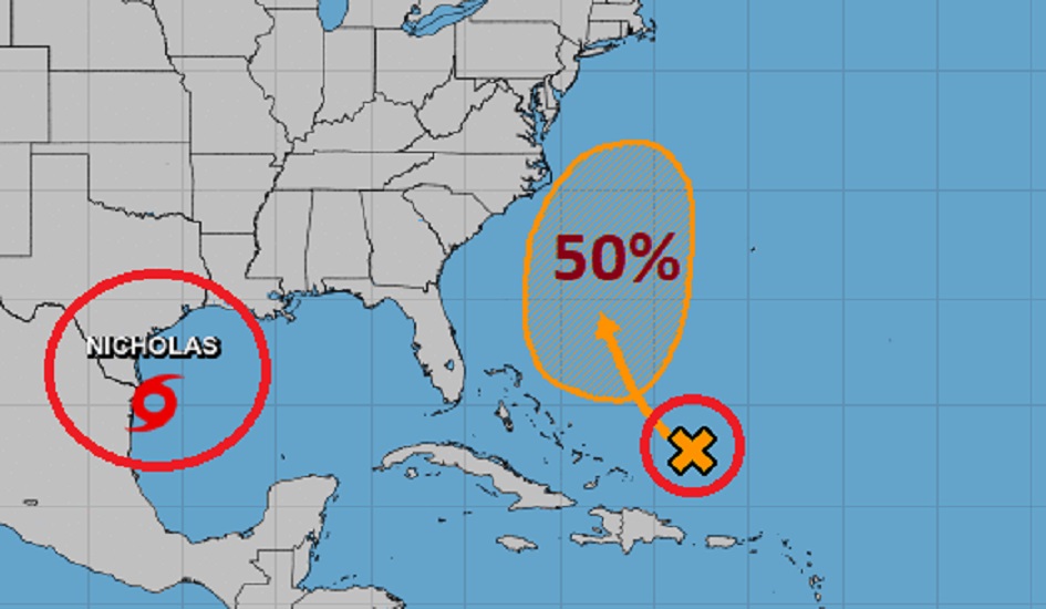
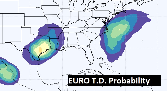
And, in the far east Tropical Atlantic, Invest 93-L needs to be watched. Down the road it could become a Tropical Depression, and eventually a Hurricane.