
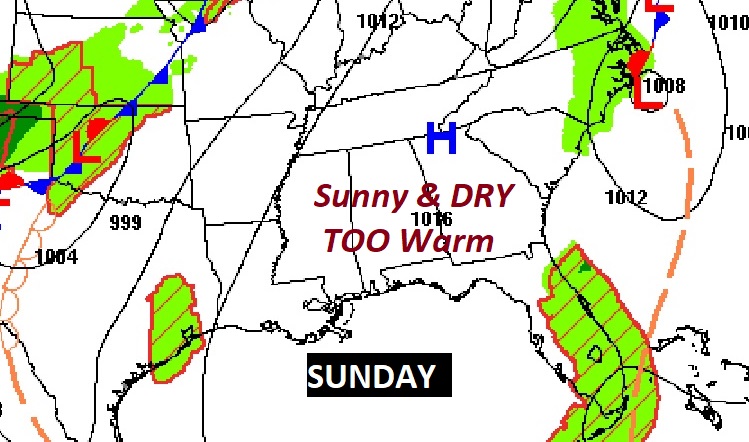
Good Morning! This beautiful sunny storm-free pattern rolls on. In fact, we may have about 6 more dry days left before rain returns to the forecast next Saturday. This is absolutely spectacular weather for the Alabama National Fair!
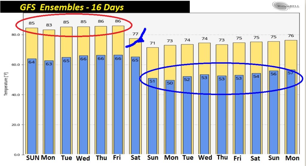
Meanwhile, it’s TOO WARM. In fact, WAY too warm for October. (Normal High 83, low 58) This stretch of Extended Summer will last through the coming work week. But, hang on. Keep your eyes on the prize. We have a “Real—Deal cool front which will sweep through the state next Saturday. Nice Fall Air is on the not to distant horizon. Details below.
TODAY: Same as Yesterday. Abundant sunshine. Way too warm. High 87. Clear tonight. Low in the upper 60’s. Light wind.
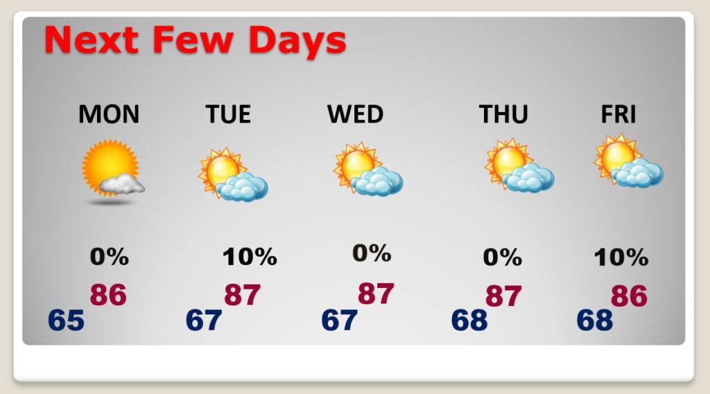
NEXT FEW DAYS: The sunny, storm-free pattern rolls on all week. Ideal for the Fair! Too warm through Friday. Highs mostly upper 80’s. Lows mostly upper 60’s.
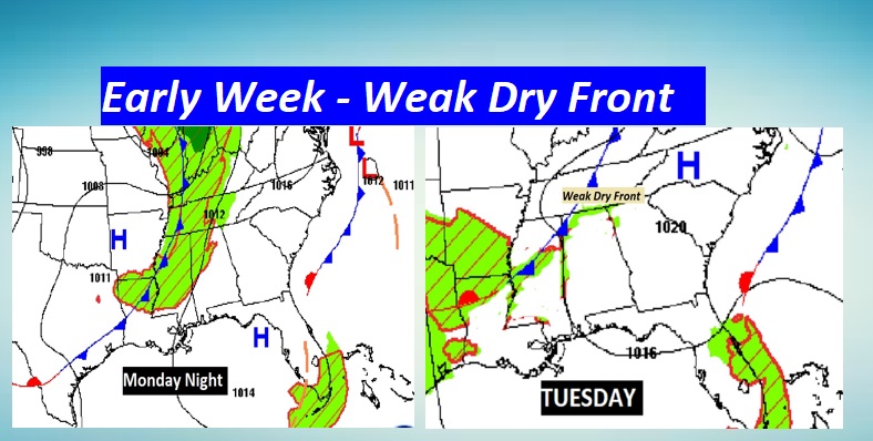
Early in the week….on Tuesday, a weak front will move into Alabama. It should be a weak front. A dry front. It should have no impacts on the forecast.
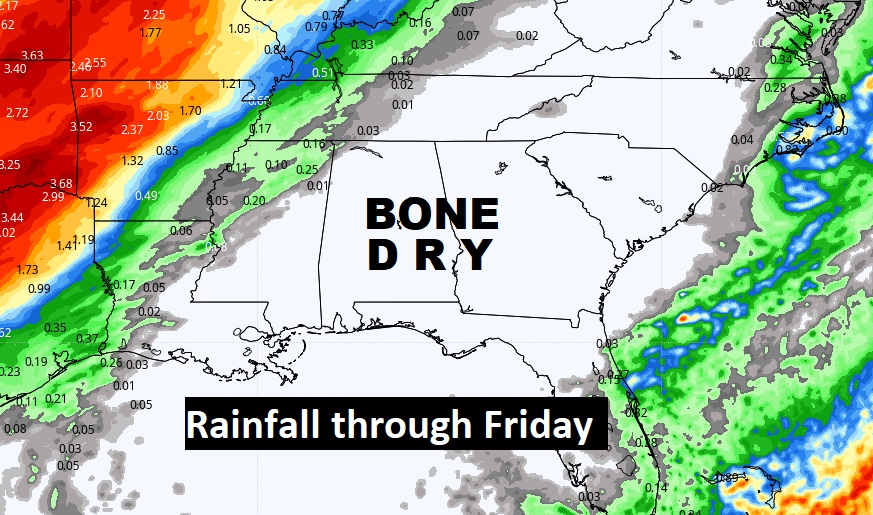
LACK OF RAINFALL: Take a look at the rain prospects for the next several days. Not a drop is likely through Friday.
IMPORTANT COL FRONT SATURDAY: Showers and thunderstorms return to the forecast next Saturday, ahead of a significant “Real-Deal” Cool Front which will sweep through the state, ushering in some very nice air, behind it.
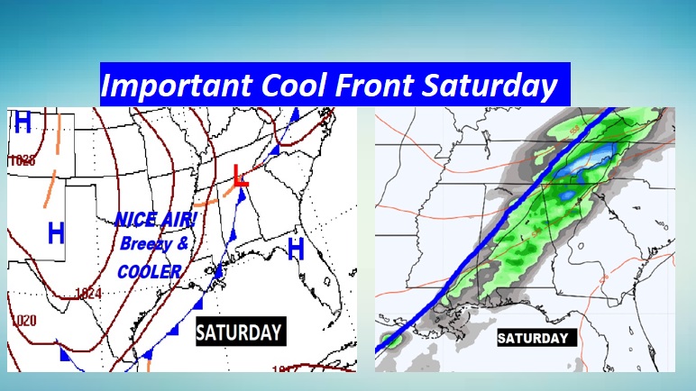
Next Sunday will be breezy, much cooler, much lower humidity. 70’s daytime, low 50’s by Sunday night. Lok at the graph below. That Nice Air will linger for several days. Hang on. Keep your eyes on the prize.
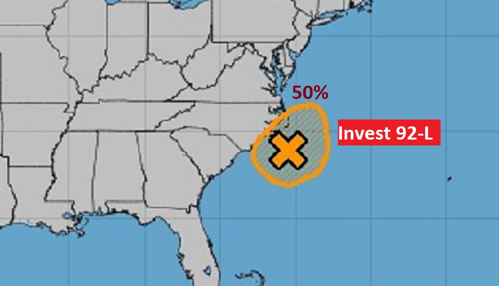
TROPICAL UPDATE: A large low pressure area is nearly stationary located about 100 miles off the coast of North Carolina. While recent satellite wind data indicates that the center has become better defined while producing an area of gale-force winds, the associated shower and thunderstorm activity near the center is minimal and has not become better organized. This system could still become a short-lived subtropical storm later today, but environmental conditions should become unfavorable for any further development on Monday. (if it gets a name it would be WANDA)
.
HURRICANE MICHAEL ANNIVERSARY: Three years ago today, powerful destructive Hurricane Michael came ashore not far from Mexico Beach, FLA. It was the first Cat. 5 Hurricane to strike the US since Andrew in 92, and one of the worse Cat 5’s to cross the northern US Gulf coast since Camille in 1979. 160 mph winds.

Michael went through a frightening Rapid Intensification Cycle just before landfall, becoming a Cat. 5, 160 mph monster.
I’ll have a complete video in the morning. Enjoy your Sunday!
–Rich