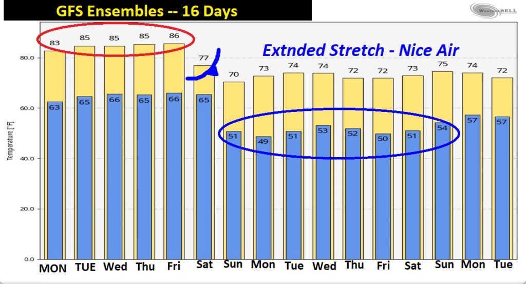
Good morning! Happy Columbus Day! Our extended quiet, dry and very warm October pattern will continue for most of the week ahead. A weak front will approach the state tonight, but will fizzle as it enters the state tomorrow. The countdown has begun for a significant “Real Deal” cool front which will sweep through the state Saturday. It will usher in Cool Fresh Fall Air, with comfortable days and Jacket Weather Nights. Hang on. A band of showers and storms will precede the front. Details on this video.
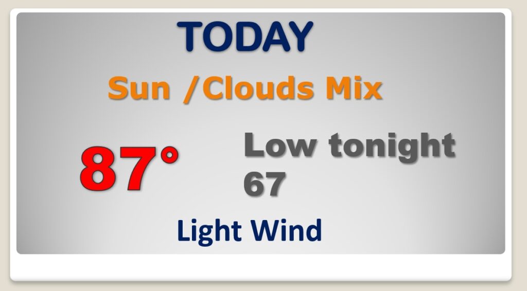
Not much change today. We’ve had a high of 87, last two days, and I expect we will be near that number today. Lots of sun, mixed with some clouds. Upper 60’s tonight. (Normal High 82 / Low 57)
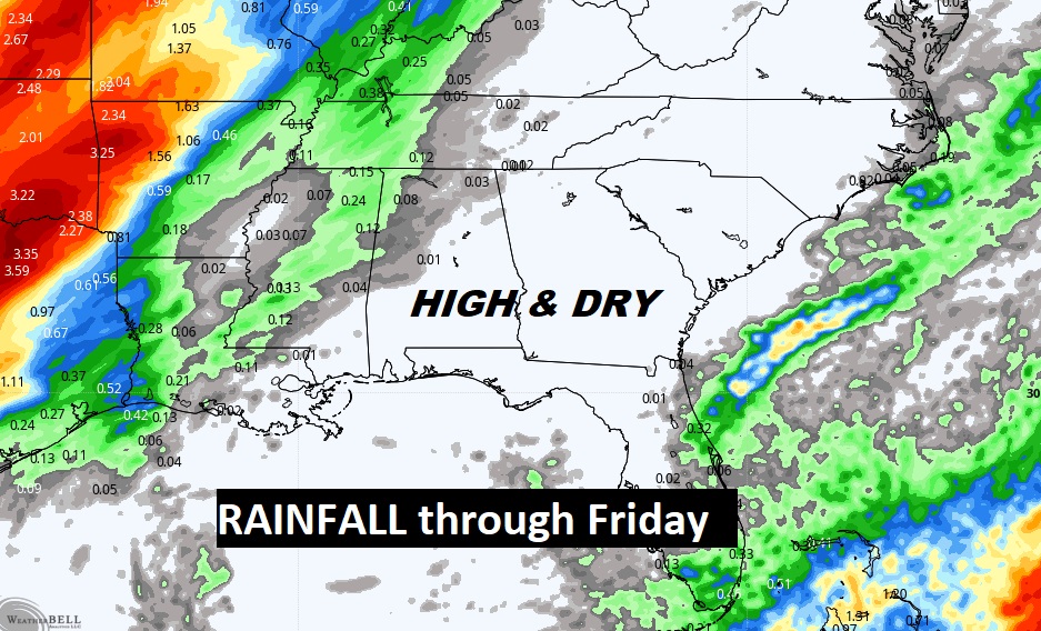
The weak front which will move into the state tomorrow will fizzle. Meanwhile, a strong Upper Ridge of High pressure will control our weather for most of the week ahead. Continued Warm & Dry.
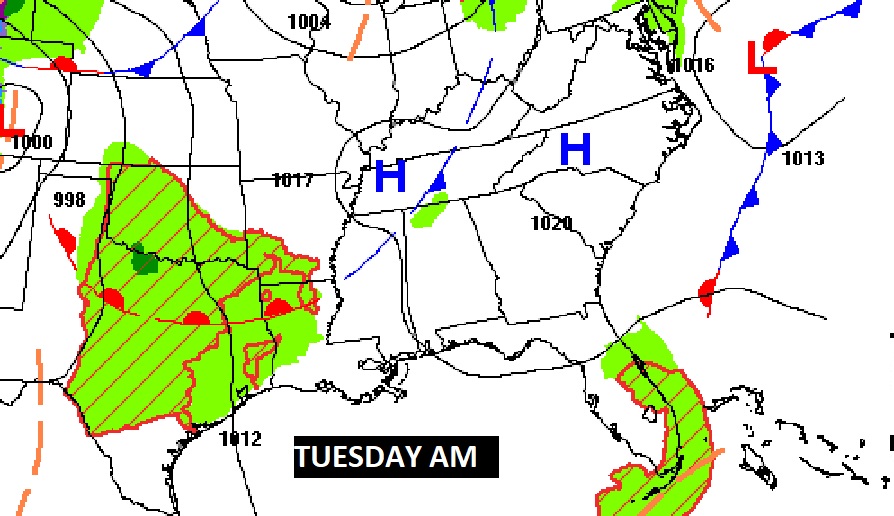
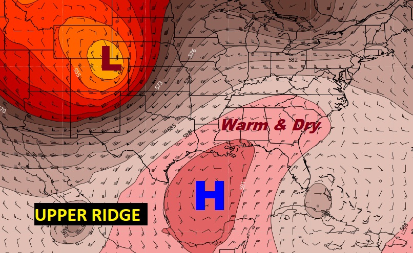
So, mainly just warm and Dry through Friday. WAY too warm for October. Showers and thunderstorms ahead of the Saturday cool front.
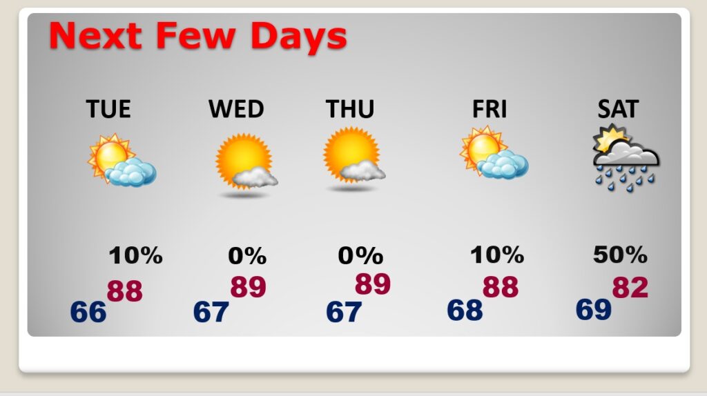
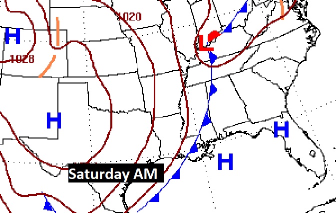
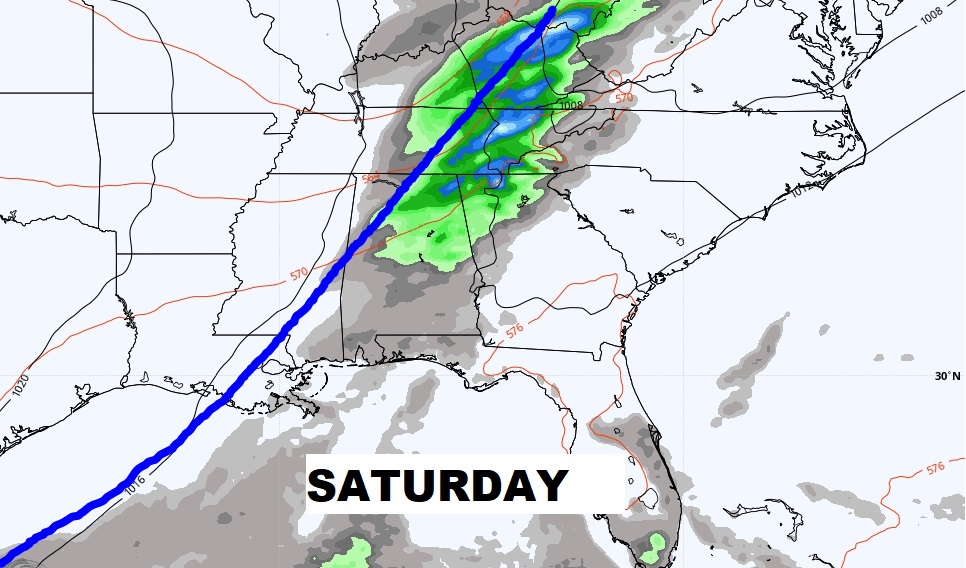
Get excited! Some really NICE Fall air will will follow the Saturday frontal passage. It will usher in Cool Fresh Fall Air, with comfortable days and Jacket Weather Nights. Hang on.
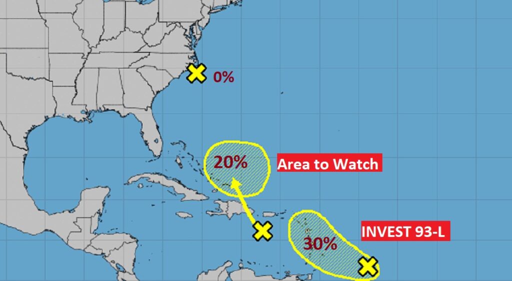
In the tropics, Invest 92-L is dead near the Carolina coast. New Area to Watch in the Caribbean heading for the Bahamas. NEW Invest 93-L could have future implications down the road and should be monitored.