
Good Morning! Our unusual Record Warmth continues through New Years Day. We had a record shattering 85° Thursday. Today and Saturday we’ll be near or above a record again. Then, get ready for a big changes.
A significant Storm System will be approaching the state late Saturday, through Saturday night. We could see a Significant and potentially dangerous severe weather threat in the overnight hours Saturday night through Sunday morning, including the threat of tornadoes. The overnight timeline is troubling. The Severe Risk will shift southeastward on Sunday, as a strong cold front sweeps through the state. Expect falling temperatures Sunday. We could be in the 20’s by Monday AM. Get ready for a big reality check. Parts of extreme north Alabama could see a few snow flurries by Sunday evening.
TODAY: Dense fog advisory early this morning. Very warm today. High near 80. A lot of clouds with some “sunbreaks”. Today’s record is 81 from 1951. Scattered showers and thunderstorms are possible. Widely scattered storms are still possible tonight for New Years Eve celebrations. The Midnight temperature will be near 70.
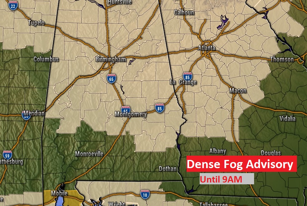
Dense Fog Advisory until 9AM. Visibility will be less than a quarter of a mile in spots.
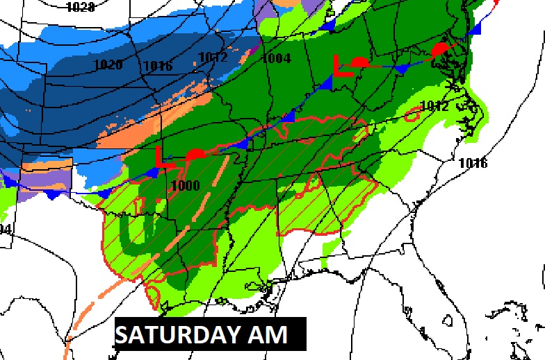
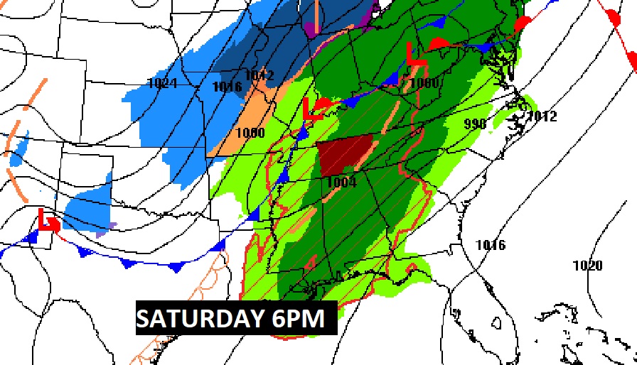
THE SATURDAY SET-UP: Massive storm system will effect multiple states with a variety of weather, including snow, ice and Severe Weather.
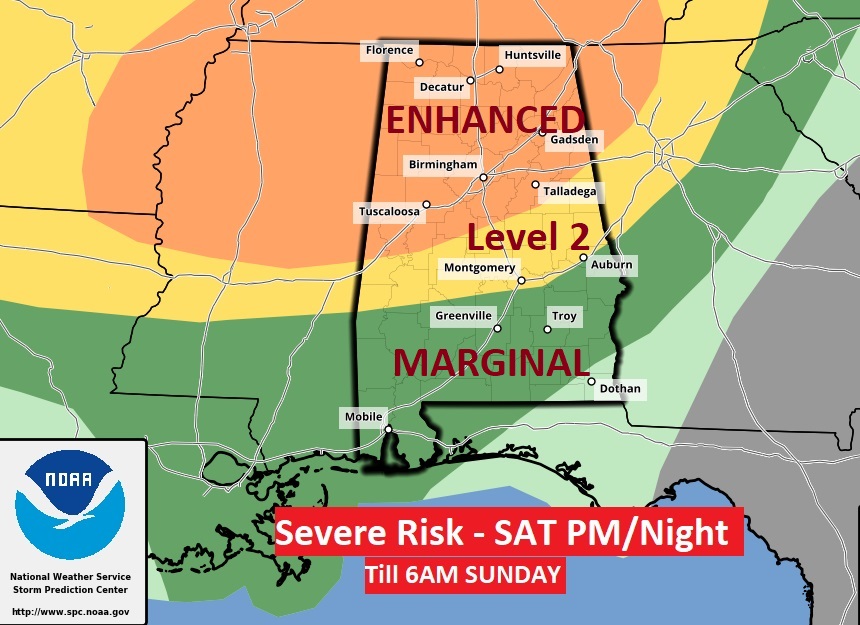
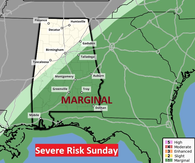
SATURDAY SEVERE THREAT: The Storm Prediction Center has upgraded the Severe Risk Threat Level for parts of Alabama. There is now a Level 3 Enhanced Risk for about the northern third of the state. The Level two risk extends as far south as Montgomery and Auburn. A marginal risk covers the rest of South Alabama. All modes of severe weather are possible including tornadoes. While the main line of thunderstorms will move through in the wee hours of Saturday Night/Sunday morning, there is new evidence that we could see a potential round one Saturday afternoon into the evening, especially father north in the state. There could be a few supercells which start to rotate, potentially dropping tornadoes.
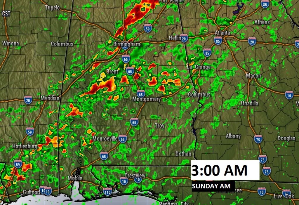
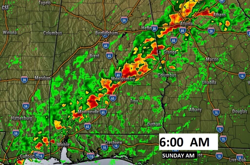
Here’s a couple of overnight Future Radar Snapshots showing the progress of the “Squall Line” (QLCS).
. The Severe Risk will shift southeastward on Sunday, as a strong cold front sweeps through the state. Damaging wind gusts would be the biggest threat.
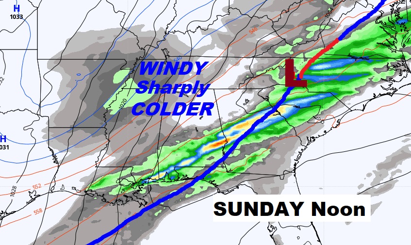
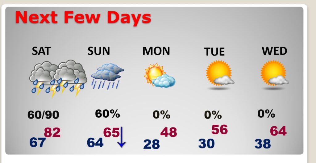
NEXT FEW DAYS: After the Severe Weather Risk Saturday night/Sunday morning, the threat of showers will continue through mid-day Sunday. Look for sharply falling temperatures Sunday. We could be in the upper 20’s Monday morning, with highs only in the 40’s. What a shocker. Get ready.
.
I will have another complete blog update in the morning…of course. I’ll update you on the latest trends for the Severe Weather Threat. Happy New Year!
–Rich