
3:45 PM Update:
\Tornado Watch covers much of north and west Alabama until 10PM. Couple of strong tornadoes possible. Damaging wind gusts to 70 mph. Isolated quarter size hail possible. #alwx
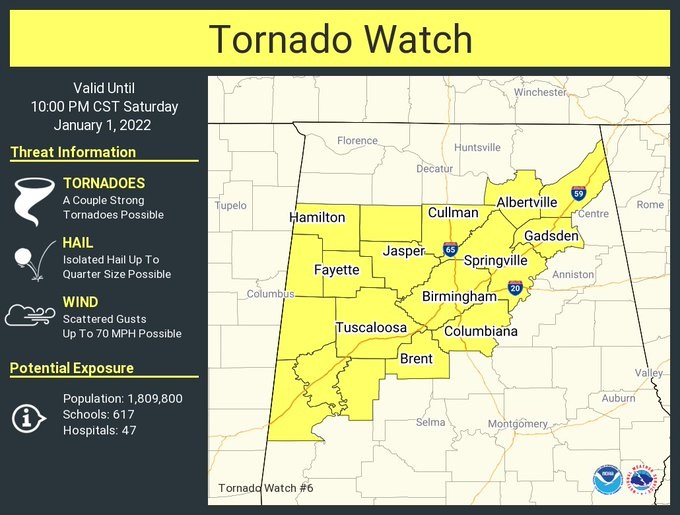
Tornado Watch covers much of north and west Alabama until 4AM. Couple of strong tornadoes possible. Damaging wind gusts to 70 mph. Isolated quarter size hail possible. #alwx
11:AM UPDATE:
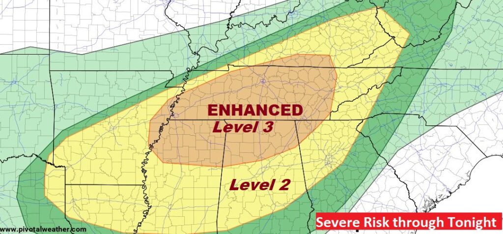
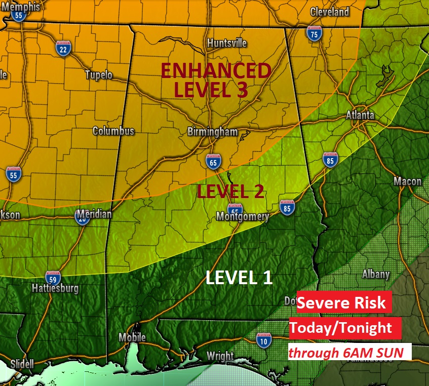
A Storm Prediction Center New Years Day severe risk updated outlook, through tonight, covering a massive area from Texas to West Virginia. Enhanced tornado risk covering parts of 5 states in the mid-south.
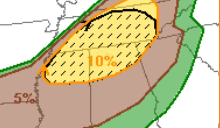
In the Hatched 10% Risk area…Strong, EF-2 or greater, long tracked tornadoes are anticipated.
EARLY MORNING UPDATE:
Happy New Year! We are in an amazing set-up, as Record Warmth continues, and a significant storm approaches. This is the set-up for a potentially dangerous severe weather threat across the South, starting today and through the overnight hours tonight. A huge chunk of our state are included in an Enhanced Risk, including the risk, or likelihood of tornadoes.
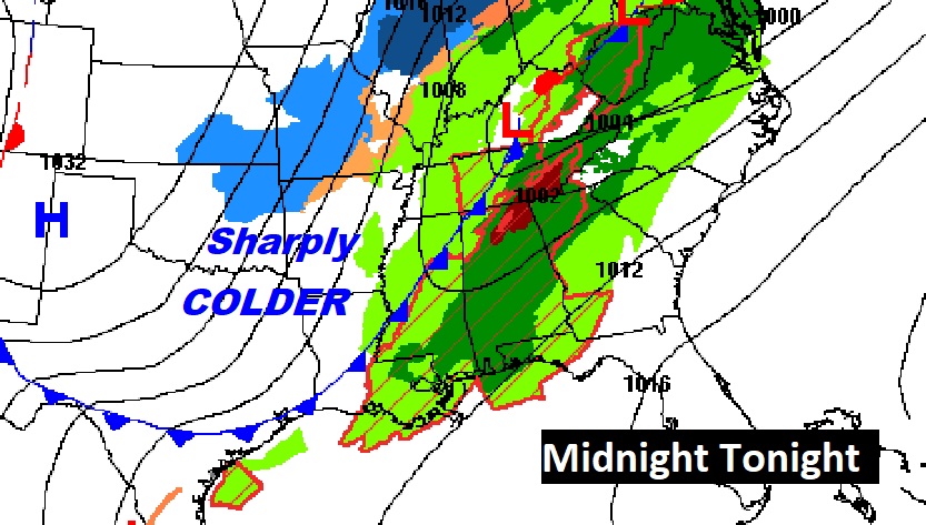
Then, after the Cold Front moves through, get ready for a significant temperature crash. We may fall to the upper 20’s by first thing on Monday morning. The high on Monday may not make it out of the 40’s. It will be quite a shock to the system.
We’ve been breaking records right and left since Tuesday. Today will be the FIFTH day of 80 plus degree heat. The Record High for New Years Day is 79 from 1952. We will easily break that record as we head for the lower 80’s. Yesterday with 83 degrees in Montgomery, we broke the record of 81 from 1951.
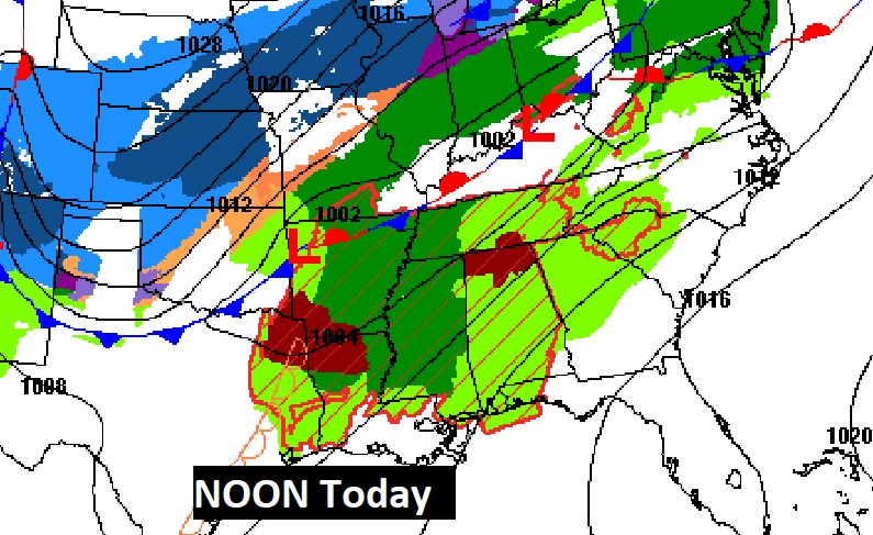
Here’s the set-up on this New Years Day. A massive storm system is affecting multiple states. Snow and Ice on the cold side and a significant severe risk on the warm side. Record Warmth across the South.
NEW YEARS DAY: Wind Advisory starts at 10AM and continues through tonight. Southwest wind 15 to 20, gusting as high as 35+ mph. Partly sunny. Humid. High 82. Scattered showers and thunderstorms this afternoon. Expect and increasing threat of thunderstorms tonight and especially late tonight. Some severe storms in the overnight hours, including a tornado risk. More details on the Severe Threat below.
SEVERE WEATHER THREAT: A huge chunk of Alabama is included in a Level 3- Enhanced Risk, including the risk, or likelihood of tornadoes. The enhanced risk covers most of the northern half of the state. In fact, the Level 2 threat area extends as far south as Montgomery and Auburn. The rest of Alabama is in a Level 1 Marginal Risk. All modes of severe weather are possible including damaging wind gusts of 70+ mph, large hail and tornadoes. A lot of the activity, overnight, will be along a “Squall Line” of thunderstorms, with damaging wind gusts and embedded tornadoes. There is a chance, this afternoon, that some individual thunderstorm cells, well in advance of the main line, may begin to rotate and drop tornadoes, particularly over the northern half of the state.
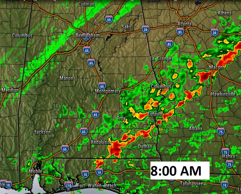
I’ll show you some Future Radar snapshots from one of the high-res models. (NAM) But, I do it with great caution. Every model looks different. Some models are faster on the timing.
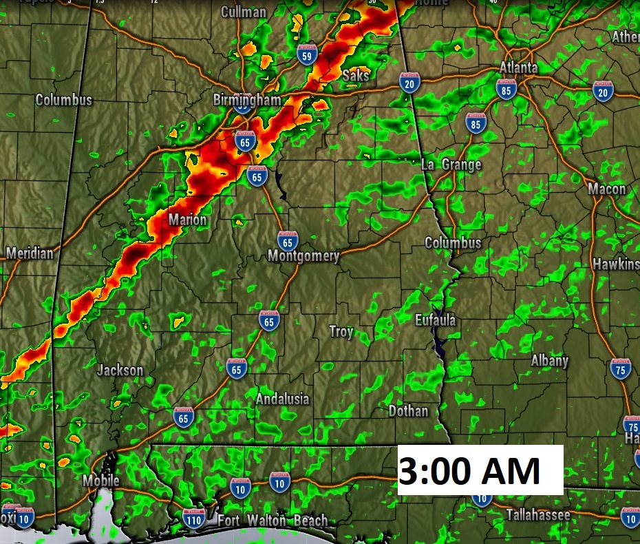
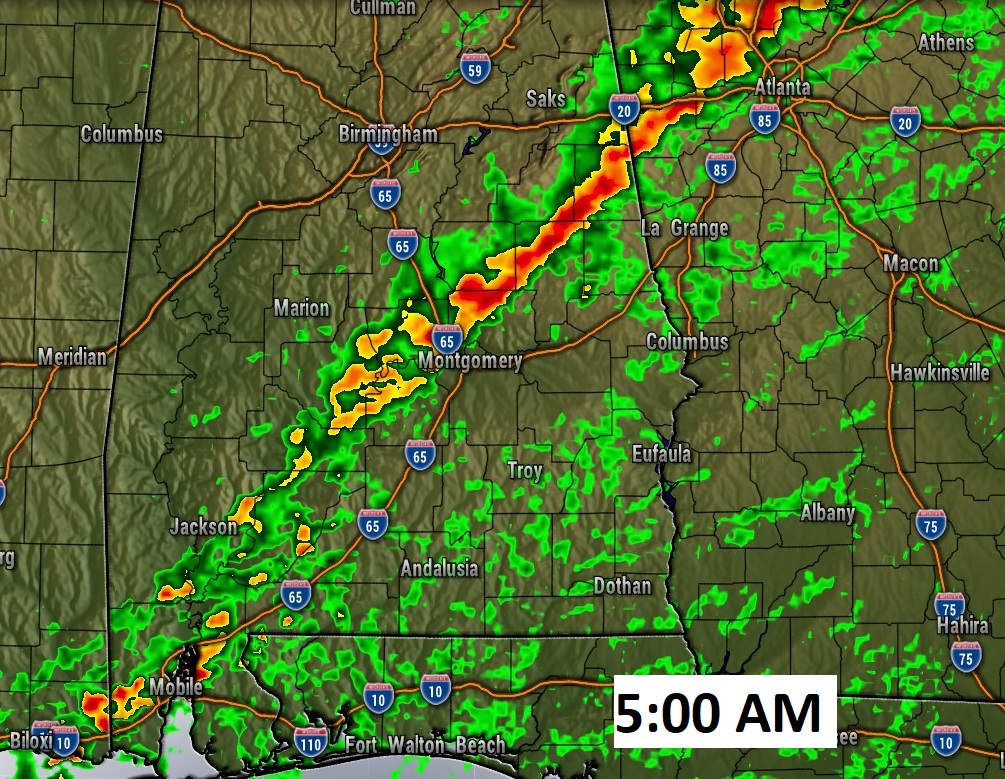
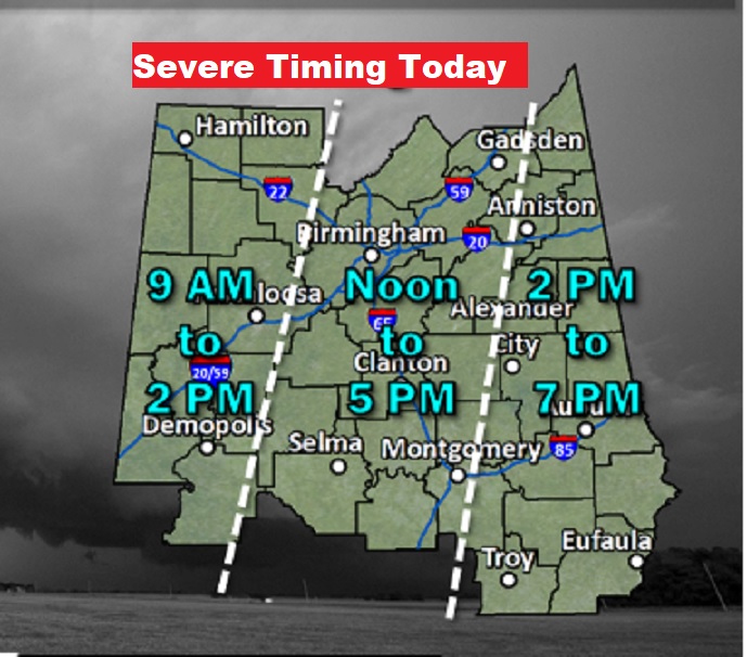
Here’s just a general Threat Timeline, provided by the NWS in Birmingham for the counties they are responsible for. Note the dangerous overnight time factor.
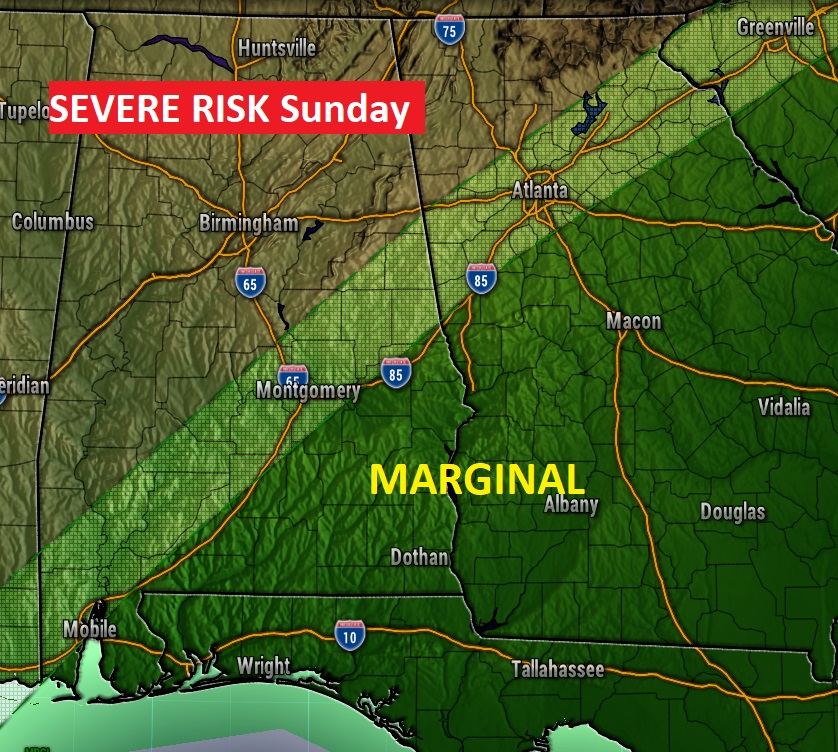
On Sunday the Marginal Severe Risk shifts to the southeastern third of the state, ahead of the Cold Front.
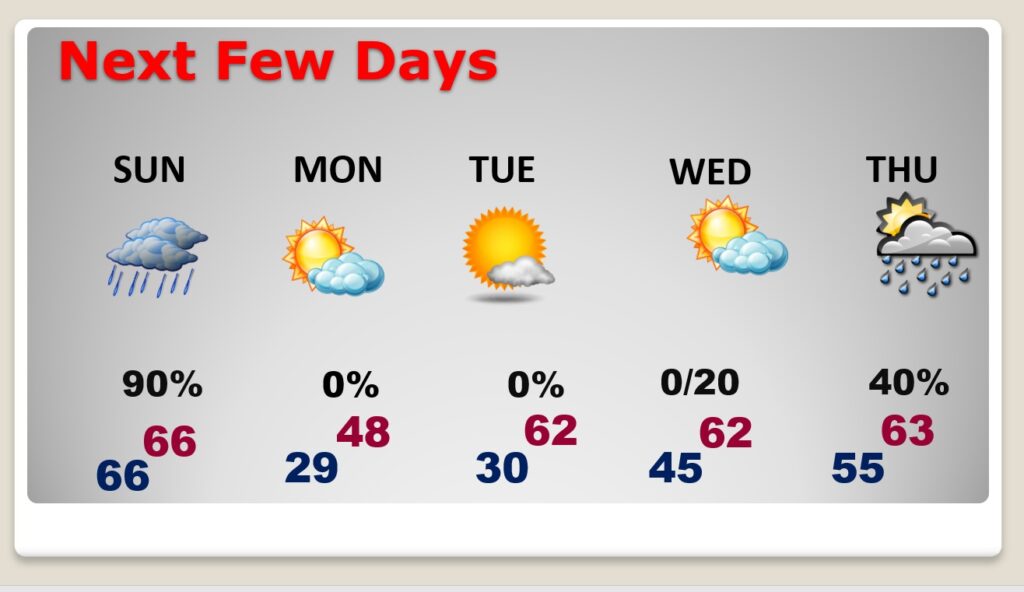
NEXT FEW DAYS: Note the temperatures on Sunday. The overnight low matches the high for the day. Temperatures will be on the slide all day, perhaps reaching the upper 20’s by Monday morning. On Monday we may not make it out of the 40’s. What a shock to the system after the 80’s. we’ll recover back to the 60’s by mid-week. Risk of showers by Wednesday night into Thursday.
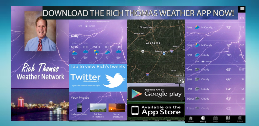
Happy New Year! Enjoy a windy late Spring/early summer day. Be ready to take action tonight. Our weather App will keep you on top of the action with instant push notifications for severe weather alerts. We’ll also be interrupting across the radio dial for any tornado warnings. Updates on Facebook and Twitter, too.
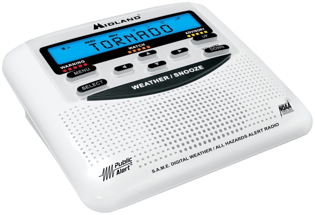
Make sure your weather radio is plugged up, I the alert mode, so that it can wake you up when there is a warning for your county.
I’ll be camped out at the Bluewater Weather Center late tonight.
–Rich