
Good Morning! A large, significant Winter Storm will cross the southern states this weekend, causing a variety of winter weather hazards….heavy snow in some areas, and a crippling ice storm is likely in the Carolinas.
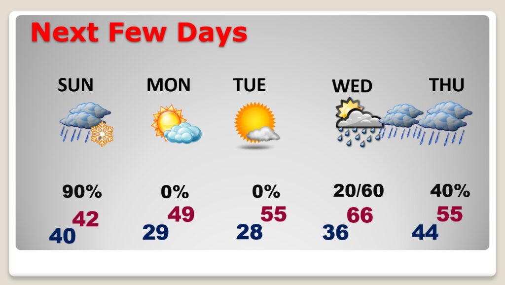
For many of us in central Alabama and even in south central Alabama will see a rain/snow mix on Sunday, with falling temperatures and gusty wind. Wind advisory in effect.
MLK Day will be cold. Upper 20’s at dawn. Upper 40’s in the afternoon. Details below…
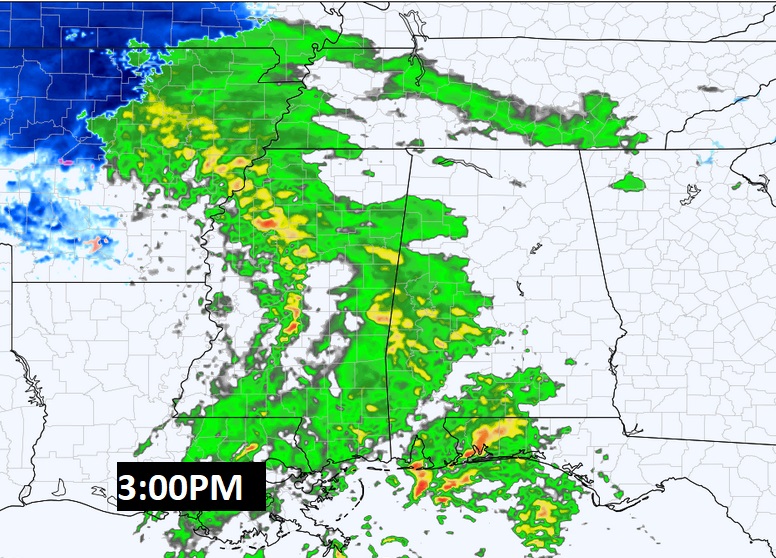
TODAY: Cloudy & mild today. High 62. Rain showers this afternoon & tonight. Gusty SE wind 10-15+ today. Wind advisory begins tonight and continues Sunday. East wind at 10 to 20 gusts as high as 35 mph. Low tonight 40. No travel problems are anticipated in central and south Alabama. The snow should melt as it falls. However, I wouldn’t be surprised if a light dusting could occur in parts of Chilton, Coosa and northern Tallapoosa. Here’s a Future Radar snapshot at 3PM…as showers move in.
SUNDAY: Much colder. Periods of rain occasionally mixed with snow. No accumulation expected. Windy. West wind 10 to 20, gusting as high as 35 mph. Temperatures near 42 early will fall into the 30’s by afternoon. Rain tapers off by late afternoon. Very cold Sunday night. Low 29.
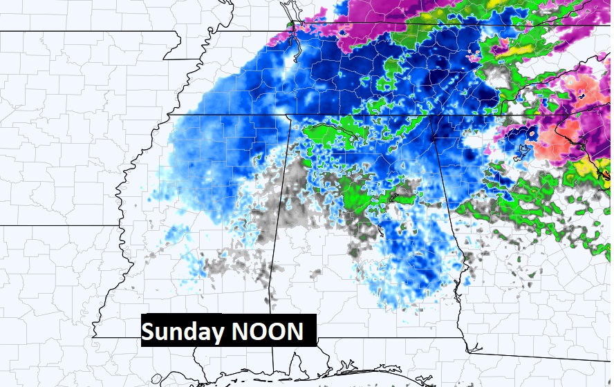
Here’s one Hi-res Model (NAM) at Noon Sunday. Blue is snow. Notice the rain/snow mix in central Alabama. There could even be a few snow flakes mixed in with the rain in South Alabama.
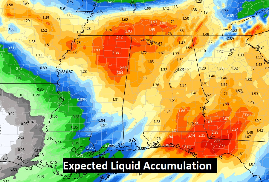
Some spots could see quite a drenching tonight & Sunday. 1 to 2 inches in some areas. More in others.
NEXT FEW DAYS: MLK Day will be cold. Upper 20’s at dawn. Upper 40’s in the afternoon. More rain returns by Wednesday and Wednesday night & Thursday. Mid 60’s Wednesday. Colder Thursday.
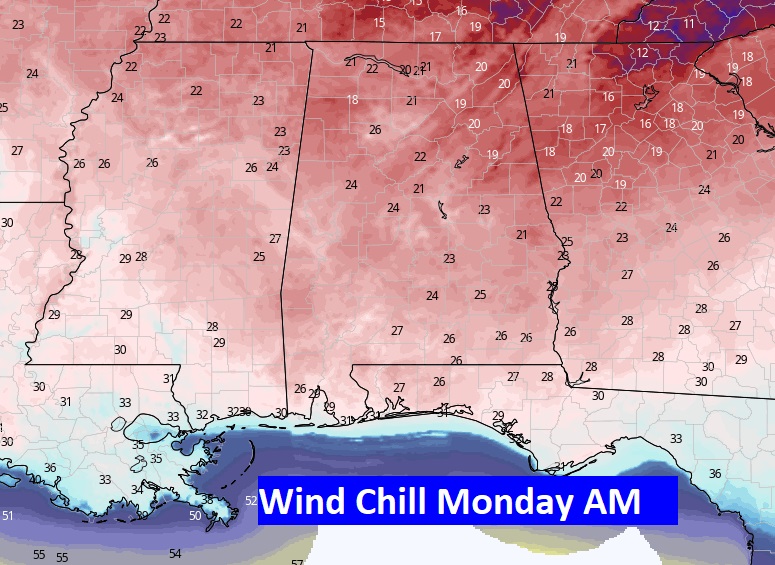
Wind chill will fall to the low 20’s Monday AM, and perhaps the teens in spots.
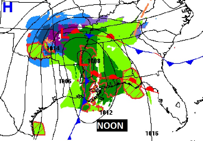
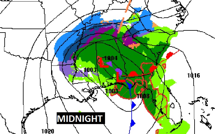
SNOW ACCUMULATION: The greatest chance of snow accumulation in Alabama will be from I-20 northward. A few inches of snow are expected in the Tennessee Valley region. In the mountain resorts of eastern Tennessee, snowfall amounts of 9 to 10 inches are possible. The western Carolinas could have up to a foot of snow, or more.
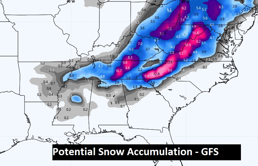
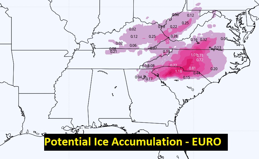
ICE STORM: A crippling ice storm is expected in the Carolinas and northward. As you look at this map, consider this. A serious ICE STORM is defined as a storm with and accumulation of .25”. Notice some spots in the Carolinas could see more than an inch. Power failures will be widespread.
No travel problems are anticipated in central and south Alabama. Fortunately, we are on the “better” side of the storm. We won’t have to deal with the High Impact travel problems.
I’ll have another Blog update in the morning. Stay weather aware.
–Rich