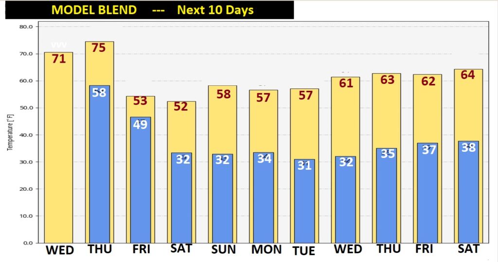
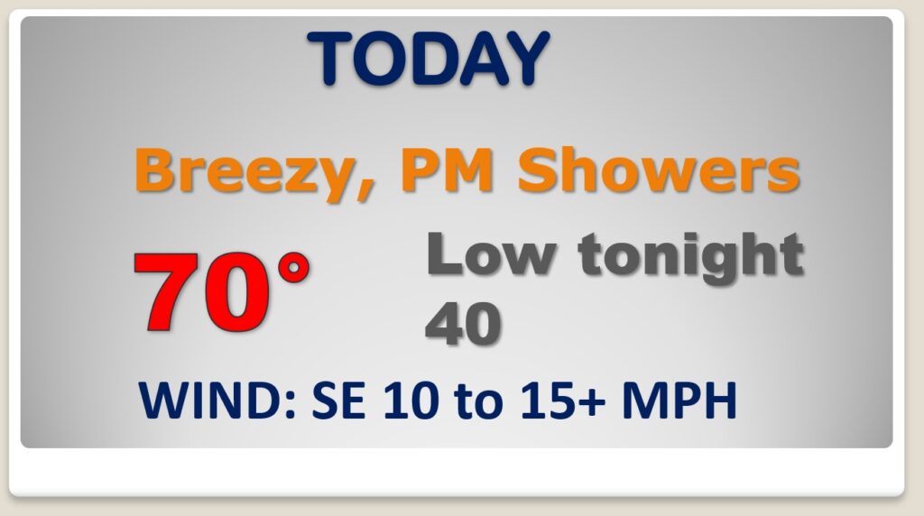
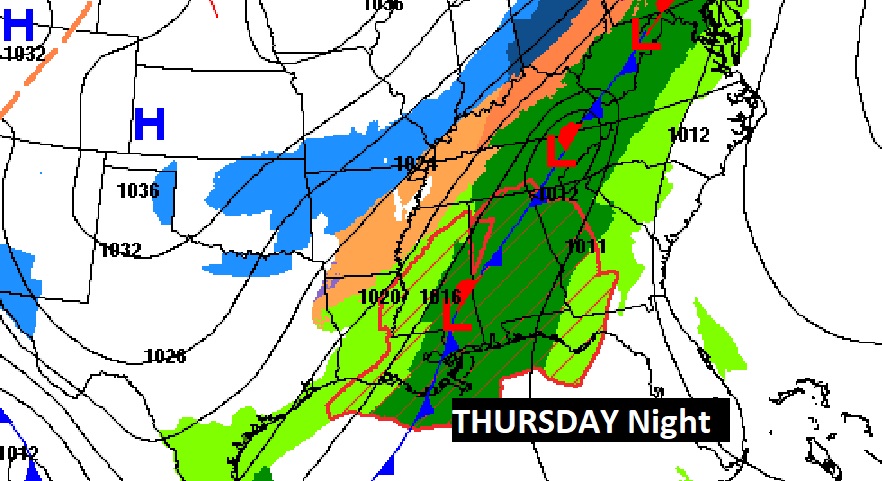
Good Morning! Our spring-like warmth continues for now. We’ll be 70 or above today, and mid 70’s Thursday. Changes are on the way. Risk of showers returns this afternoon and tonight. An approaching cold front will bring a band of rain and storms to the area by Thursday afternoon and more likely Thursday night. Locally heavy rainfall amounts are possible. It will turn much colder behind the front Friday. On this video, I’ll bring you up to speed in the details and the timeline.
Expect another Spring-like day. High near 70. Small risk of showers today. Scattered showers tonight.
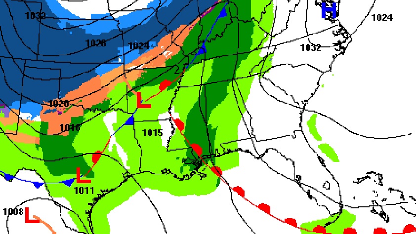
Big changes on the way as a significant storm system crosses the country. This will be a huge snow and ice producers for some. We’ll be on the warm air side. Showers and thunderstorms, especially By Thursday night ahead of a cold front.
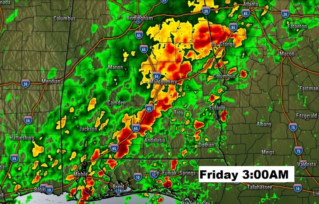
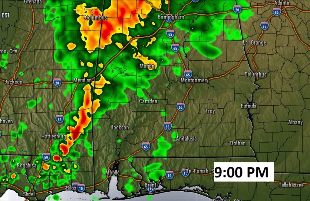
Looks like s soaker. Flash Flood Watch in effect.
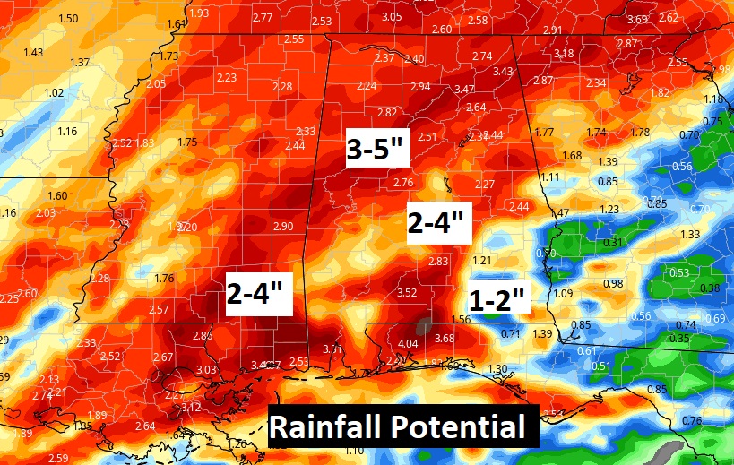
Rain and thunderstorms Thursday, Thursday night and Friday morning. Then, more chilly air. Falling temperatures Friday. Chilly weekend. Storm-free this weekend through early week.
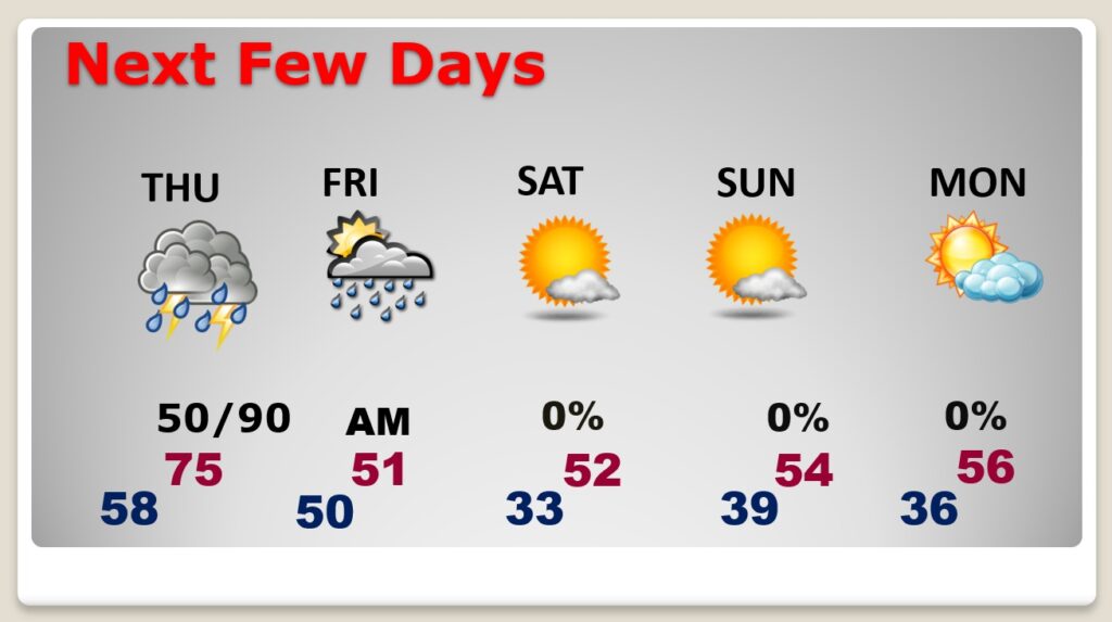
Spring-like through Thursday. Then, chilly for several days. Slight moderation begins again in about a week.