
Good Morning! Get ready for a big change. Our nice tranquil, spring-like journey is ending. Today will be warm again for February. But, a Cold Front will sweep through the state overnight tonight. There’s a small chance of a brief shower with the front overnight. Super-bowl Sunday will be quite a change in reality. Windy and much colder, but sunny.
But, as you will see on this Blog Update, this “Cold Shot” will be very brief indeed. I’ll tell you about another significant temperature recovery next week. And, we’ll look ahead at what could be a significant storm system by Thursday. This storm system could produce some severe weather.
TODAY: Patchy morning fog. Partly cloudy and very mild again. High near 70. Clouds increasing in the afternoon. West wind 5 to 10. Cloudy tonight. Chance of some brief isolated showers late. Perhaps a brief shower in the overnight hours. Precipitation chance is only 20% or less. Colder tonight. Becoming breezy. Low 34.
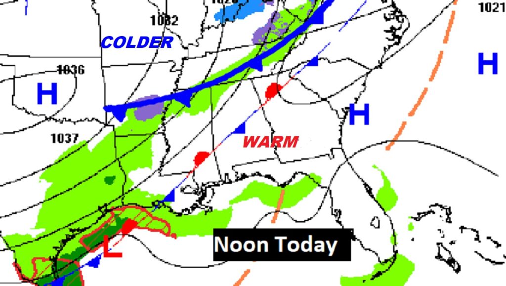
On today’s map, you see two fronts. Ignore the first front. The second front, approaching the northern Alabama border, will sweep through the state tonight, delivering a quick shot of much colder air.
Yesterday’s high in Montgomery was 71. Thursday we had 69. Normal high is 64.
SUNDAY: Windy & much colder. Our high temperature may not quite make it to 50 degrees. Northwest winds at 10 to 20 will make it seem colder. Clear and cold Sunday night. Low 28 by dawn Monday.
NEXT FEW DAYS: Cold & breezy Super Bowl Sunday. The coldest morning will be Monday morning, in the upper 20’s. Nice rebound Monday afternoon. Back to the 60’s Tuesday, and mid 70s Wednesday. Showers and maybe some strong/severe Thunderstorms Thursday.
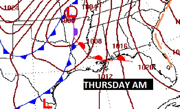
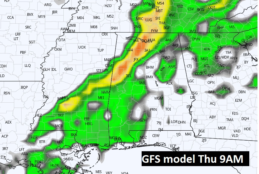
THURSDAY STORM SYSTEM: The map set-up on Thursday morning appears slightly ominous. A significant storm system will approach the state.
Warm air will be in place across the Gulf South. High temperatures in the 70’s are expected with dewpoints in the 60’s. Models do not agree on the other severe weather ingredients, including low level Jetstream and the extent of pressure falls, etc. But, there is enough evidence of a potential threat, the Storm Prediction Center has included a huge chunk of Alabama in it’s Day 6 outlook (Thursday).
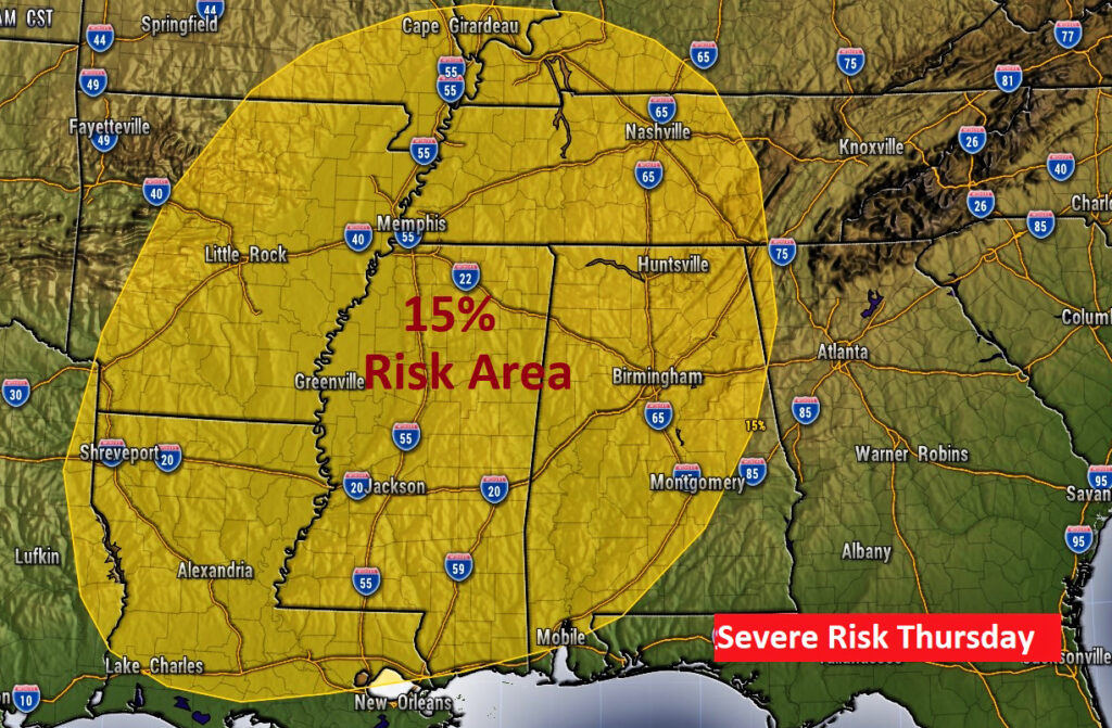
Timing details are yet to be worked out. If the best timing occurs in the daytime, the potential risk would be higher. Nighttime risk would not be quite as concerning. It’s just best to plan for a Severe Weather Threat some time Thursday and/or Thursday night. Stay tuned.
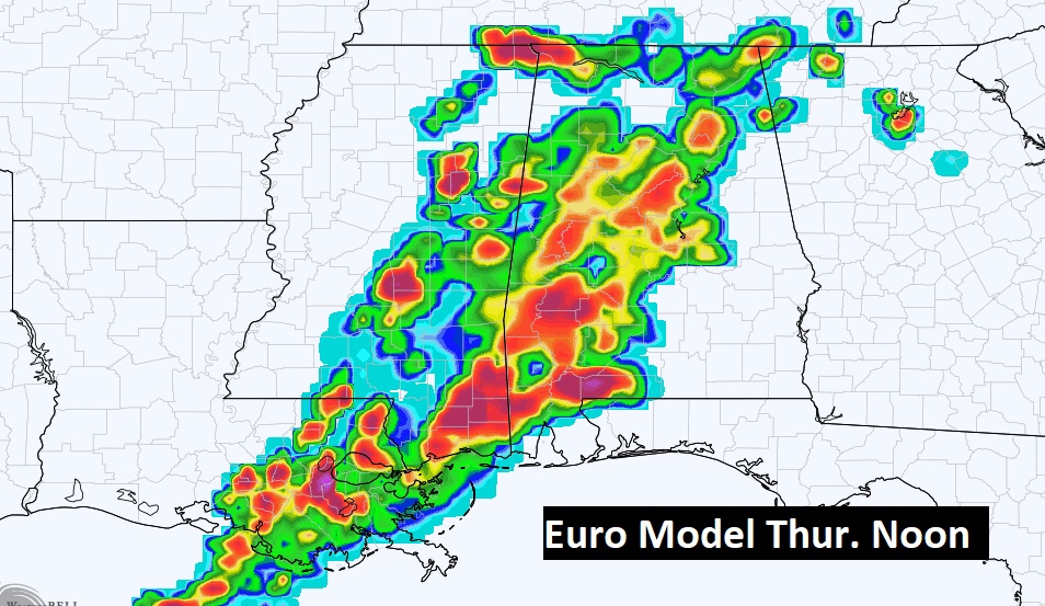
We’re so far out, the timing will likely change, perhaps drastically. However, here’s a quick peek at two major global models daytime Thursday.
We have a few days to watch this. Details will become clearer as we get closer.
.
I’ll have another Blog update in the morning. Have a nice weekend!
–Rich