
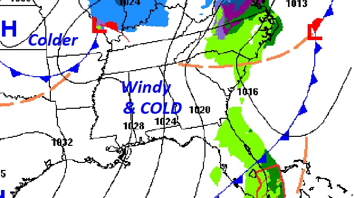
Good Morning. What a change! The Cold Front that moved through overnight has ushered in a quick shot of some much colder air, on gusty northwest winds. Yesterday’s high was 73. Today we’ll be lucky to reach 50. The wind will make it seem colder. We’re headed for the 20’s tonight.
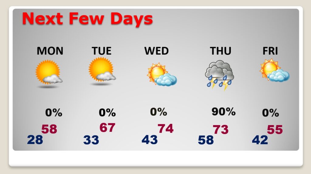
The best news is…the cold won’t last long. Look for a remarkable recovery in the week ahead. In fact, we’ll be in the 60’s again by Tuesday and the 70’s on Wednesday. But, there is a price to pay. ‘Tis the season for severe weather. A Thursday storm system could bring another severe weather threat to the state. The Storm Prediction Center first alerted us last Friday, that this Thursday’s storm could be a problem.
TODAY: On this Super-Bowl Sunday — Windy & cold. Today’s high may fall short of 50 degrees. Gusty northwest wind at 10-20 will make its seem colder. A few clouds, but mostly sunny. Clear and cold tonight. Not as windy. Low 28.
NEXT FEW DAYS: Nice rebound ahead. Upper 50’s Monday afternoon, mid 60’s Tuesday, mid 70’s Wednesday. All eyes on that Thursday storm system. Potential Severe Weather Day in Alabama. More below.
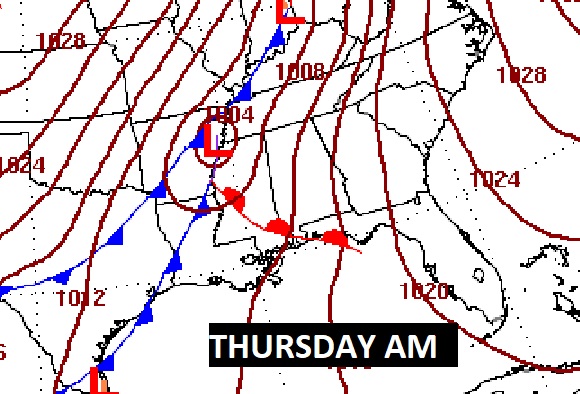
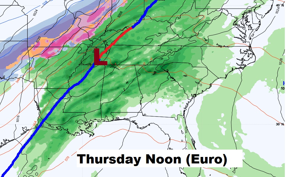
THURSDAY STORM SYSTEM: A potent storm system will move out of the plains state on Thursday. Strong to severe storms are a good bet ahead of the front. Here’s the impressive set-up on Thursday morning. The risk will be strongest across Louisiana, Arkansas and Mississippi.
The Storm Prediction Center maintains a Severe Risk eastward into Alabama Thursday. But, there are some potential limiting factors. The main Severe Weather ingredients may race northeastward as the storms approach central Alabama. That may limit the eastward extent of the severe weather. For now, we’ll just say that strong to severe storms, along with a few tornadoes are possible Thursday. We’ll know much more about details as we get closer to the event. In addition to the severe weather risk, strong gusty surface winds, ahead of the front could gust as high as 35 mph.

Timing with this storm system varies between the two main global models. The GFS is roughly 6 hours faster than the Euro. Over the next few days, hopefully the models will come into closer agreement on the timeline.
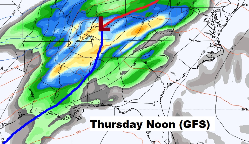
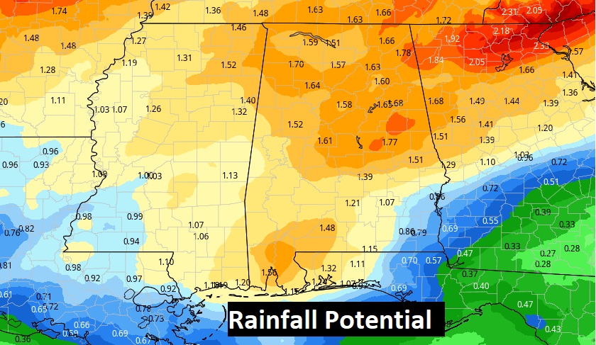
Locally heavy rainfall is also expected.
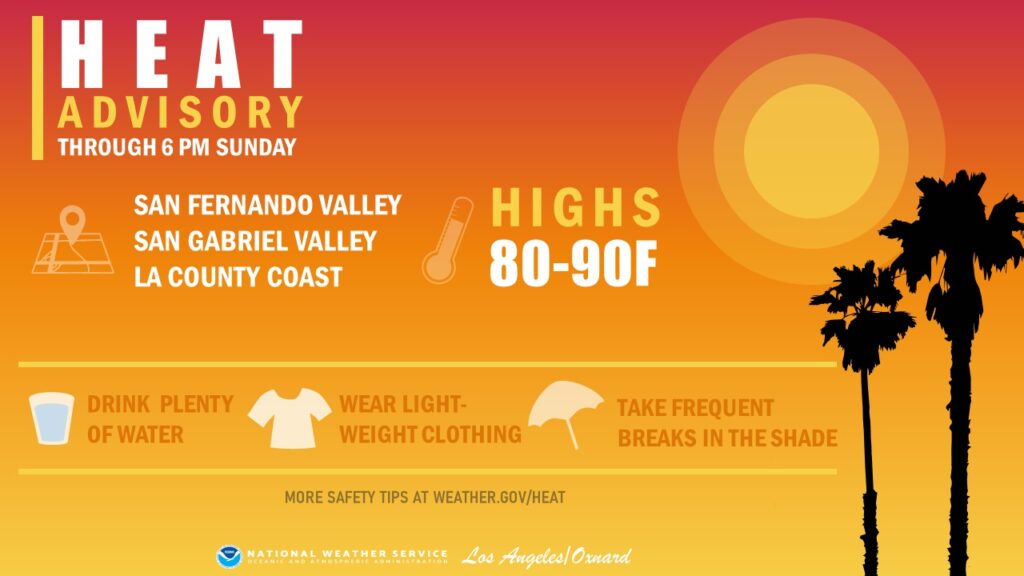
Have a Nice Super-bowl Sunday! Enjoy the game! In southern California there’s a heat alert today> High today, outside the Super Bowl will be 85 to 90!
I’ll have a complete video in the morning, online by 4:45 AM.
–Rich