NOON UPDATE:
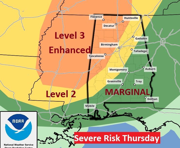
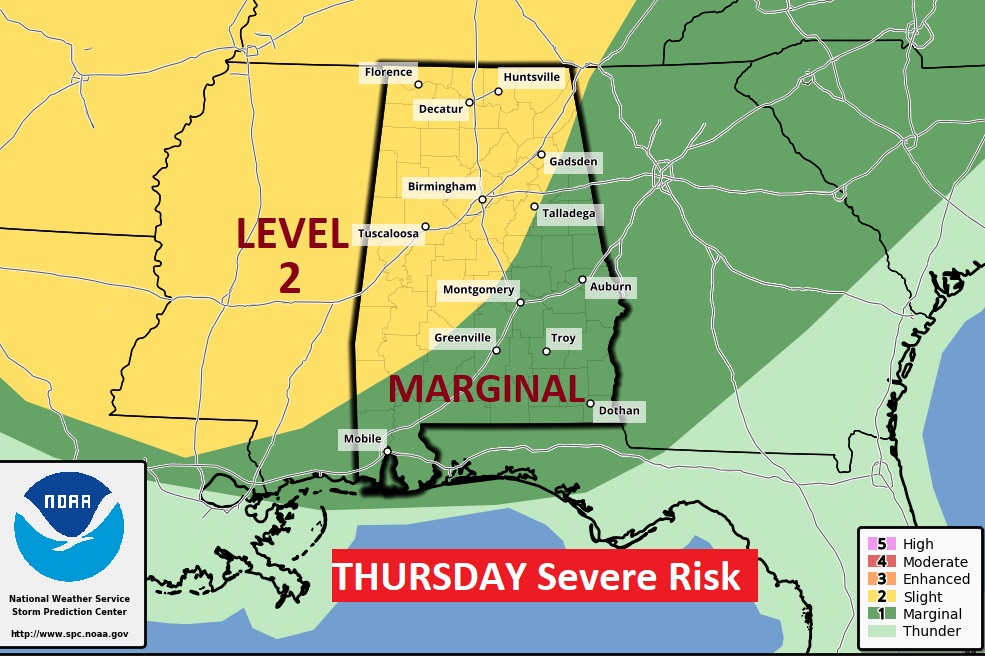
The Storm Prediction Center has upgraded parts of northwest Alabama, north Mississippi and west Tennessee to a Level 3 Enhanced risk for Thursday and Thursday night. This is where the greatest threat of a few tornadoes will exist. No change in the level 2 or level 1 aerial coverage. #alwx
EARLY MORNING UPDATE:
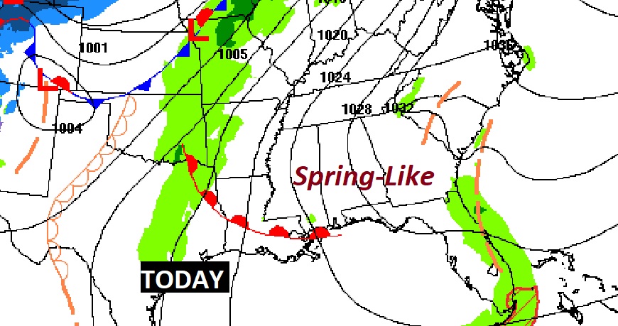
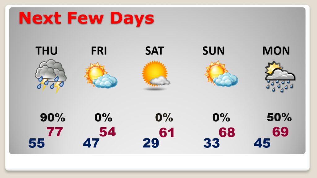
Good Morning! Our string of storm-free, spring-like days is coming to an end. A significant storm system will affect the state by late Thursday and Thursday Night. A line of strong to severe storms will sweep across the state Thursday evening. Outside of thunderstorm areas, strong winds will gusts as high at 40 mph, enough to bring down some small trees. Behind the storm system, colder air will funnel in Friday. On this video, I have the updated Severe Risk level, and an update on timing. Plus, we’ll look ahead to the weekend, and another week storm system, which will bring more rain back to the area at the first of next week.
Enjoy today. The is the final storm-free/spring-like day in this series. We made it to 70 yesterday. I think we make it to the mid 70’s today. It will be a breezy day with a sun/cloud mix.
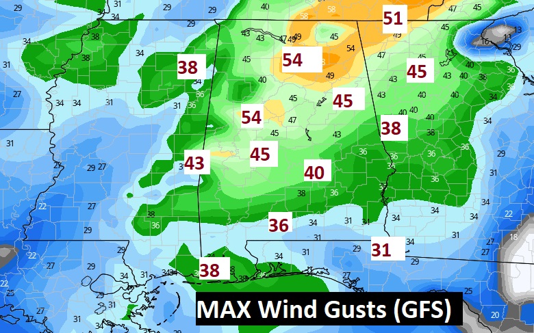
A significant storm system will approach tomorrow. A line of strong/severe storms will sweep across the state Thursday evening and Thursday night.
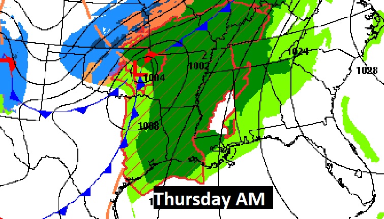
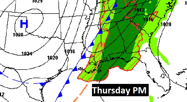
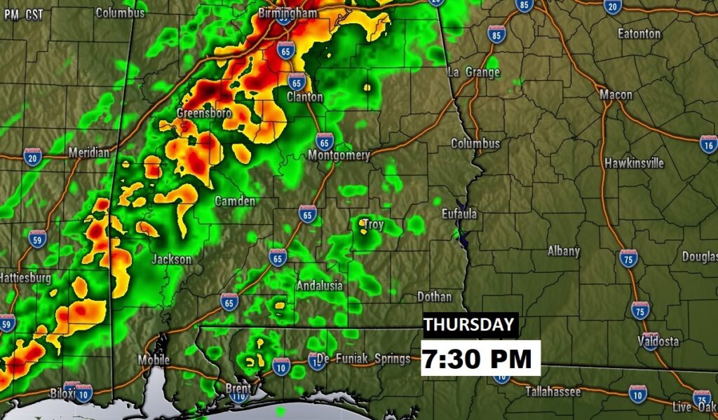
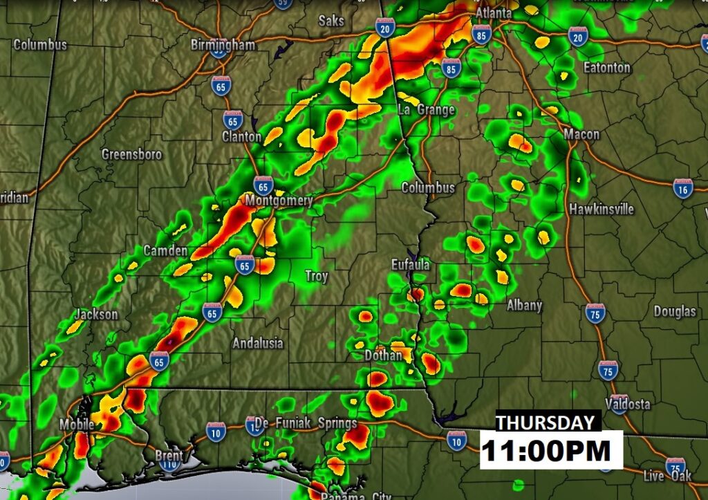
A line of strong/severe storms will sweep across the state Thursday evening and Thursday night. Damaging wind gusts are the main risk. A tornado can not be ruled out, particularly in the western and northwest portion of the state in the Level 2 risk area. The line of storms should begin to weaken as it reaches the I-85 corridor. That’s because the severe weather dynamics will begin to race to the northeast away from Alabama.
Outside of thunderstorm areas, strong winds will gusts as high at 40 mph, enough to bring down some small trees.
Colder air funnels in Friday behind the storm system. After a freeze Saturday morning, there should be a nice turnaround Saturday afternoon. Warmer Sunday. Risk of rain by Monday afternoon. Better chance of rain Tuesday.
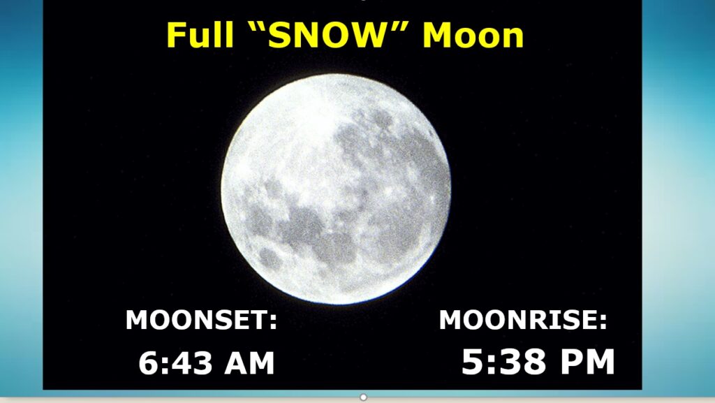
Bright full snow moon out there this morning.