
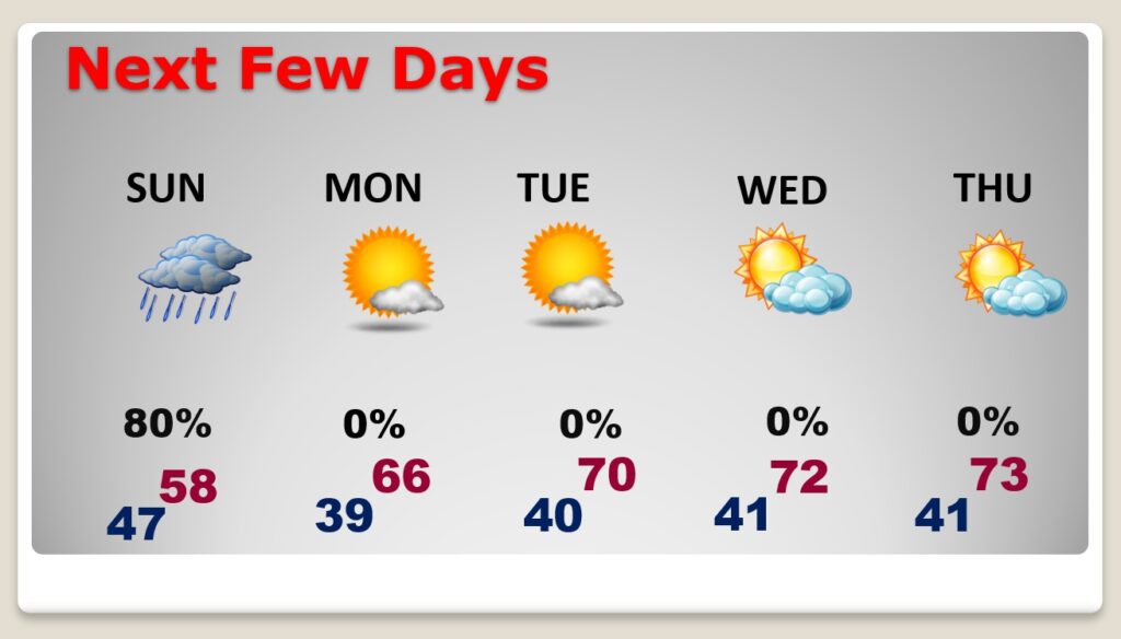
Good Morning! We have nice last Saturday of February ahead of us. The normal high is 67. Today we’ll be close to normal, with a lots of sunshine. Enjoy today. Sunday will not be very pleasant. A wave of low pressure moving along a front in the Gulf, will bring rain back to the Alabama. It’ll be a wet, chilly day. Our high temperature will fall short of 60°.
But, hang on. There’s good news as February ends and March begins. Expect an extended string of storm-free days, with a warming trend on the way. We’ll be 70 or above Tuesday through Friday. Sunshine will dominate through the end of the week and perhaps beyond.
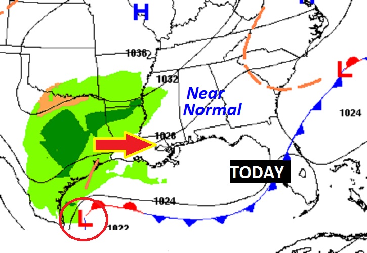
On the map today, high pressure dominates our weather. But, to the west, a western Gulf of Mexico storm system is approaching.
TODAY: Mostly Cloudy.. Our high temperature lower 60’s. North wind at 5 to 10 mph. Increasing clouds tonight. Chance of s few showers in the overnight hours after Midnight. Low 39.
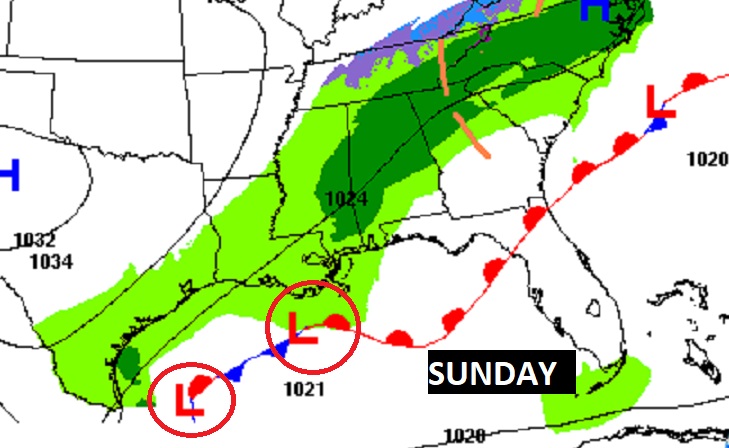
SUNDAY: Periods of rain. Chilly day. High 58. West wind 6 to 12 mph. Showers continue Sunday evening, ending by Midnight. Low Sunday night 47.
On the map, we see that stalled front in the Gulf, with waves of low pressure riding along the front like a train track. That will make for a very wet Sunday.
NEXT FEW DAYS: The last day of February will be nice. Lots of sun. Upper 60’s. Warmer Tuesday through Friday. Lots if sunshine. A very nice string of days, as March comes in “like a lamb.”
A massive Ridge of High Pressure in the upper atmosphere will insure a storm-free first 5 days of March and a pronounced warming trend.
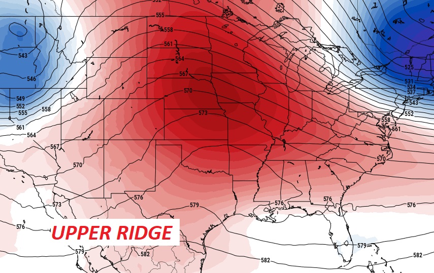
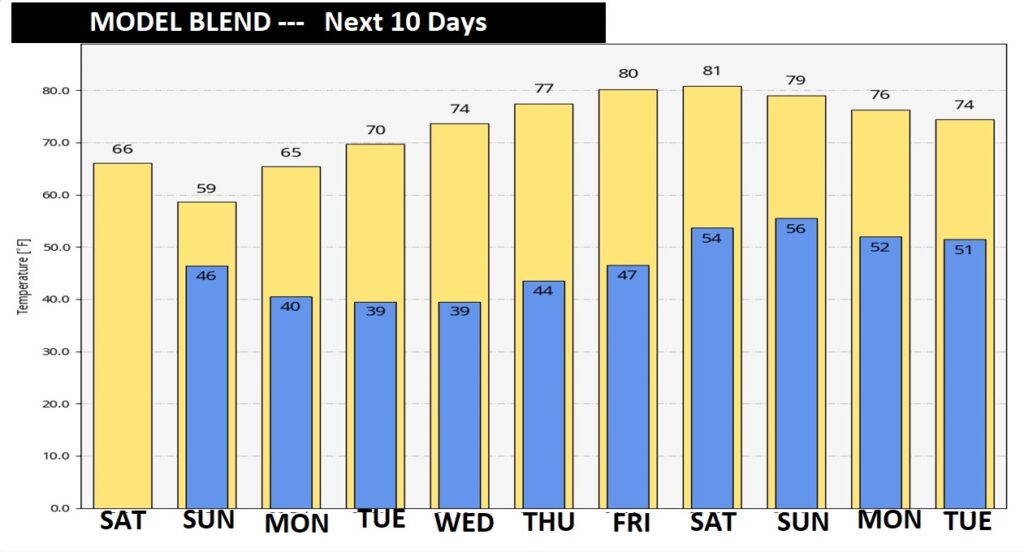
NEXT 10 DAYS: The 10 Day Model Blend shows a very nice, gradual warming trend Tuesday through Saturday, in the first five days of March. The next significant storm system is expected sometime next weekend.
.
I’ll have another Blog update in the morning. Enjoy this nice day, today. Have a nice weekend!
–Rich