
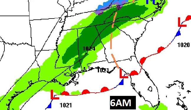
Good Morning! A wave of low pressure, moving along a frontal system in the Gulf. Patchy rain has already overspread most of the state north of the I-20/I-59 corridor. The rain will be more widespread later, but, in general the rainfall is expected to be quite light and spotty for most of us in central and south Alabama. Expect a cool day with highs in the 50’s.
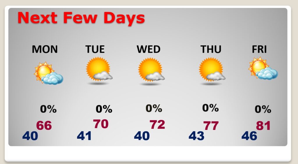
There’s much better news in the week ahead as February ends and March begins. Sunshine returns Monday. A significant warming trend is on the way. Nice warming trend Wednesday through Friday. Lower 80’s by Friday. A beautiful extended string of beautiful, sunny storm-free days as March rolls in “like a lamb”.
TODAY: Cloudy & cool. Spotty rain at times today, ending by evening. (The best rain chance will be across the northern half of the state.) Today’s high 56-58. Northwest wind 6 to 12 mph. Mostly cloudy tonight, partial clearing late. Low near 40.
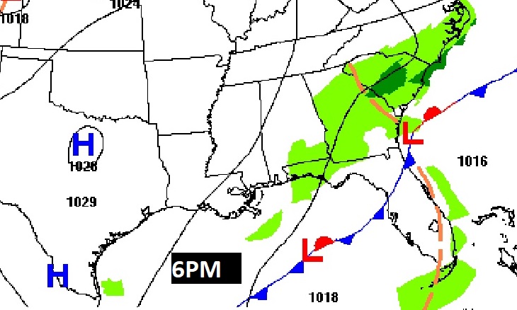
On the map, the culprit for today’s is a wave of low pressure south of the Louisiana coast, riding along a stalled frontal system. Rain exits the state by evening, as the low moves east.
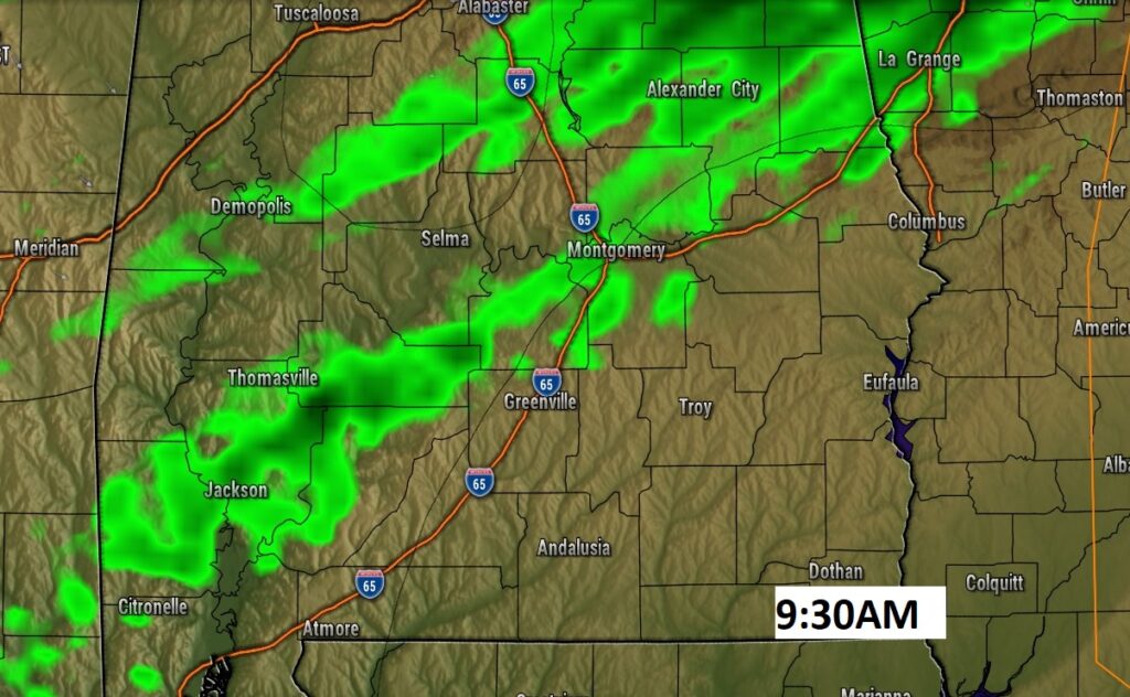
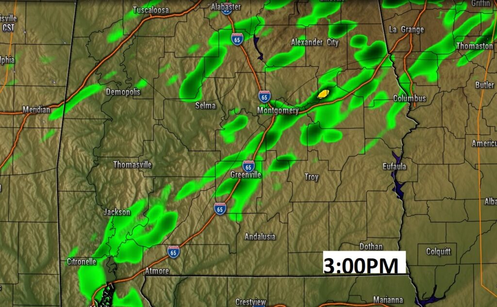
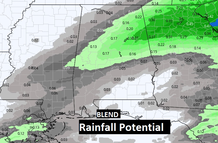
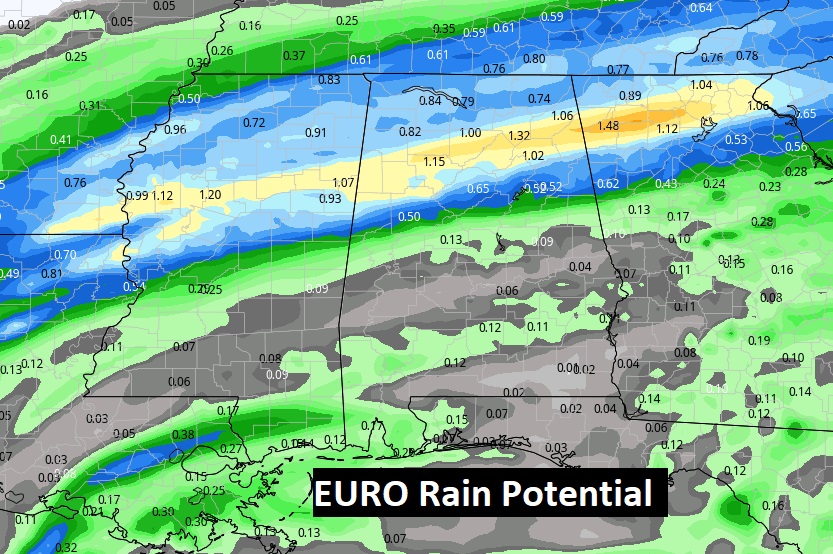
VERY LIGHT RAINFALL AMOUNTS: Rainfall will be very light & spotty across central & south Alabama. Some towns just won’t see much. Here’s a sample of some Future Radar snapshots, and a couple example of projected potential rainfall totals. Notice the EURO model is on the wetter end. The Model Blend is much drier. The truth probably lies in-between.
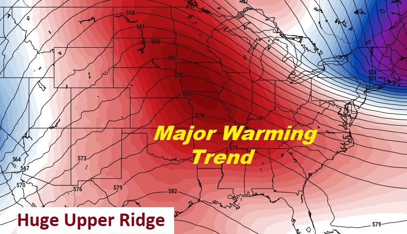
AMAZING WEEK AHEAD: The key to our weather for the week ahead will be a Massive Upper Level Ridge of High Pressure dominating a large part f the country. For us this spells an extended storm-free series of days with a significant warming trend.
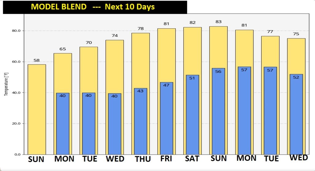
NEXT FEW DAYS: Normal high is 68. Monday will be below normal. Perhaps mid 60’s. Tuesday will be closer to normal, close to 70. Nice warming trend Wednesday through Friday. Lower 80’s by Friday. A beautiful extended string of beautiful, sunny storm-free days.
NEXT 10 DAYS: The model blend looks great. We cross into above normal territory by Tuesday afternoon. The first six days of March looks amazing. Each day will be warmer. Highs will reach the lower 80’s by Friday through Sunday.
.
Have a Great Sunday! I’ll have a complete video in the morning, online by 4:45 AM.
–Rich