
(** A few technical issues this morning…so I’m producing a Blog instead of a video. I promise there will be a video on Wednesday morning.)
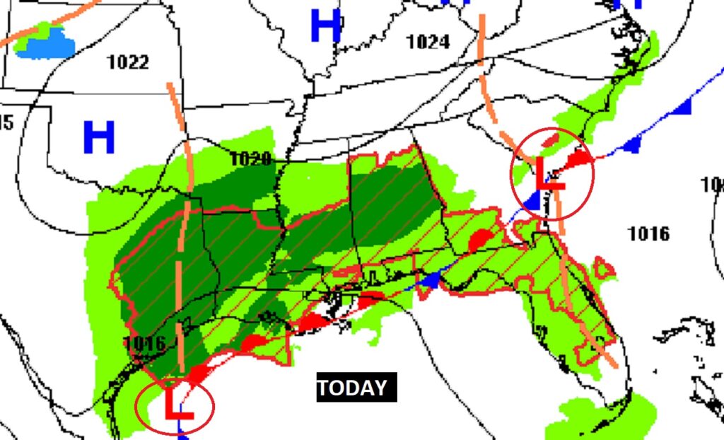
Good Morning! The Cold Front which brought a round of strong storms to the state yesterday has stalled in the northern Gulf. Over the next few days, waves of low pressure will “ride” along the front, like a train track. Periods of showers and storms will affect the state through Friday. It won’t rain all the time. The rain will come in waves. The next surge of showers and storms arrives this afternoon and through tonight. It will be a much cooler day. Yesterday’s high was 79. Today’s high will struggle to reach the mid 60’s.
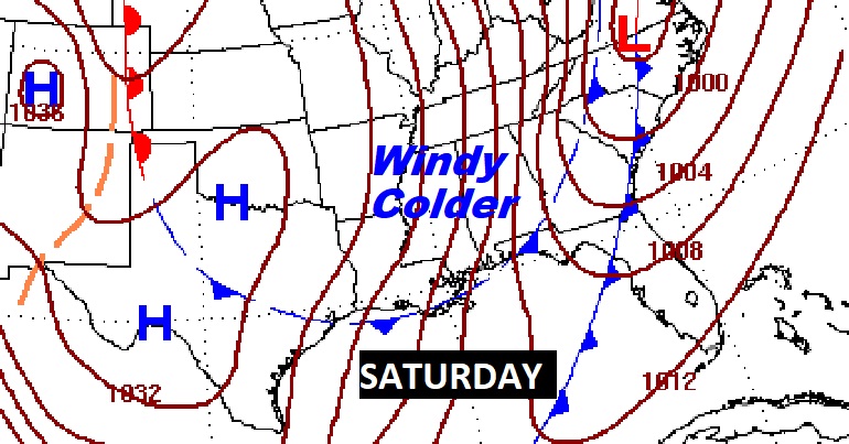
A strong Cold front will enter the state Friday/Friday night. A round of strong/severe storms are expected with the front. Dramatically colder air will follow the front. Expect a late season “Cold Snap”. Saturday will be windy and rather cold. Temperatures will probably not make it out of the 40’s. Alabama growers beware. We’re headed for the upper 20’s Saturday night/Sunday morning. It’s possible we may see a couple of freezing morning before temperatures recover.
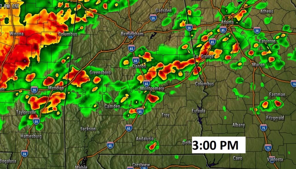
TODAY: Much of the morning should be dry. The next surge of showers and thunderstorms will spread across the area by this afternoon and tonight. Much cooler today. High 65. Low tonight 55. No severe weather is expected.
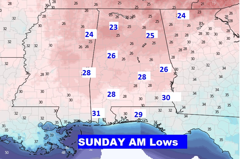
NEXT FEW DAYS: Periods of rain are expected over the week ahead through Friday, as waves of low pressure move along a stalled front in the Gulf. Much colder air arrives by Saturday. The coldest morning will be Sunday morning with lows in the 20’s. Alabama Growers: Get ready for a late season Freeze.
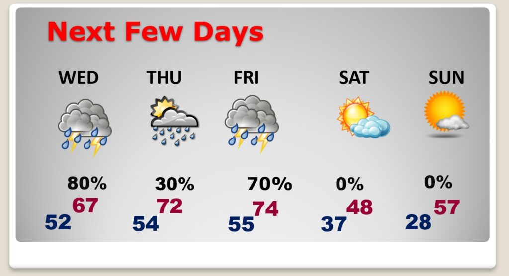
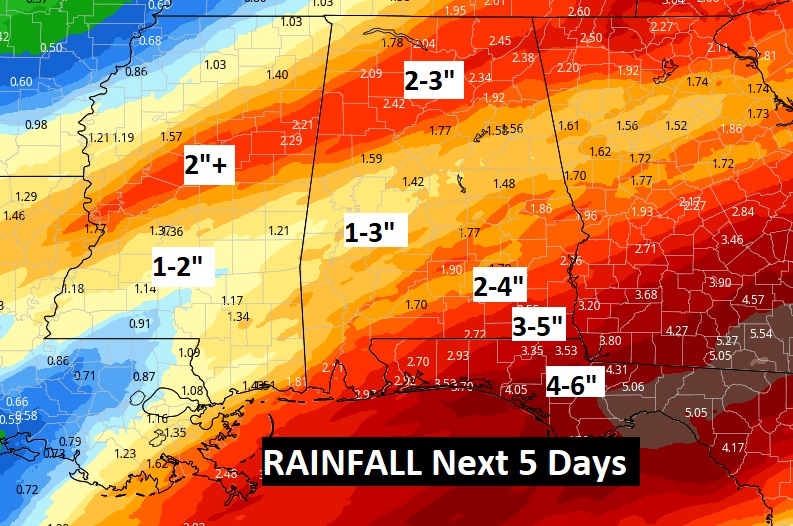
A series of Waves of low pressure moving along the front in the Gulf will bring in surges of rain to the area. It will be wet at times today through Friday. Excessive rainfall is possible in spots, particularly in the southeastern part of Alabama.
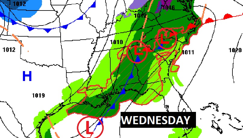
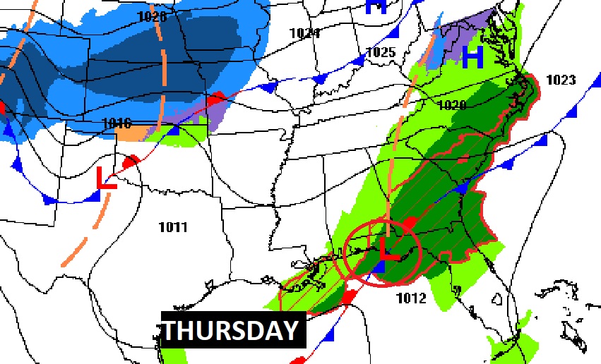
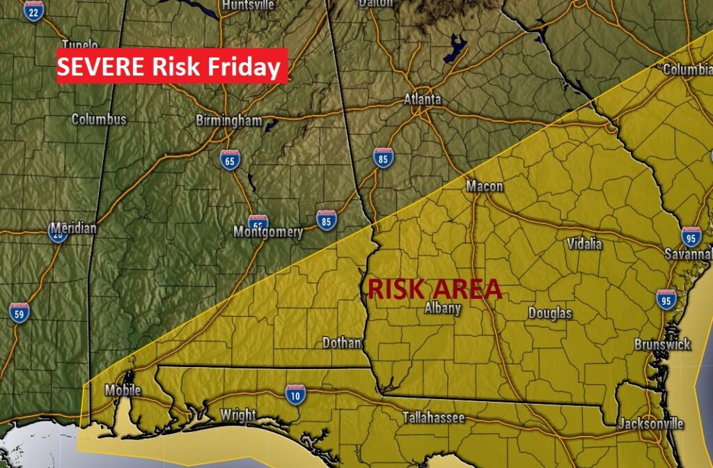
STRONG STORMS FRIDAY: The most important front of the week will approach the state Friday. Showers and thunderstorms will spread across the area. Some of the storms could be strong, possibly severe, especially over southeast Alabama. We’ll know more about this potential Severe Threat as we get closer to the event Friday. much colder air will follow the front. Temperatures will drop dramatically in the overnight hours Friday night.
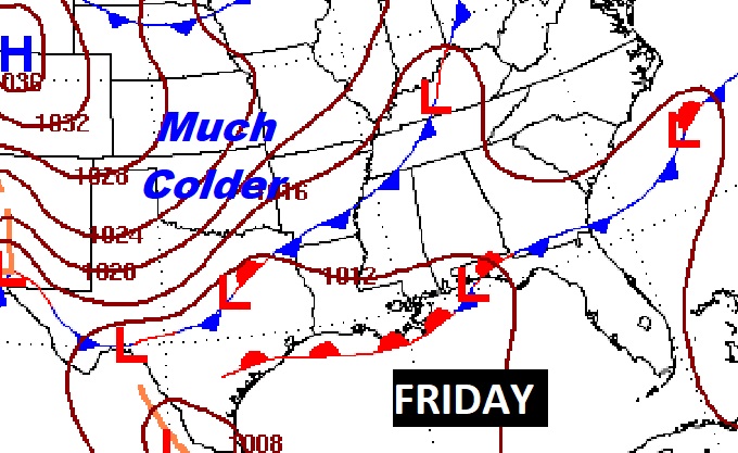
WEEKEND COLD SNAP: The Friday night cold front will usher in some dramatically colder air. Saturday will be a raw day, with highs that may not make it out of the 40’s. Winds will make it seem colder.
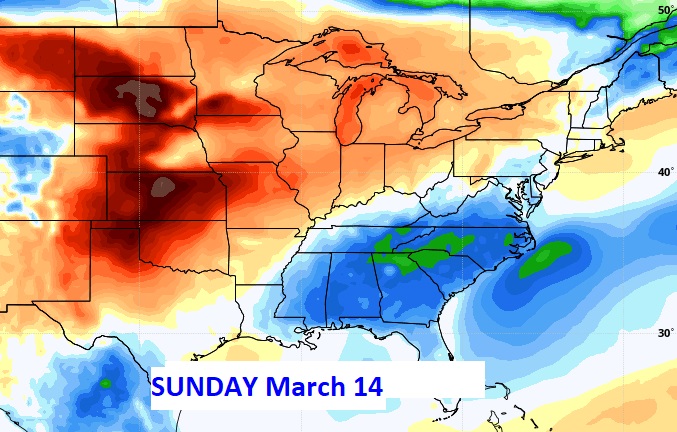
The Coldest morning is likely to be Sunday morning with lows falling to the upper 20’s. We could see a couple of mornings at or below freezing. Alabama growers beware.
—
Thanks for reading the Blog this morning. We’ll get back to a video update tomorrow morning. Everything else is normal this morning, including live on NewsTalk 93.1 from 6 to 9 and Live on TV on CBS 8 and ABC 32.
–Rich