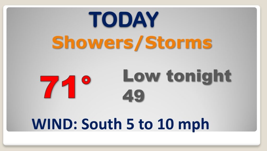
Good Morning! We’ll be radar-watching today as thunderstorms develop. A few storms could be on the strong side, as a Gulf coast storm system slides eastward. We’ll get a nice, but brief break on Thursday. St. Patrick’s day looks pretty nice. Then, all eyes on the next storm system. We are in a Level 2 risk area Friday, as more showers and storms move across the state. Expect a very active pattern through next week. But on this video, I have good news about the weekend. And, well look ahead. It looks like another severe weather threat around Tuesday night or Wednesday of next week. I the updated details of the next 8 days.
A Gulf coast storm system will bring showers and storms to the state today. A few stronger storms are possible, especially this afternoon.
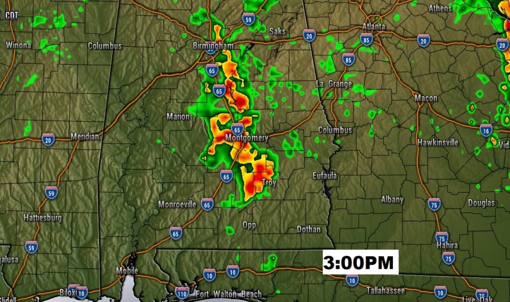
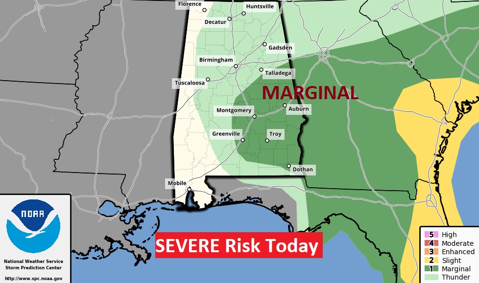
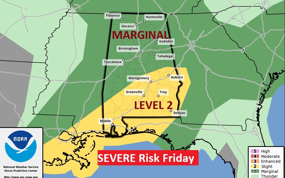
Marginal Severe Risk today. Damaging wind gusts and maybe some hail in the stronger storms today.
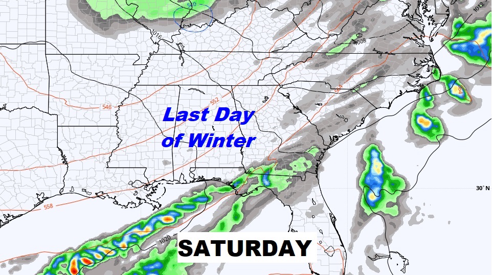
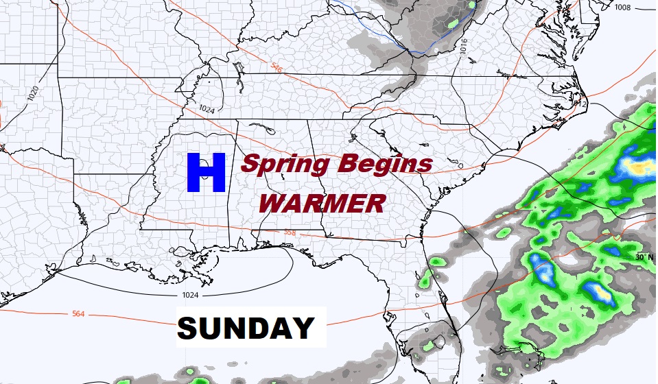
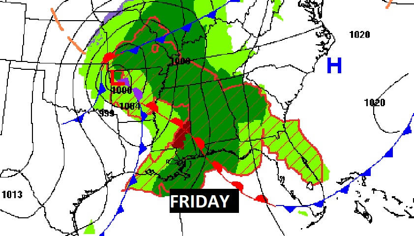
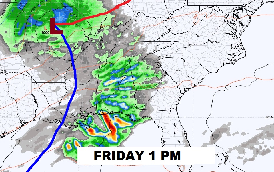
St. Patrick’s Day looks pretty good. Morning fog. Nice afternoon. Severe weather threat Friday. Nice weekend, More storms next week.
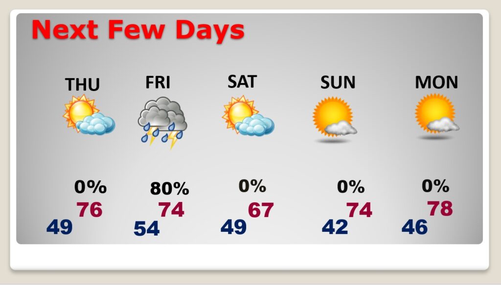
Friday’s severe weather threat could begin early. Tornadoes are also possible.
Weekend loos great.