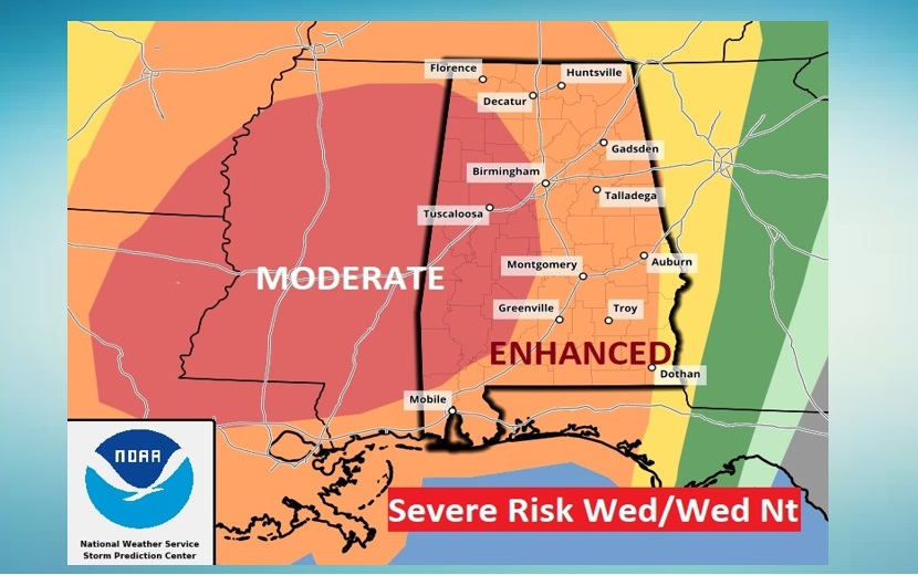
Good Morning! Our big warm-up continues. But, our long string of dry/storm-free days is about to end.. All eyes on a storm system, moving out of the Plains, which will bring yet another Severe Weather Risk to Alabama by Wednesday night. In fact, the threat level has increased to an Enhanced Risk for most of us (Level 3 out of 5). West Alabama now has a concerning Level 4 Moderate Risk. All modes of severe weather are on the table including Tornadoes. On this video, I have an update on timing, and we’ll look ahead through the upcoming weekend.
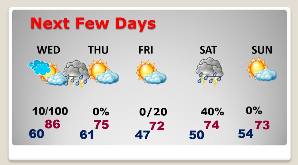
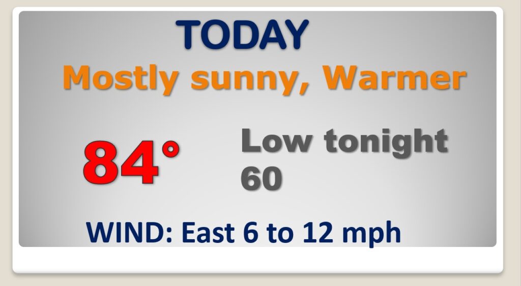
Enjoy today. It will be a warmer day. This will be the last storm-free day in this series.
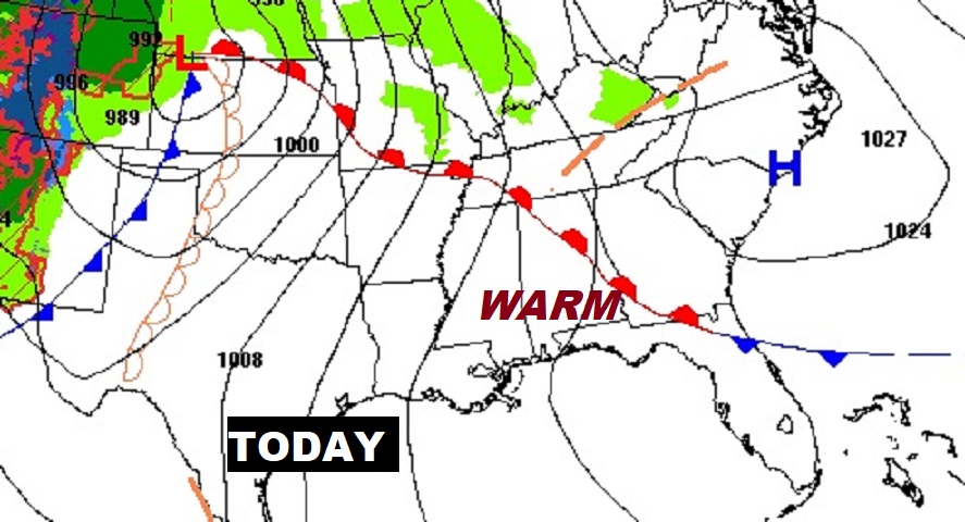
A regional outbreak of severe thunderstorms is expected on Wednesday across the Lower Mississippi Valley and Southeast States. All severe hazards are possible, including significant gusts over 75 mph and strong (EF2+) tornadoes.
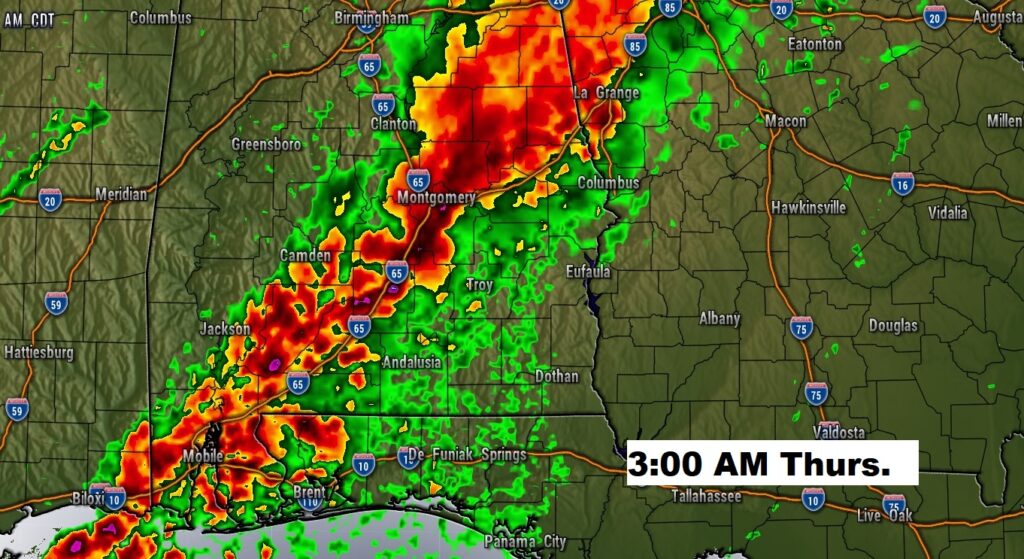
There will be a risk of tornadoes in the overnight hours Wednesday night, but it appears the highest risk will be damaging winds. Could be a significant damaging wind event. We’ll see. Here’s a snapshot of one high-res model.
Showers move out Thursday morning. Friday looks nice. Risk of scattered showers/storms Saturday. Sunday looks nice.