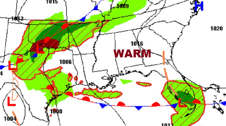
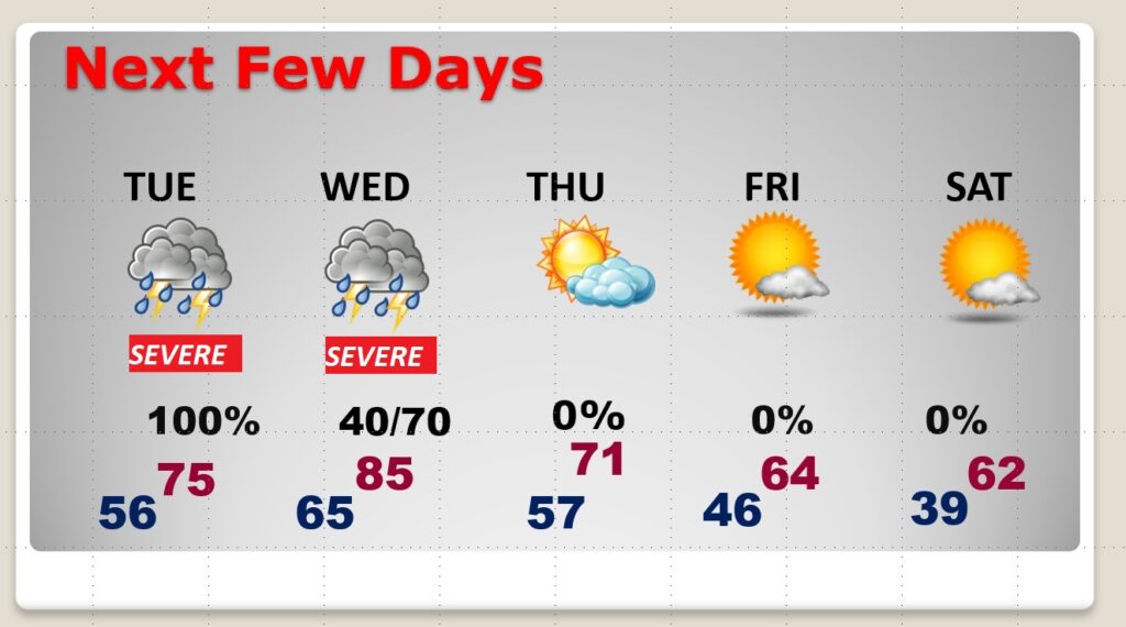
Good morning! Get ready for a simply perfect Monday. Lots of sun. Warmer. Enjoy this. More big changes are on the way. For the third week in row, it appears we are in for another severe weather threat. In fact, this time, it looks like multi-day severe threat. We have an enhanced risk Tuesday. And, then, another threat by Wednesday afternoon and Wednesday night ahead of a strong cold front. On this video, I’ll bring you up to date. I have the updated risk level, and the expected timeline. Much cooler air will follow late week.
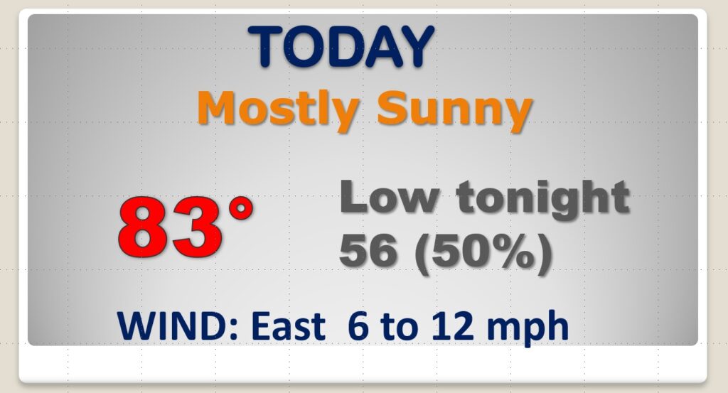
Enjoy today. Lots of sun. Warm. Showers and storms hold off until the overnight hours tonight.
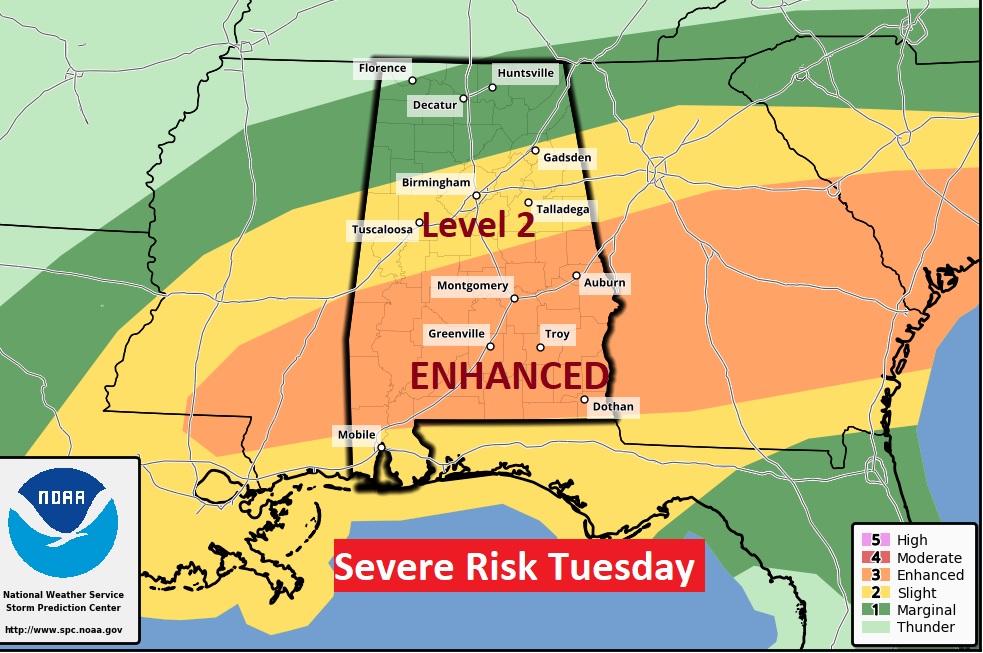
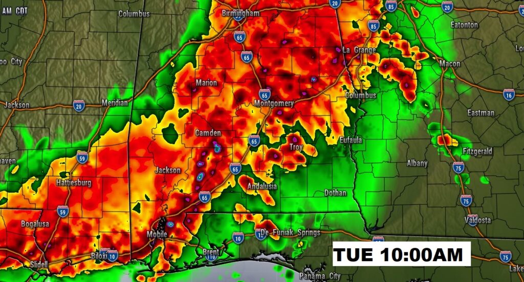
It’s possible some strong to severe storms could arrive before 7AM Tuesday morning. Then, Tuesday will get quite active and maybe quite early. All modes of severe weather including damaging wind gusts and tornadoes.
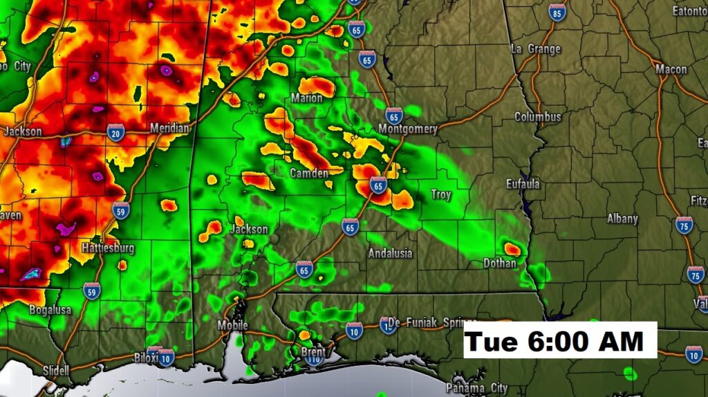
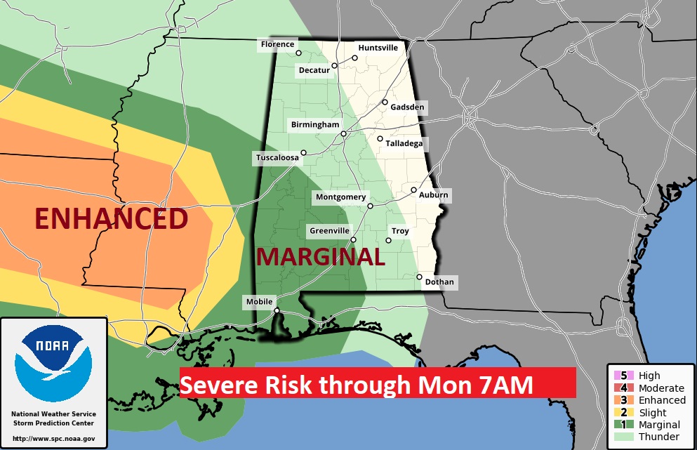
A concerning EHANCED (Level 3) Severe Risk covers central & south Alabama Tuesday.
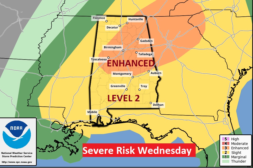
On Wednesday afternoon & Wednesday night, another round of severe weather is expected as a strong cold front approaches. Again, a big chunk of the state is in a ENHANCED risk, including a tornado threat.
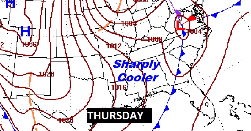
Expect sharply cooler air by late week. We could be in the upper 30’s by Friday night. Barely low 60’s Saturday.
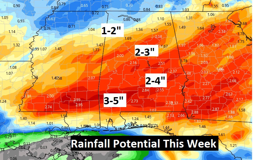
Check out the potential rainfall in the week ahead!