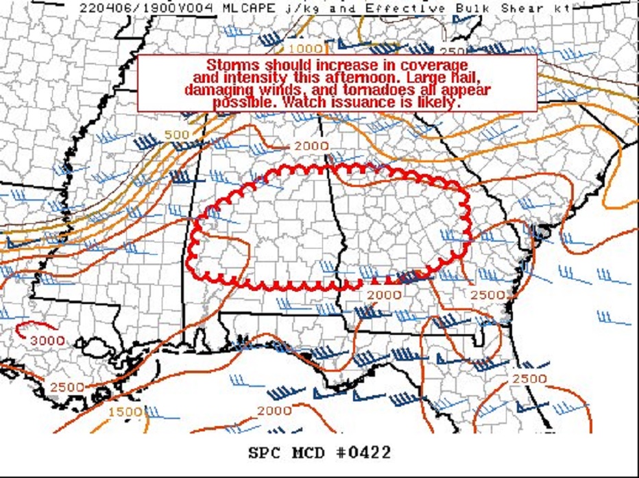
11:30 AM UPDATE:
SPC says a Watch is likely by early afternoon. (80% chance) Almost certainly a tornado watch. #alwx
https://www.spc.noaa.gov/products/md/md0422.html‘
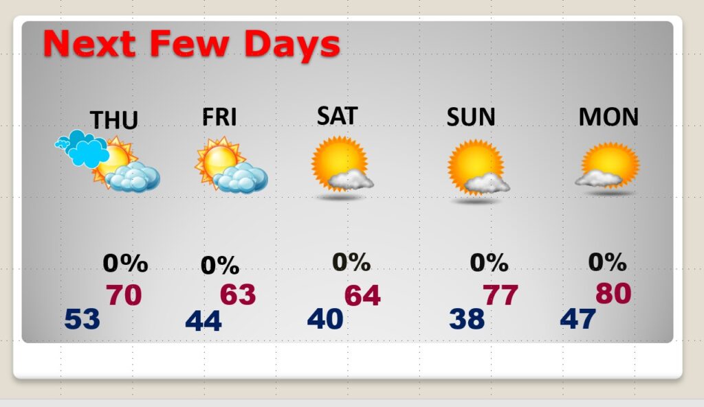
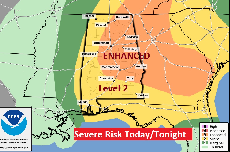
Good Morning! We’ll be watching radar closely again today. A strong cold front is approaching. A line of strong/to severe storms will accompany the front itself tonight. But, there’s also a chance that strong storms will develop in a warm/moist environment this afternoon. Many of us are in an Enhanced Severe Threat from SPC. All modes of severe weather are possible, including a Tornado Risk. Much cooler air will funnel into the state Thursday. Expect a late season cool snap. Highs barely reach the low 60’s Friday and Saturday. We’ll be near or below 40 Saturday and Sunday. On this video, I’ll show you future radar, the new SPC threat levels, and we’ll look ahead to the weekend and beyond.
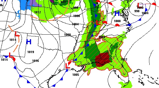
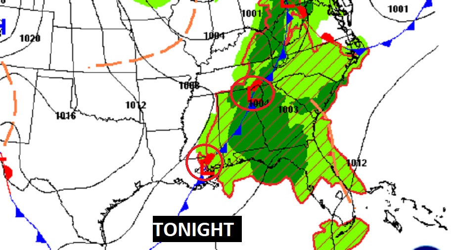
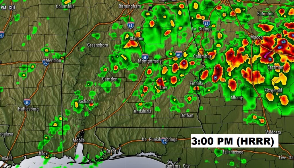
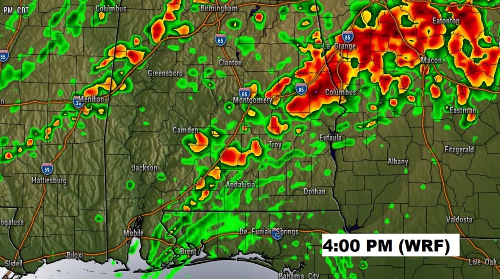
A strong cold front will sweep across the state tonight. Ahead of the front, strong to severe storms are expected. There could be two modes of severe weather. A potential cellular mode this afternoon could produce damaging wind gusts and some tornadoes. The second mode would involve a line of storms along the front itself tonight. That would be more of a damaging wind gust threat and a small tornado risk.
Two hi-res models suggest a potential dangerous afternoon cellular severe mode. We’ll see.
Once again today, many of us are in an Enhanced Level 3 Severe Risk today. A tornado Watch is likely.
Much cooler air will funnel in behind the cold front Thursday. It will be dramatically cool for so late in the season Friday and Saturday. We could be in the upper 30’s by Sunday morning.’