
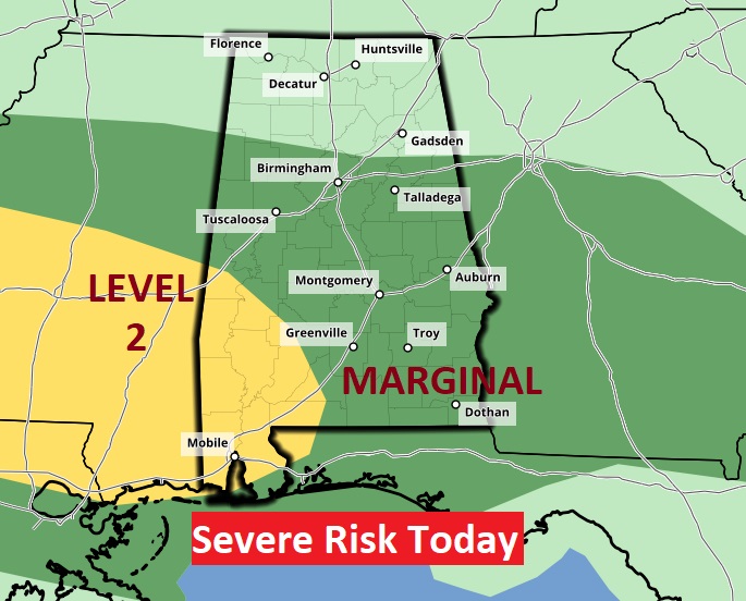
Good Morning! Unfortunately, the Easter Sunday forecast is less than ideal. Areas of Dense Fog this morning. Strong to severe thunderstorms this afternoon and tonight. Most of us are in a Marginal Severe Risk. All of southwest Alabama is in a Level 2 Severe Risk, again today. The main risk is damaging wind gusts. Some storms will have large hail. The tornado threat is low, but not zero.
The rain risk will end Monday morning. Big improvements begin Monday afternoon. Expect a series of cooler days and chilly, jacket weather nights. But, the main point is – we’re in for an extended series of very nice days in the week ahead.
Stormy Easter Sunday across the deep South.
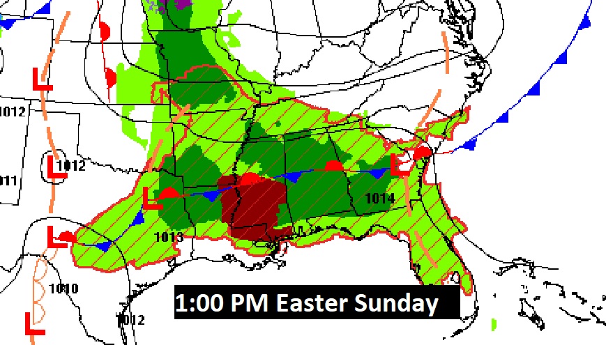
TODAY: Areas of Dense Fog this morning. Strong to severe thunderstorms this afternoon and tonight. Most of us are in a Marginal Severe Risk. Damaging wind gusts are the main threat. But some storms will also feature large hail. The tornado threat is low but not zero. High today 78. Low tonight 62.
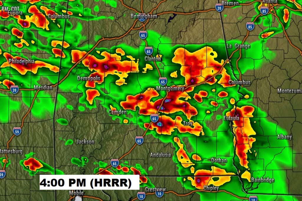
The BEST chance of strong to Severe storms will be this afternoon. Here’s a Future Radar snapshot from on the models at 4PM. Our weather app will keep you on top of the action.
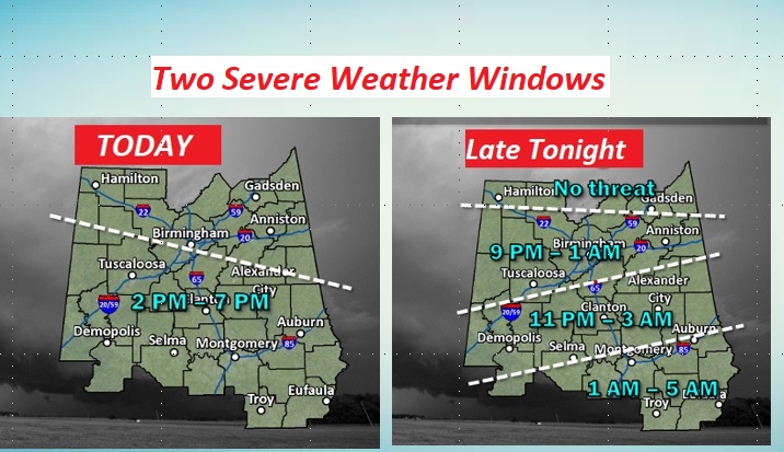
There’s actually two potential Severe Weather windows — one this afternoon and another one overnight tonight. This NWS Graphic may help with your planning.
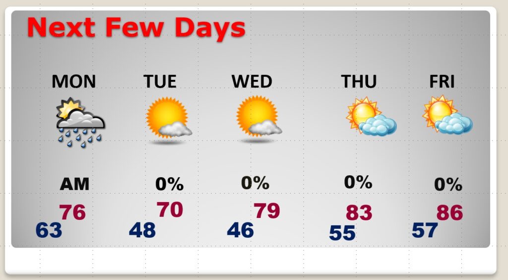
MONDAY: Risk of showers and storms mainly through the morning hours. Look for nice improvements Monday afternoon. High 76. Mostly clear and cooler Monday night. Low 48.
NEXT FEW DAYS: Starting Monday afternoon, improvements begin. Then, the rest of the week looks rather sensational. Cooler but comfortable, beautiful days, chilly, jacket-weather nights. A GREAT pattern is on the way.
.
Have a nice Easter Sunday! I’ll have a complete update in the morning, online by 4:45 AM.
–Rich