
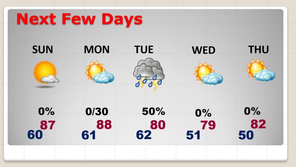
Good Morning! You can’t write a better script than this. The weekend forecast is nearly perfect. What a far cry from last weekend. The storm-free, sunny days roll on. The warming trend continues. Today will feel more like late May or early June.
The next frontal system approaches the state by Monday night. There could be a few showers Monday night. A better chance of scattered showers and thunderstorms holds off until Tuesday. After that, it looks like another series of quiet, beautiful, storm-free days.
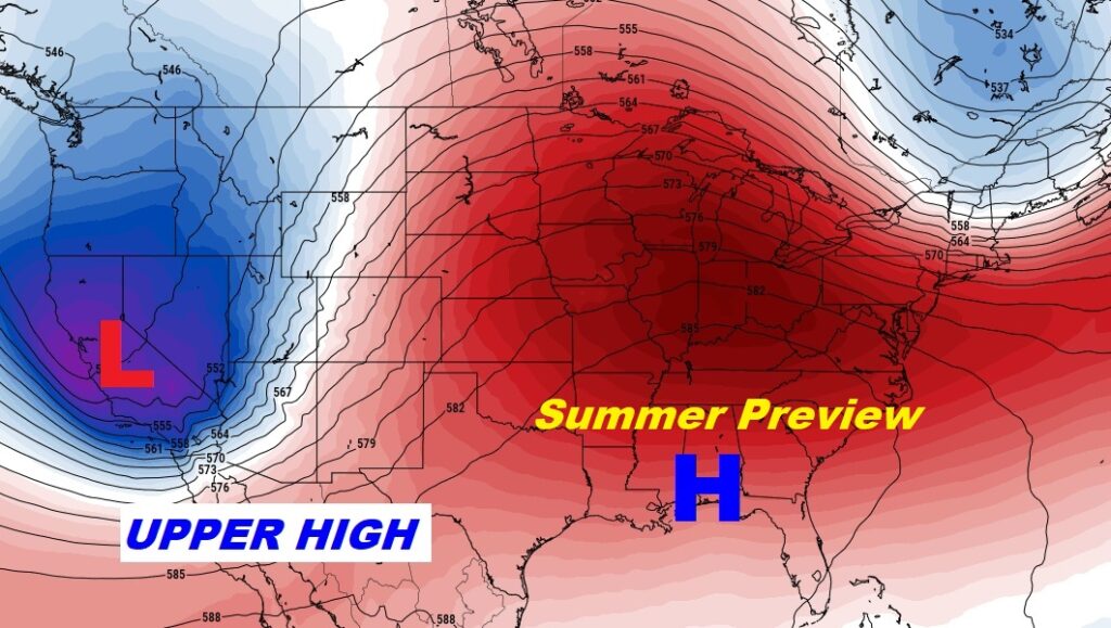
I really don’t see any concerning “Big Ticket” weather in the next 1o to 15 days.
A huge mound of high pressure in the upper atmosphere continues to act as a protective dome, diverting storm systems around us.
TODAY: Abundant sunshine. Nearly perfect. High 85. (Normal high 80) (Yesterday’s high 84) Breezy today. Southeast wind at 10 to 15 gusting as high as 20 mph. Partly cloudy tonight. Low 61.
SUNDAY: Mainly sunshine. High in the mid to upper 80’s. Low Sunday night 60.
NEXT FEW DAYS: Nearly perfect through Sunday. Even most of Monday will be dry and warm for April. Small risk of showers by Monday night. Scattered showers and thunderstorms return Tuesday as a weakening front moves through the state. Beautiful weather follows the front starting Wednesday.
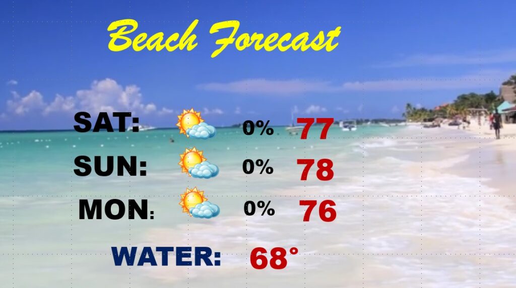
BEACH FORECAST: Breezy weekend. Cooler at the Beach due to the onshore flow off the chilly 68 degree water. Highs in the upper 70’s. Lows in the 60’s. Sunshine. Nice weekend.
TALLADEGA: Very nice. High near 84 today and Sunday. Nighttime lows in the upper 50’s. A Great Race Weekend.

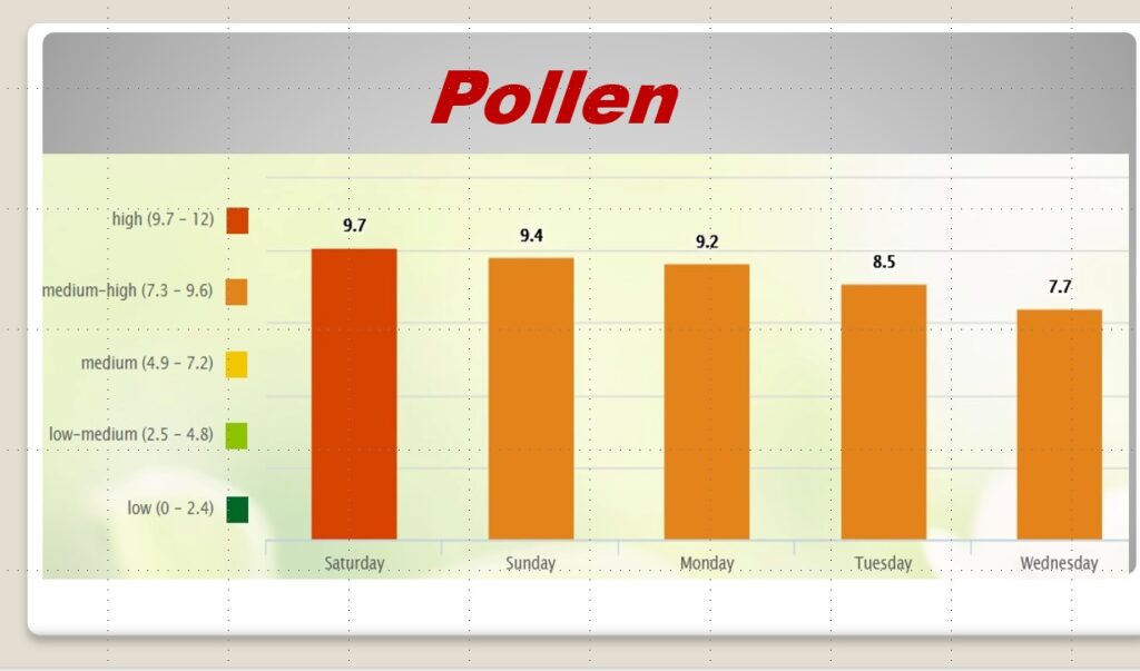
POLLEN: Unfortunately, the pollen numbers remain quite high through the next several days.
.
I’ll have another Blog update in the morning. Enjoy this beautiful weekend weather.
–Rich