
12 NOON UPDATE:
EARLY MORNING UPDATE:
Good Morning! Here’s my brief video forecast discussion.
TODAY: Very warm & humid. Sun/cloud mix. We’ll be near or at 90 degrees for the afternoon High. (Humid. Dewpoints in the upper 60’s) Widely scattered mainly afternoon & evening showers and thunderstorms. Low tonight mid 60’s.
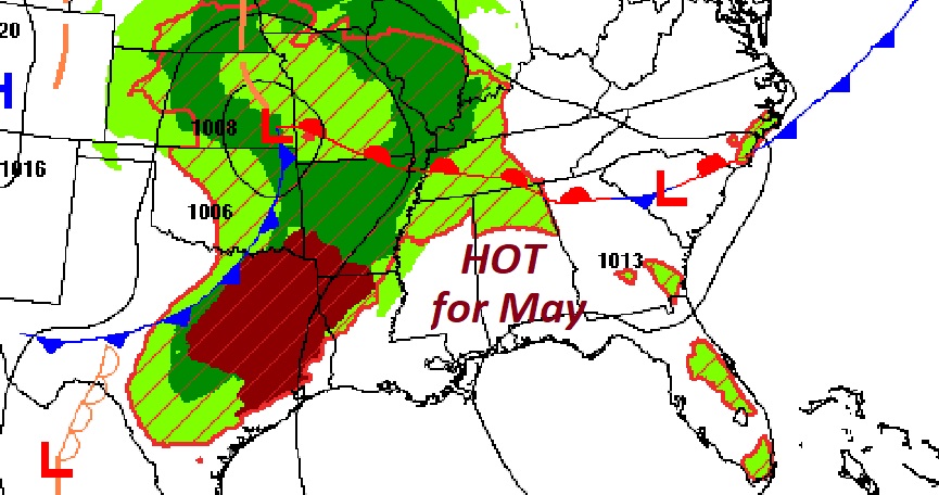
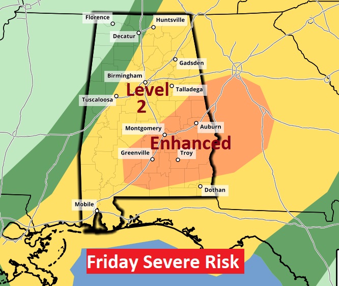
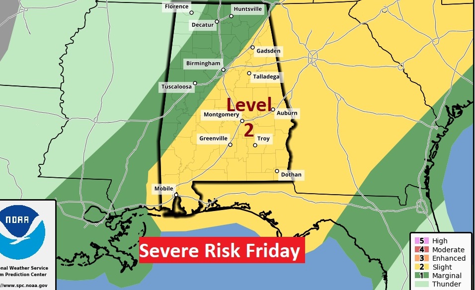
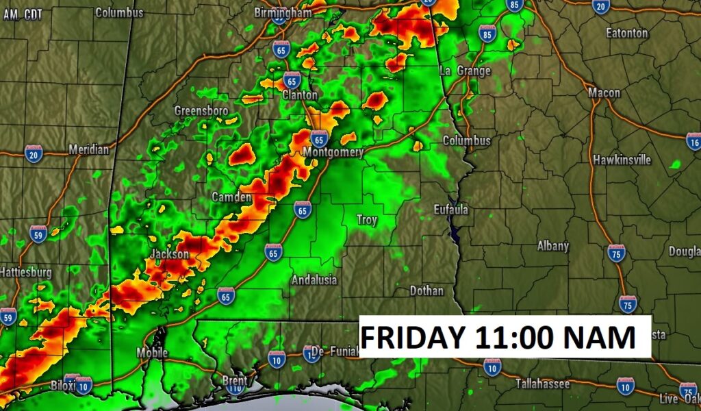
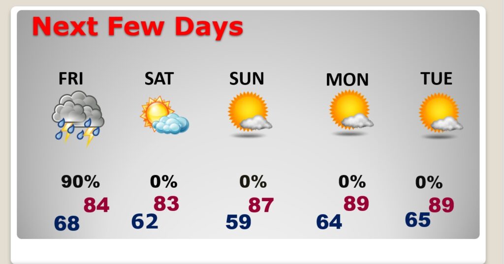
FRIDAY: Thunderstorms likely. Strong to severe storms are a good bet. Damaging wind gusts if the main risk. An isolated tornado can’t be ruled out. The main window for many of us will be morning and mid-day. Then, shifting into southeast Alabama in the afternoon. And isolated tornado or two can’t be ruled out.
NEXT FEW DAYS: On Saturday, the risk of showers and storms shifts to the coast. Most of us should be dry. Less humid and comfortable. Mother’s Day Sunday should be dry & warm & nice. Monday and Tuesday look very warm.
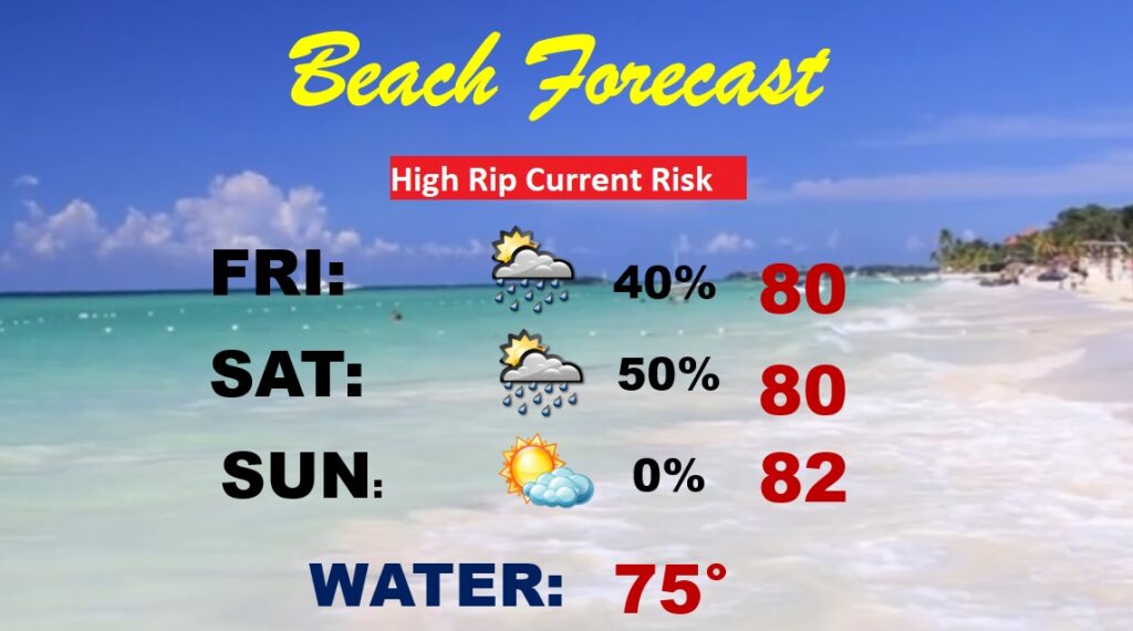
BEACH FORECAST: Scattered showers and thunderstorms Friday & Saturday. NICE on Mom’s Day Sunday. HIGH rip current risk Friday & Saturday and a moderate risk Sunday.
—
Thanks for reading this Blog this morning.
This morning we are LIVE on the radio from 6 to 9 on NewsTalk 93.1. Watch us on TV on CBS 8 and ABC 32. I’ll have another update for you in the morning. Have a nice day.
–Rich