
Good Morning! Here’s my brief video forecast discussion.
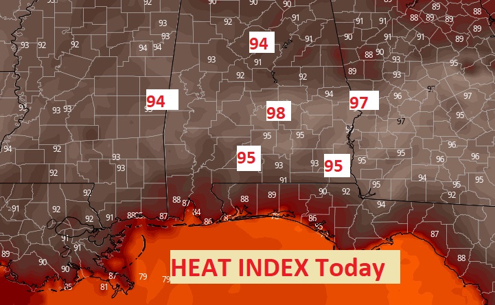
TODAY: Morning clouds will give way to lots of sun later. Hot for May. A little more humid today. High 94. Normal High 86. Record high 97 from 1962. Southwest wind at 5 to 10. Mainly clear. Warm tonight. Low 71.
With the extra humidity today, the Heat Index will be edging closer to the upper 90’s.
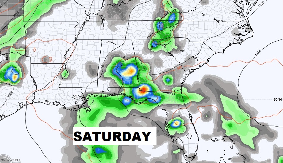
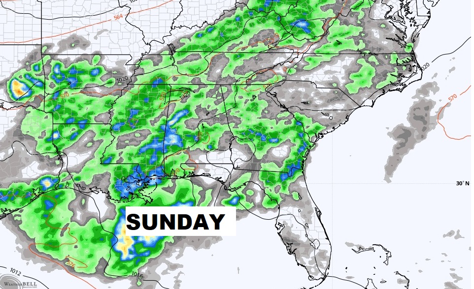
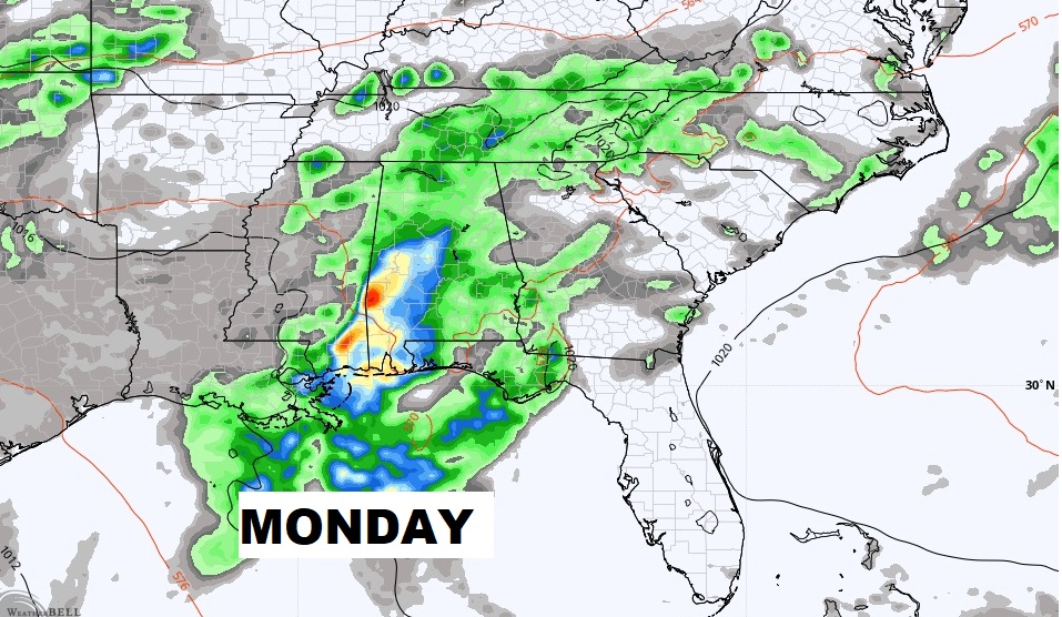
NEXT FEW DAYS: Still Hot Friday. Breezy. High in the mid 90’s. Over the weekend a front approaches. Scattered thunderstorms return for Saturday. Showers and thunderstorms are quite likely Sunday and Monday.
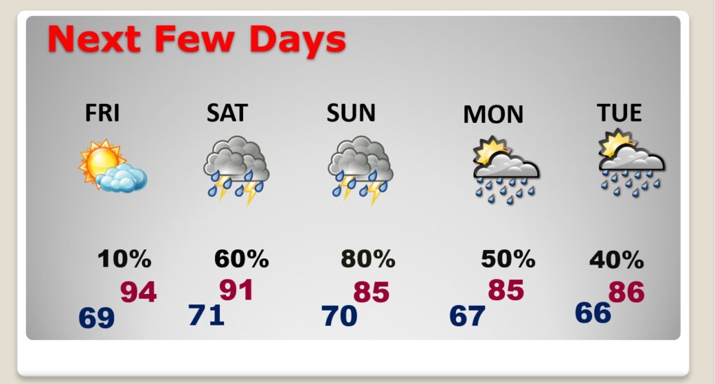
Be flexible over the weekend. It will be wet at times. We sure need the rain.
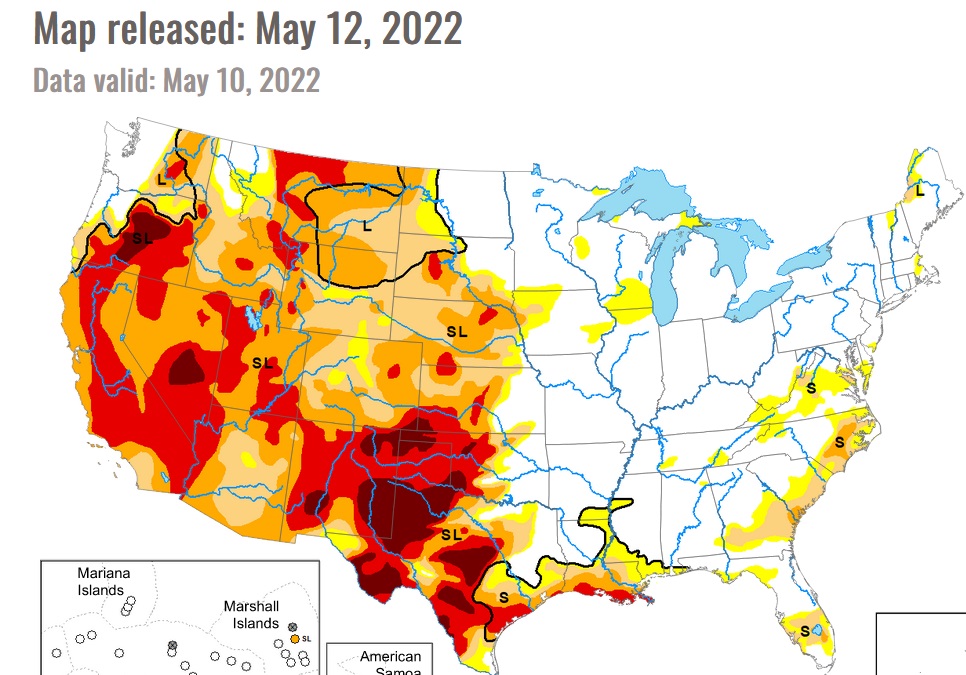
NEW DROUGHT MONITOR COMES OUT LATER TODAY: We’ll see how all these dry days effects the new map, which will come out later in the day. Here’s last week’s Drought Monitor Map.
.
.
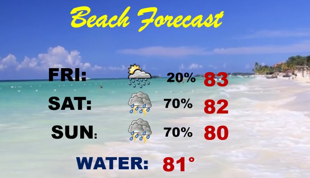
BEACH FORECAST: Not the best forecast. Friday is the best day. Widely scattered thunderstorms. Showers and thunderstorms are quite likely Saturday and Sunday. Stay out of the water. High rip current risk. Gulf water now 79 degrees.
—
Thanks for reading this Blog this morning!
This morning we are LIVE on the radio from 6 to 9 on NewsTalk 93.1. Watch us on TV on CBS 8 and ABC 32. I’ll have another update for you in the morning. Have a nice day.
–Rich