
Good Morning! Happy Friday! Here’s my brief video forecast discussion.
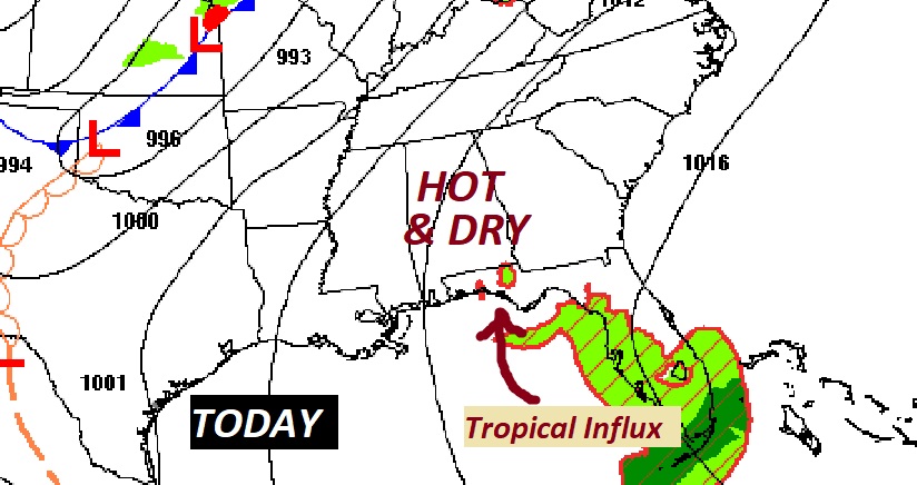
TODAY: This is the Last Dry Day in this pattern. Sun/Cloud mix. Hot for May. A little more humid today. High 94. Normal High 86. Southwest wind at 10 to 15, gusts to 25 mph. Warm & Dry tonight. Low 71.
Tropical moisture is poised to make a big comeback.
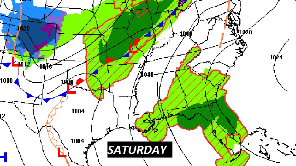
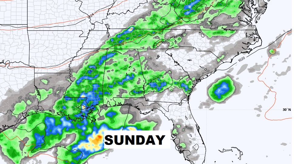
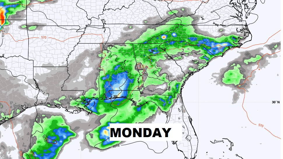
NEXT FEW DAYS: Still Hot Friday. Breezy. High in the mid 90’s. Over the weekend a front approaches. Scattered thunderstorms on Saturday, especially in the afternoon & evening. High near 90. Showers and thunderstorms are quite likely Sunday and Monday. High rain chance. Showers & storms thin out in number Tuesday & Wednesday.
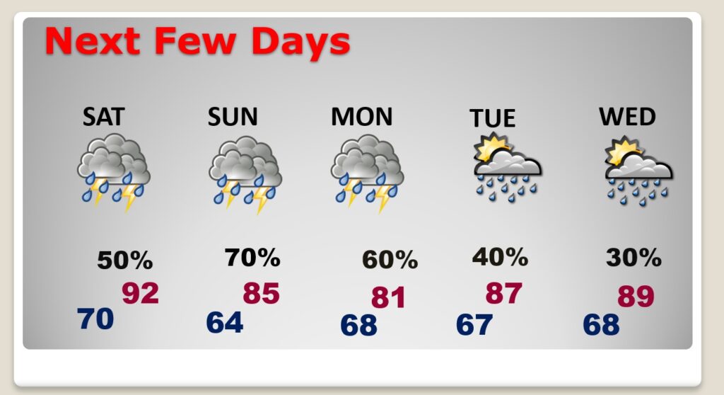
Good coverage on the showers and storms Saturday through Monday. Rain chances as high as 70-80% Sunday and Monday.

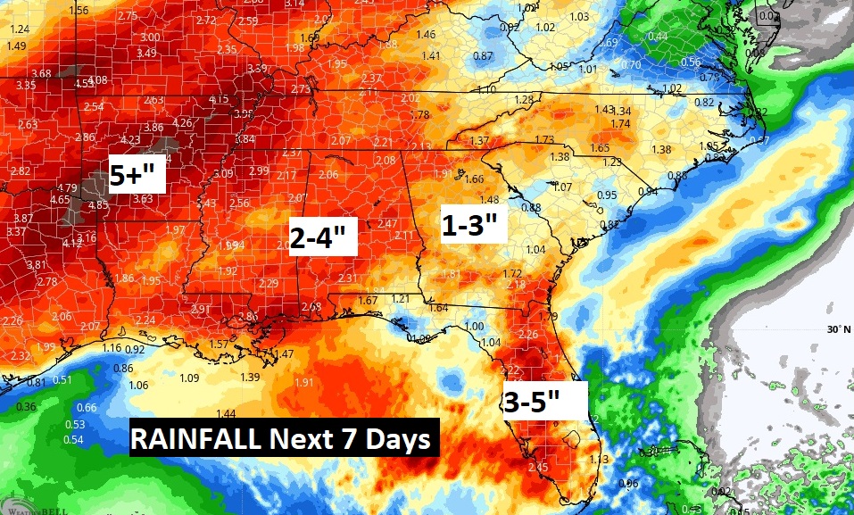
Rainfall for the next 7 days…. Well, this map will give you a good sense that our extended period f dry weather will soon be a thing of the past.
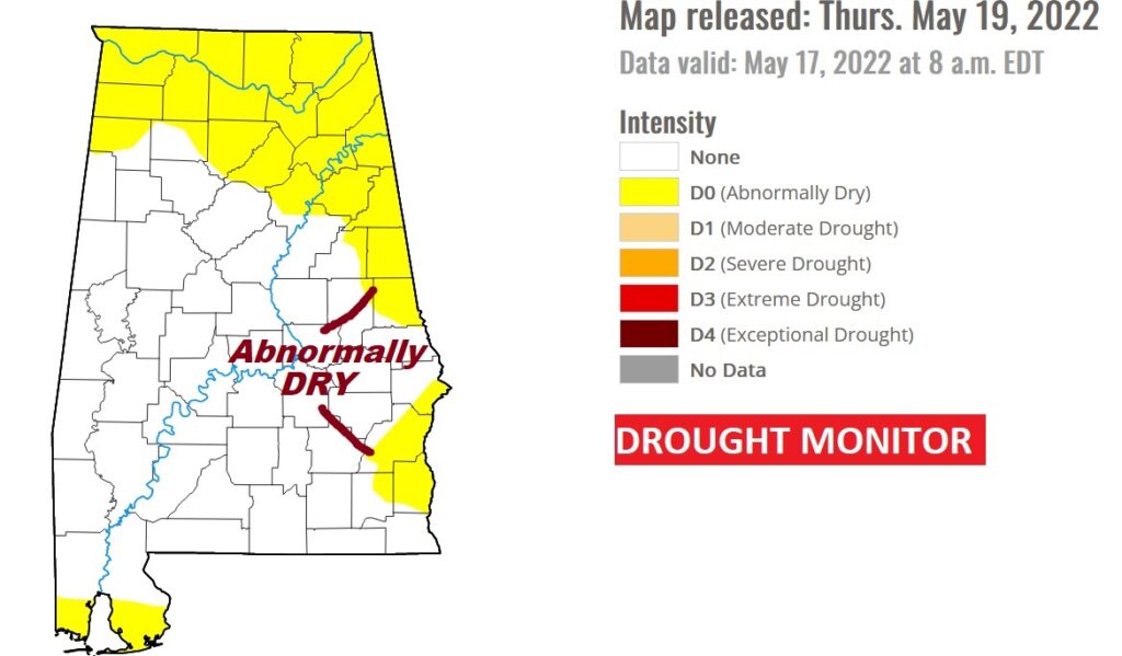
NEW DROUGHT MONITOR MAP: “Abnormally Dry” in the yellow areas on this map across much of northern, eastern and coastal Alabama. A new map comes out every Thursday.
.
.
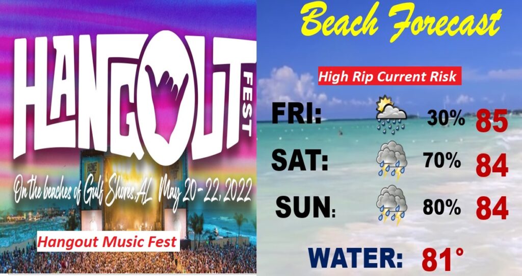
BEACH & HANGOUT FEST FORECAST: Not the best forecast. Today is the best day. Scattered thunderstorms. Showers and thunderstorms are quite likely Saturday and Sunday. Stay out of the water. High rip current risk. Gulf water now 81 degrees. It’s too bad that this pattern could have an adverse effect on the huge Hangout Music Festival.
—
Thanks for reading this Blog this morning!
This morning we are LIVE on the radio from 6 to 9 on NewsTalk 93.1. Watch us on TV on CBS 8 and ABC 32. I’ll have another update for you in the morning. Have a nice day.
–Rich