
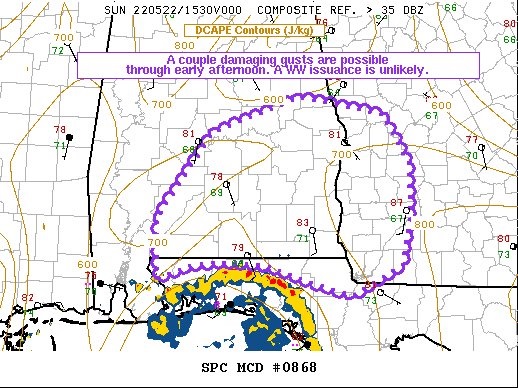
10:45 UPDATE:
SPC is monitoring much of central and southeast Alabama as a cluster of storms lifts northward out of the Florida panhandle. Few damaging wind gusts possible. “Weather Watch is unlikely” #alwx
Good Morning! Tropical moisture covers the Gulf South. Radar will be colorful today & tonight. Showers and thunderstorms will be in ample supply.
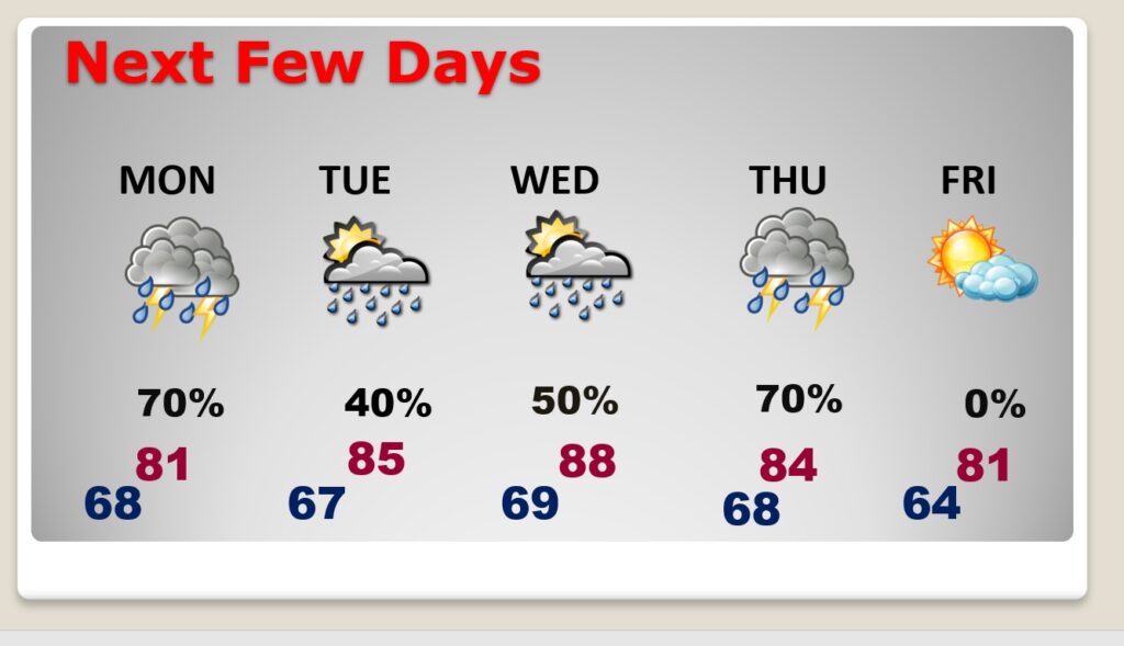
The better than normal rain chances continue Monday. Showers and thunderstorms will be likely. On Tuesday, Election Day the storms will thin out in number. Risk of scattered afternoon & evening storms. A few stronger storms are possible by Wednesday afternoon and Wednesday Night, as a front approaches.
The next front moves through late Thursday night/Friday morning. That should set the stage for a really nice Memorial Day Weekend.. Fingers crossed.
TODAY: Showers and thunderstorms will be in ample supply. The highest rain chance will be in the afternoon & evening hours when the storm will be quite numerous. Locally heavy downpours. High 86. Low tonight 68.
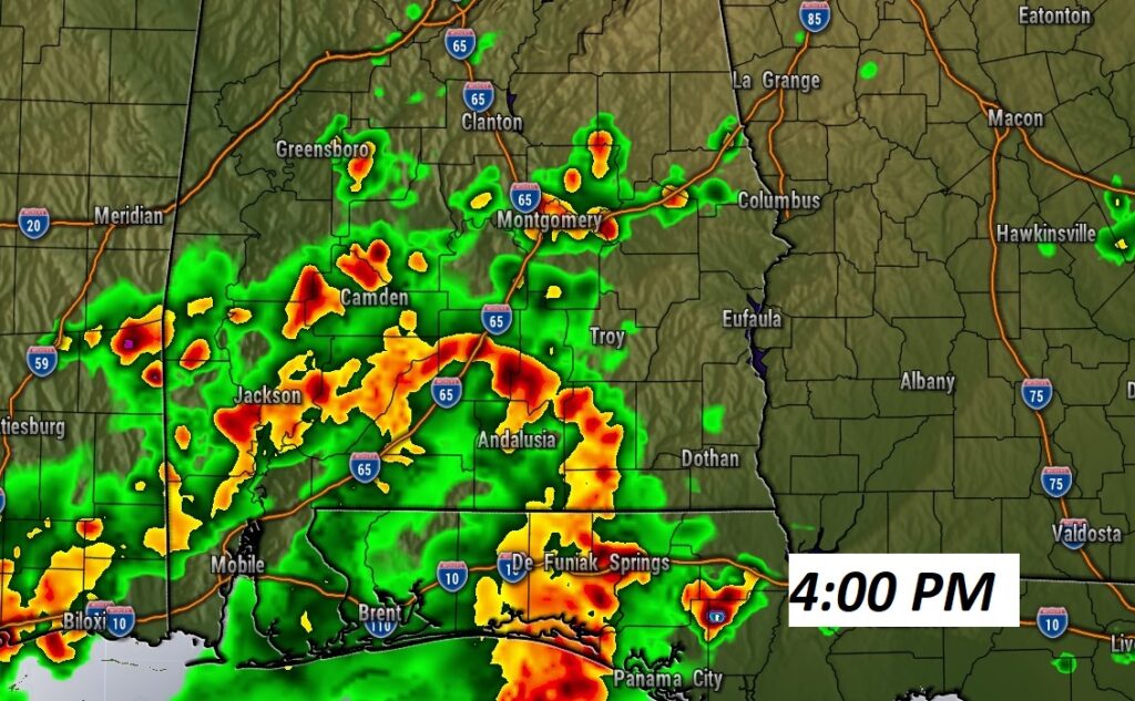
Showers and storms will be numerous. Here’s a late afternoon Future Radar Snapshot.
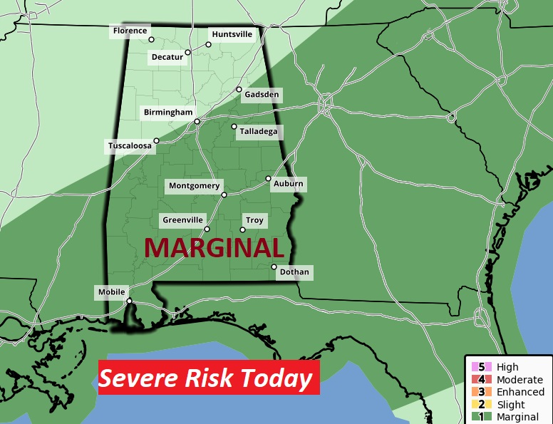
A Few Storms could be strong to Severe. We are in a Marginal Severe Risk from SPC. Damaging wind gusts are the main threat.
NEXT FEW DAYS: The better than normal rain chances continue Monday. Showers and thunderstorms will be likely. On Tuesday, Election Day the storms will thin out in number. Risk of scattered afternoon & evening storms. A few stronger storms are possible by Wednesday afternoon and Wednesday Night. Showers and storms are likely Thursday, ending Friday morning. Hopefully that will lead to a nice Memorial Day Weekend.
.
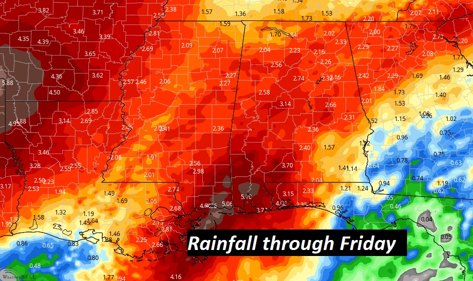
Could be a lot of rainfall in spots…through Thursday night. Here’s the “Average” projected rainfall amounts.
.
I’ll have another update for you in the morning. Have a nice Sunday!
–Rich