
Good Morning! Here’s my brief video forecast discussion.
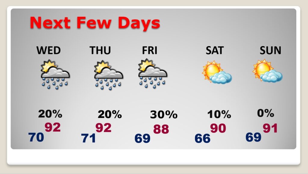
TODAY: It’s getting hotter. It’s getting more humid. It’s feeling more and more like typical summer weather. Mostly sunny today. High 92. Random, widely scattered afternoon & evening storms. Small chance. Wind: Southeast at 5 to 10 mph. Mostly clear tonight. Overnight low near 70.
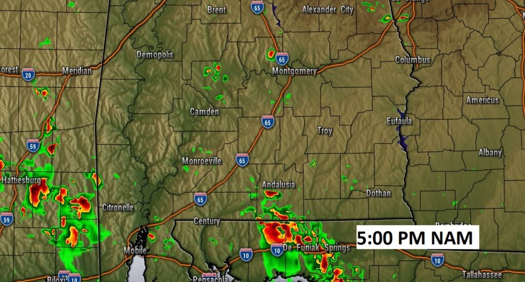
Here’s a late afternoon Future Radar snapshot.
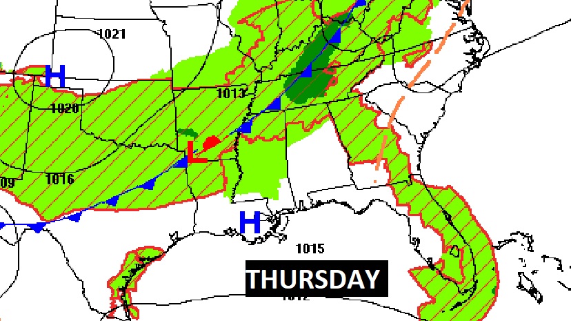
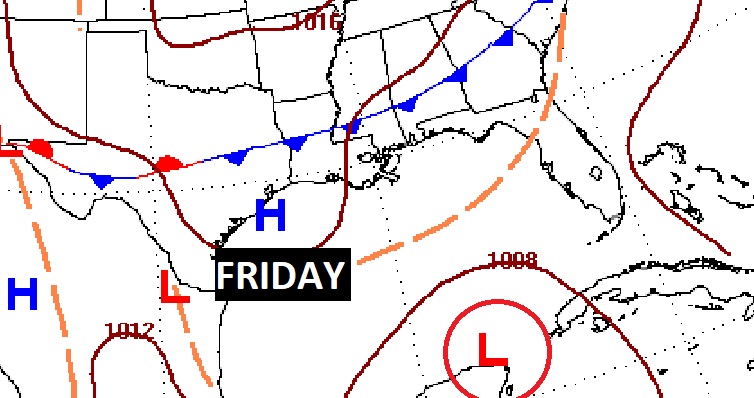
NEXT FEW DAYS: It’s a little hotter. A little more humid. Just like a typical summer day, random, widely scattered afternoon & evening storms will start to dot the radar screen over the next few days. Rain chances get slightly better Friday, as a front heads southward through the state.
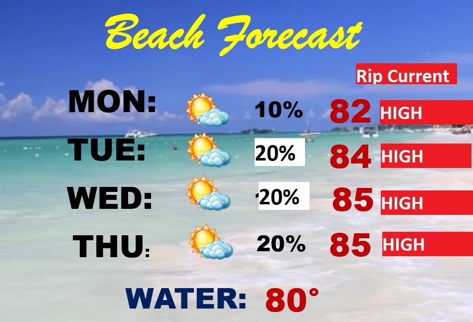
BEACH FORECAST: This is a busy week at the Beaches. It’s a pretty routine summer-like forecast as May ends and June begins. Partly cloudy. Breezy & warm. Random, widely scattered afternoon & evening storms. Gulf water temperature at 81. High rip current risk, especially from Destin through Panama City.
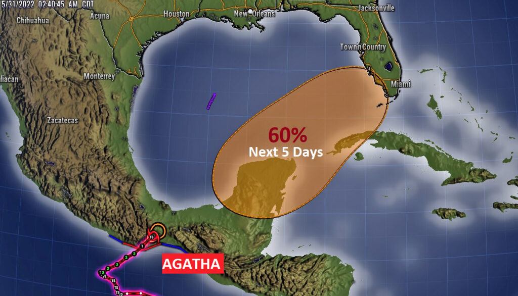
WATCHING THE GULF: Former Pacific Hurricane Agatha is now a tropical storm over Mexico. The remnants of this system will across Mexico and could have a rebirth in the Gulf of Mexico in the next 5 days. NHC now has given this system a 60% chance of development.
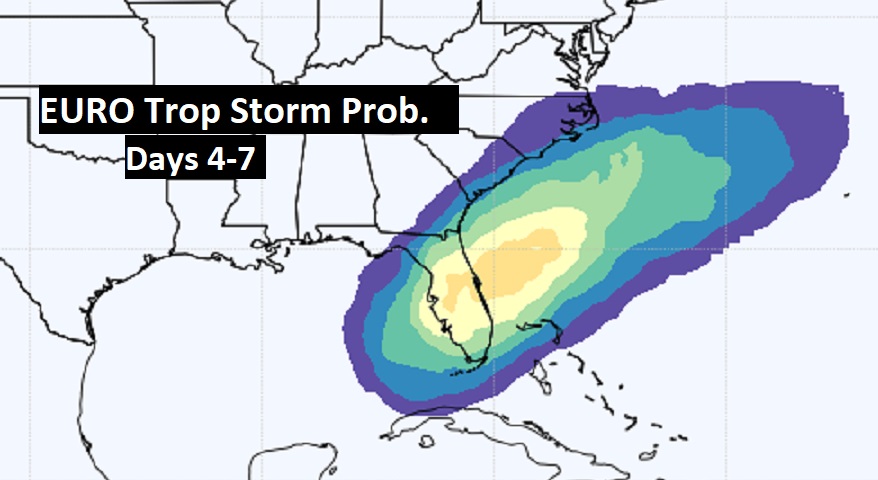
The Euro Tropical Depression Probability indicates this system could become Alex later this week and maybe target Florida.
Further development of this system could take place in the Atlantic, off the SE US coastline.

The rest of the tropics are quiet for now.
—
Thanks for reading this Blog this morning!
This morning we are LIVE on the radio from 6 to 9 on NewsTalk 93.1. Watch us on TV on CBS 8 and ABC 32. I’ll have another update for you in the morning. Have a nice day.
–Rich