
Good Morning! Here’s my brief video forecast discussion.
TODAY: Hot & humid today. Sun/clouds High 93. Random, widely scattered afternoon & evening storms. Wind: Northwest at 5 to 10 mph. Partly cloudy tonight. Overnight low near 73.
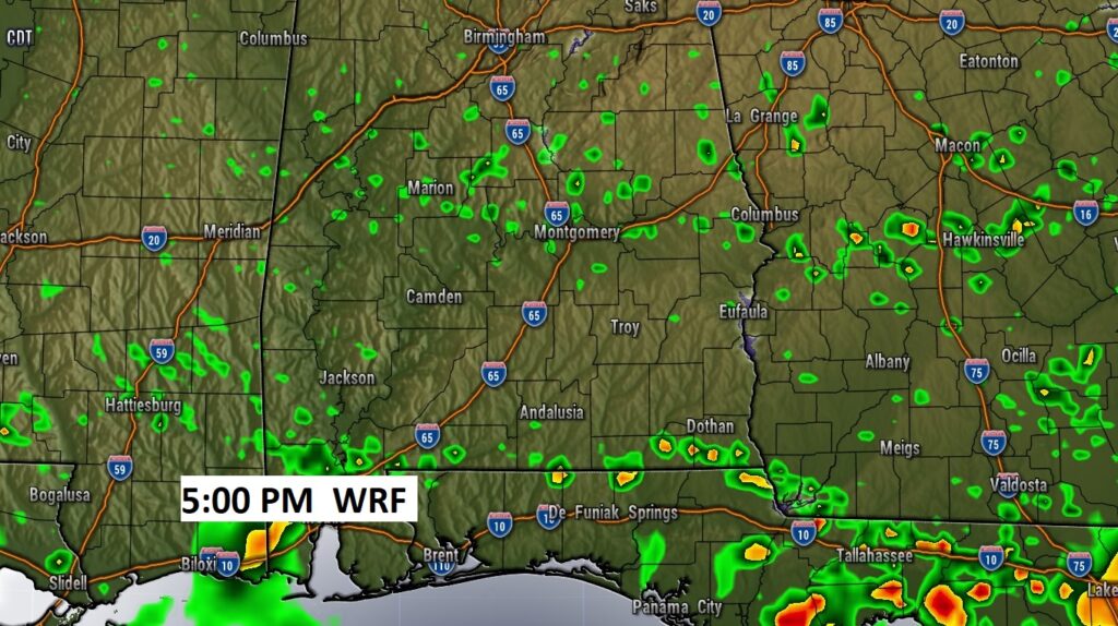
Radar will be quieter today. The best chance of stronger storms will be closer to the coast. Here’s a Future Radar snapshot late this afternoon.
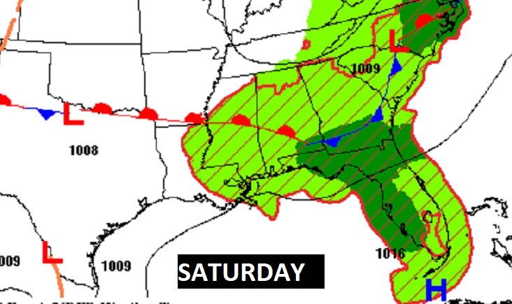
NEXT FEW DAYS: Hot & humid Friday. Scattered afternoon storms. A frontal system will help improve the rain chances by Friday evening and Friday night into Saturday. A few stronger storms are possible. Sunday looks like a drier day as the front makes it down to the coast. Rain chances generally 10% Sunday through Tuesday with lots of sun. Hot days.
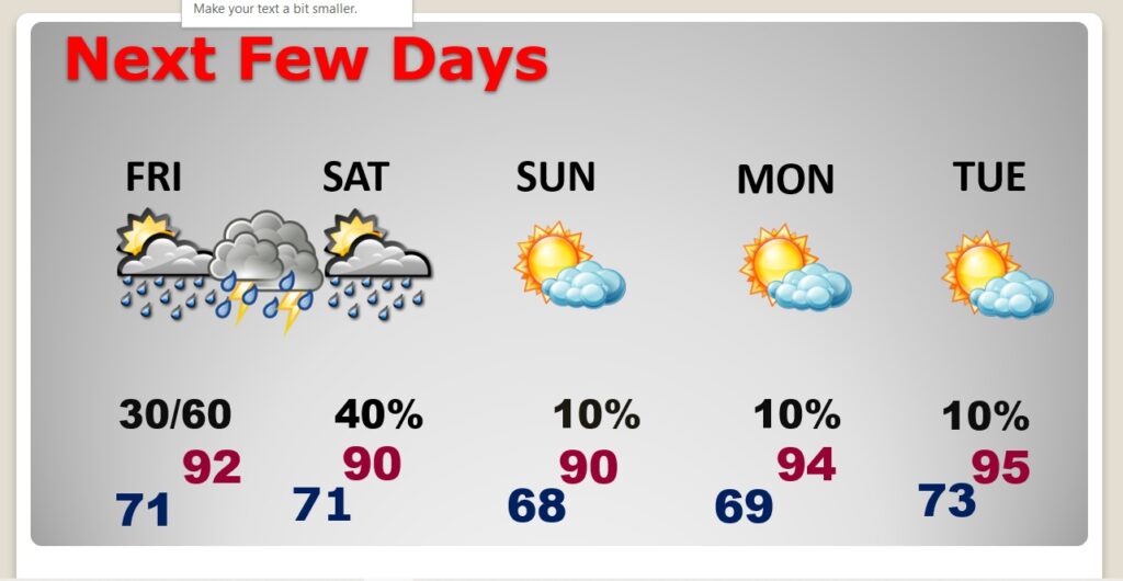
A frontal system will enhance thunderstorms especially Friday evening/night into Saturday. Sunday should be drier as the front parks near the coast.
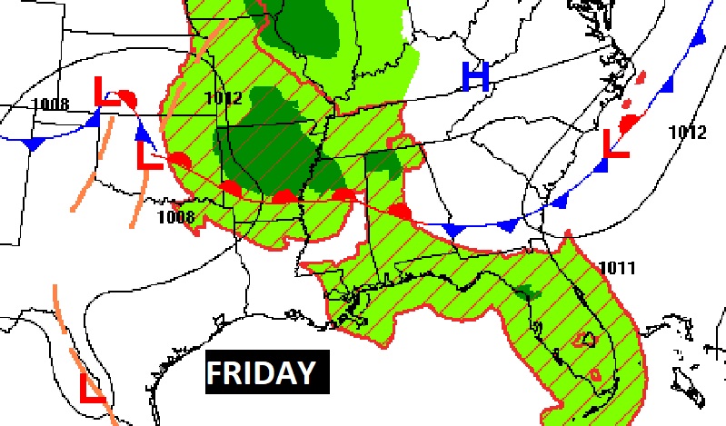
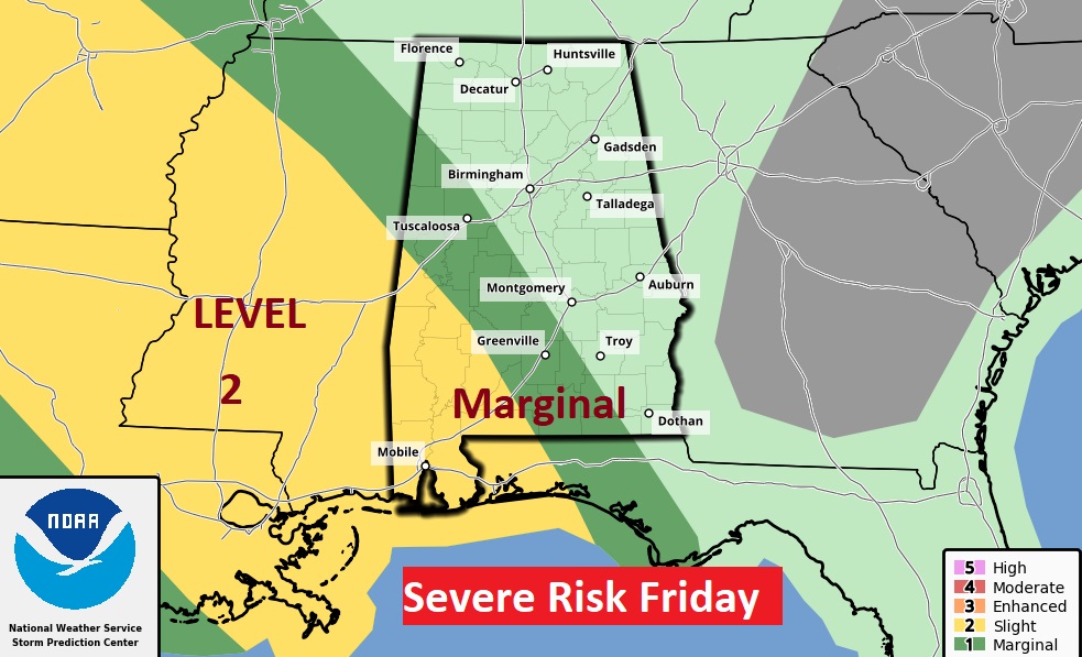
Some storms Friday could be strong possibly severe with damaging wind gusts. Many of us are in the Marginal Severe risk. Southwest Alabama is in the Level 2 “slight risk” area.
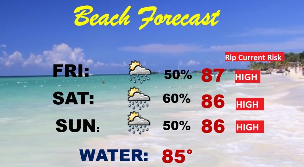
BEACH FORECAST: Not ideal. Stormy at times, through the weekend. Highs in the mid 80’s Gulf water temperature is at a season high of 85. Rip Current Risk HIGH , especially from Ft. Walton Beach/Destin through Panama City to Mexico Beach.
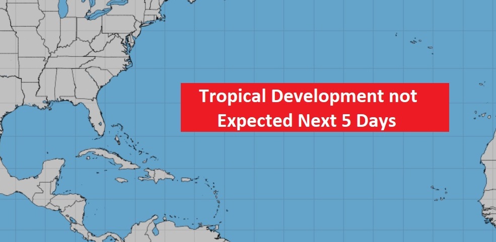
TROPICAL UPDATE: The tropics at the moment are quiet at the moment.
We’ll be watching the southwest Gulf next week. The GFS and EURO models are both hinting at possible development. Next name up on the list is Bonnie.
—
Thanks for reading this Blog this morning!
This morning we are LIVE on the radio from 6 to 9 on NewsTalk 93.1. Watch us on TV on CBS 8 and ABC 32. I’ll have another update for you in the morning. Have a nice day.
–Rich