
2:00 PM Update:
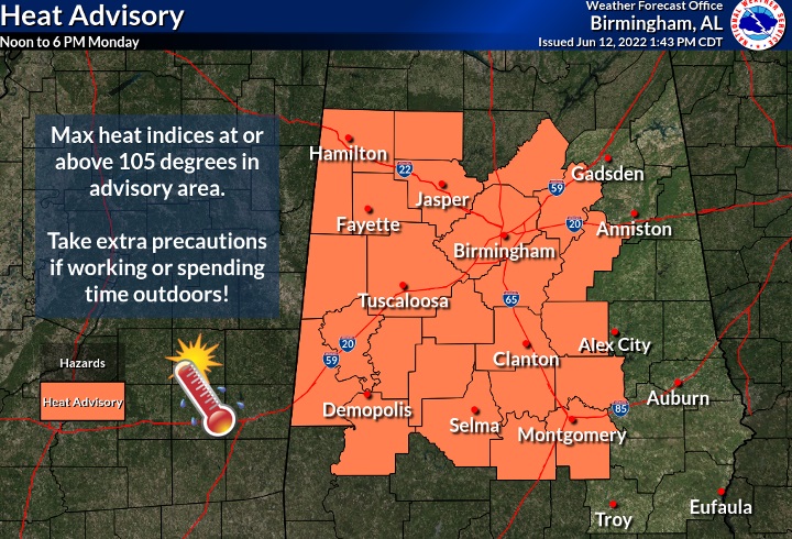
No surprise here. Heat Advisory issued for much of the state starting at Noon Monday. Dangerous Heat. Heat index near or above the 105 danger level. It’s the start of an intensely hot week. Slow down. Take it easy. Stay hydrated. #alwx
Good Morning! Are you ready for some hotter days? Ready or not…we’re headed for a June heatwave. The official first day of summer is nine days away. But, we’ll launch into mid-summer heat this week. Get ready for triple digit heat indices.
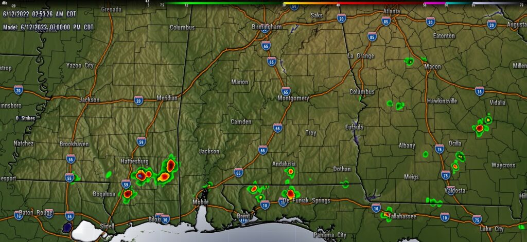
Rain chances will be small. Random storms will be few and far between, widely scattered, mainly in the afternoon and evening hours. Few and far between.
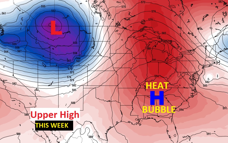
An upper level Heat Wave High, centered over the Tennessee valley, will dominate the eastern U.S.
TODAY: Good bit of sunshine. Hot & humid. High in the middle 90’s. Heat index will be near 100. Random storms will be few and far between, widely scattered, mainly in the afternoon and evening hours. About a 20% risk.
The best chance of rain today will be down at the coast, once again… Here’s a late afternoon Future Radar snapshot.
A huge Upper Level Heat Wave high spells a very HOT week ahead.
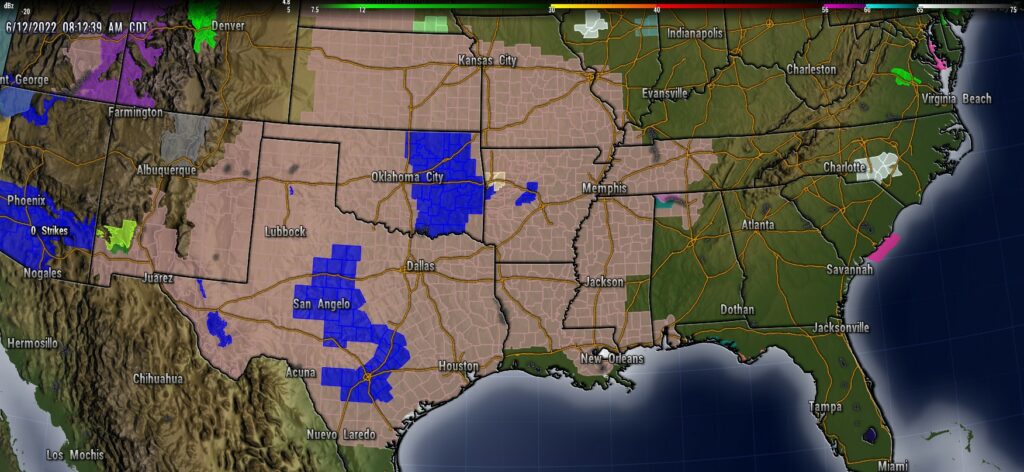
Dangerous Heat this week. A Heat Advisory now covers multiple states in the heartland of America. Even parts of NW Alabama and SW Alabama are included. Other parts of our state are very likely to see a heat advisory this week.
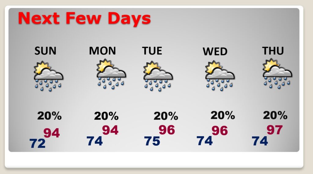
NEXT FEW DAYS: Highs in the middle 90’s. Triple digit heat indices each day. Sun/cloud mix, but more sun than clouds. Random storms will be few and far between, widely scattered, mainly in the afternoon and evening hours. Little day to day change.
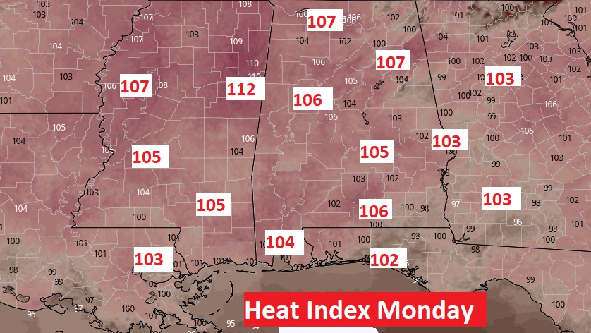
The heat index will be near the 105 danger range. Here’s an example of Monday afternoon.
.
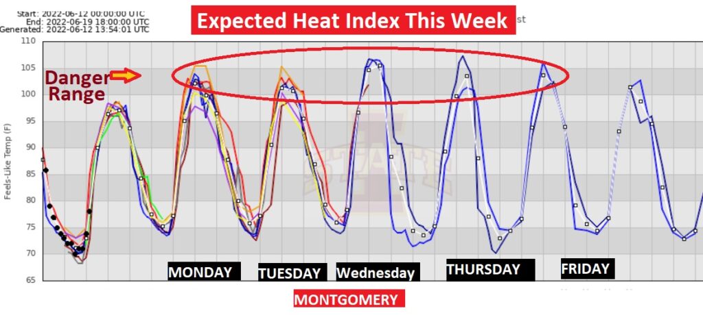
Summer officially begins in 9 days, but here comes some intense mid summer heat this week. Models project the daily Heat Index to be near or above the 105 danger range Tuesday through Thursday, especially. A Heat Advisory is quite likely to be issued. Stay hydrated
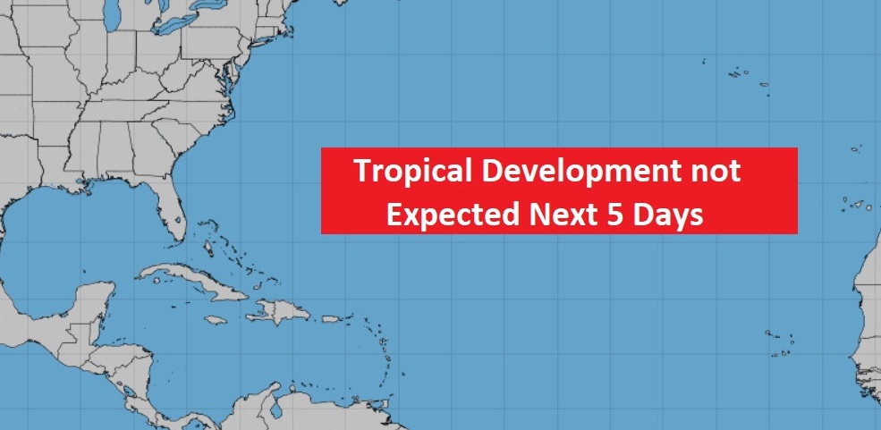
TROPICS: Fortunately, the Atlantic, the Caribbean and the Gulf of Mexico are quiet for now.
.CLIMATE DATA: Yesterday’s low 71, high 91. Normal low 69, normal high 91. Record high 101 in 1977. Record low 52 in 1913. No rain yesterday. June rainfall so far ).14″ Sunrise this morning 5:38 AM. Sunset 7:53 PM.
I’ll have another update for you in the morning. Have a nice Sunday!
–Rich