
Good Morning! Here’s my brief video forecast discussion.
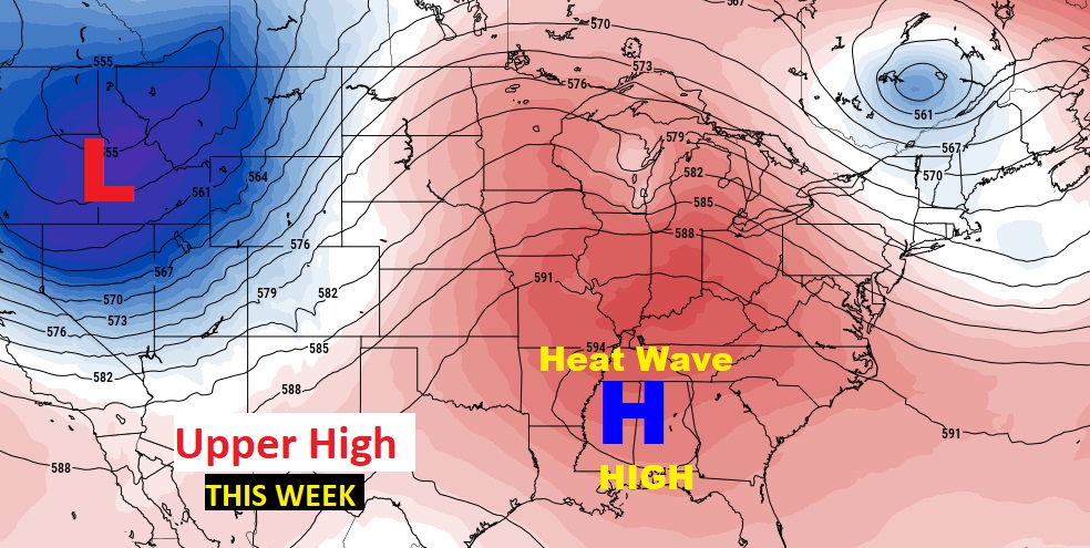
A massive Upper Level Heat Wave High is in control.
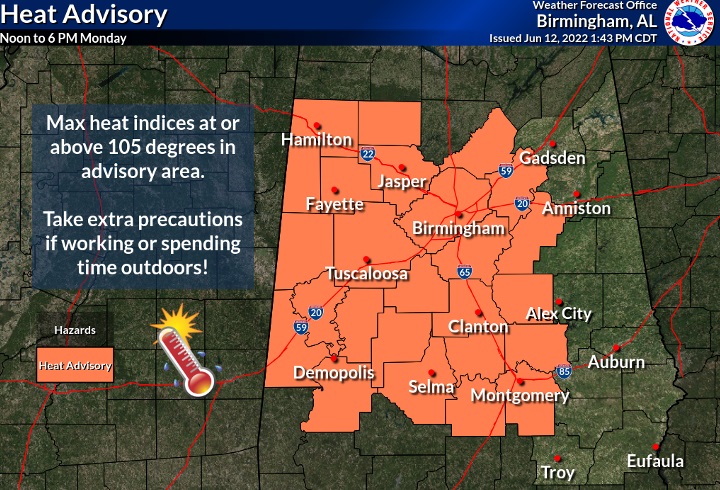
TODAY: HEAT ADVISORY in effect. Hot & humid today. Sun/clouds High 96. Heat index could be as high as 107. That’s dangerous heat. Slow down and take it easy. Random, widely scattered this afternoon. Showers & thunderstorms this evening & tonight. . Overnight low near 75.
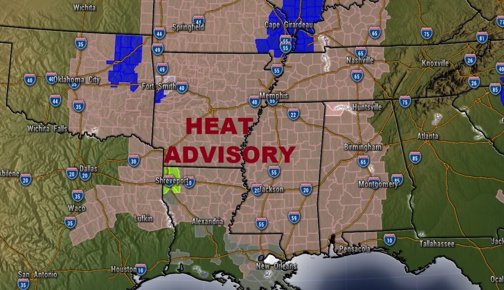
The Heat Advisory is not just for us. It covers a multi-state region.
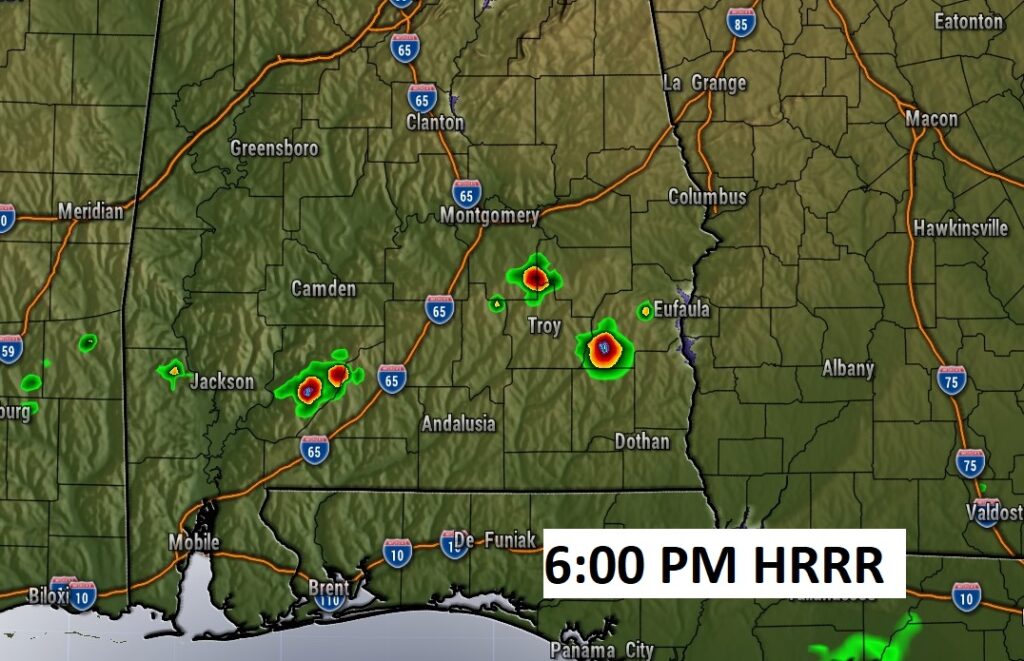
Radar should be quiet today. Any storms should be few and far between. Here’s the HRRR model at 6PM.
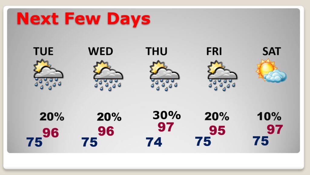
NEXT FEW DAYS: Dangerous heat. The Heat Index each day will be near or above the 105 danger range. Highs in the middle 90’s. Random mostly widely scattered storms in the afternoon & evening hours. Small rain chance. Very little day to day change.
.
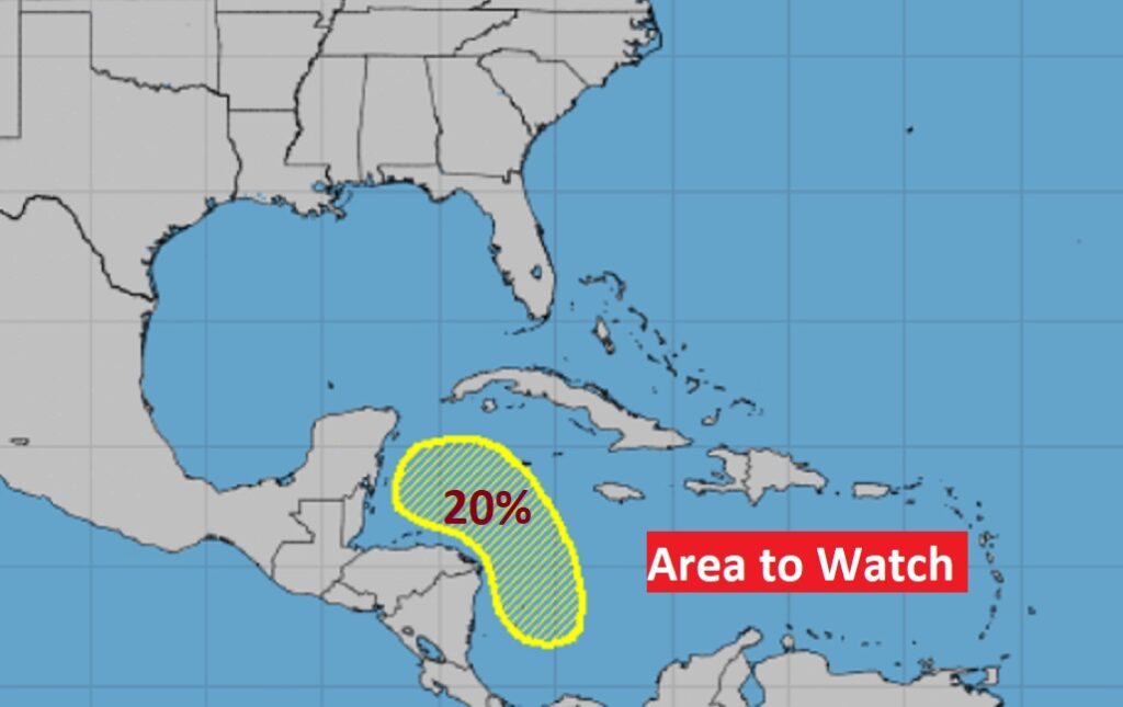
TROPICAL UPDATE: There’s a brand Area to Watch in the western Caribbean. NHC has a 20% chance of development next 5 days.
Meanwhile, it looks like a potentially busy week in the eastern Pacific.
—
Thanks for reading this Blog this morning!
I’m getting on an airplane this morning, heading to the American Meteorological Society Conference in Milwaukee. I return home Saturday. I’ll be with hundreds of my broadcast media Meteorologists from around the country — Listening and learning. I’ll have a blog update for you every morning. And, of course, you’ll still here my daily updates on the 8 station Bluewater Broadcast group.
–Rich