Good Morning! Here’s my brief video forecast discussion.
CLIMATE DATA: Yesterday’s high was 98, just shy of the record high of 100 from 1963. Heat index got to an excessive 113. Normal High 91, Low 69. Today’s record high is 100 from 1963. The hottest temperature all last summer was 97.
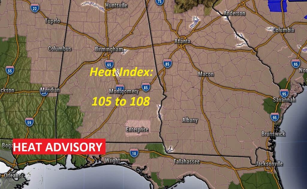
TODAY: HEAT ADVISORY continues in effect. Hot & humid today. Sun/clouds. High 97. Heat index could be 105 or higher. That’s the danger zone. Stay hydrated. Random, scattered this afternoon. Storms fade out overnight.
Heat Advisory Remains in effect today over a muti-state area. Heat index could reach 105 to 108.
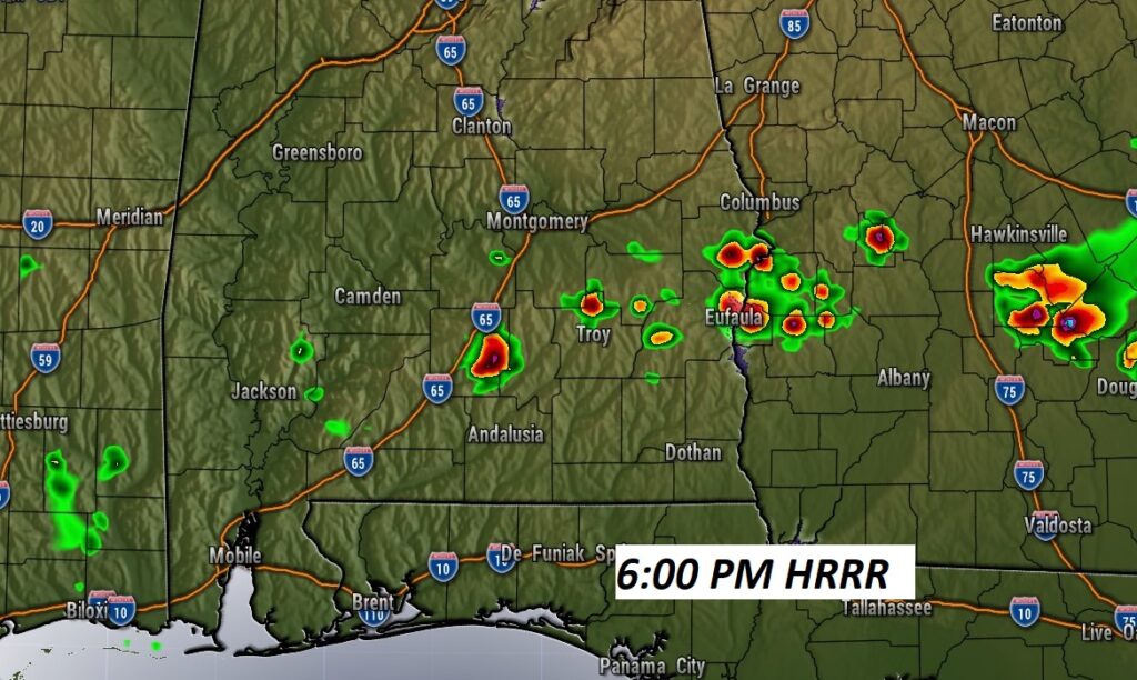
Radar should be quiet today. Any storms should be few and far between. Here’s the HRRR model at 6PM.
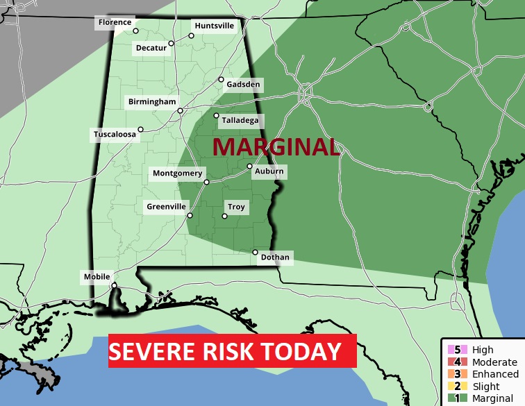
Even though there won’t be many storms around today…Big Heat produces Big Storms. SPC has a Marginal Severe Risk for much of east and SE Alabama today. Main risk is damaging wind gusts.
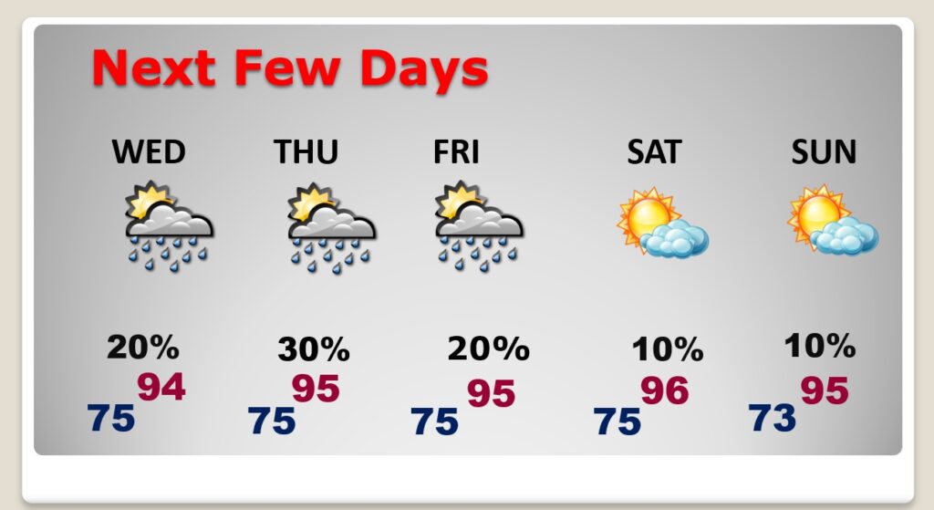
NEXT FEW DAYS: Dangerous heat. The Heat Index each day will be near or above the 105 danger range. Highs in the middle 90’s. Random scattered storms in the afternoon & evening hours. Very little day to day change. So far the weekend looks relatively dry and quite hot.
.
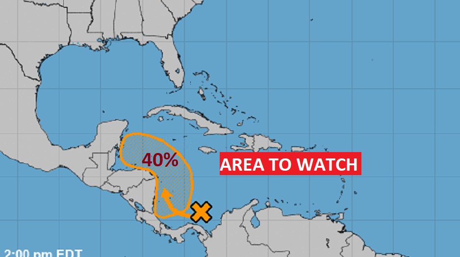
TROPICAL UPDATE: Area to Watch in the western Caribbean. NHC has a medium 40% chance of development next 5 days.
—
Thanks for reading this Blog this morning!
. I’m at the American Meteorological Society Conference in Milwaukee — Listening and learning. Have a great day! I’ll have another update for you in the morning from Milwaukee. I’ll have a blog update for you every morning. And, of course, you’ll still here my daily updates on the 8 station Bluewater Broadcast group.
My home away from home for the week ahead. American meteorological Society Broadcast Conference in beautiful Milwaukee.