
Good Morning! Here’s my brief video forecast discussion.
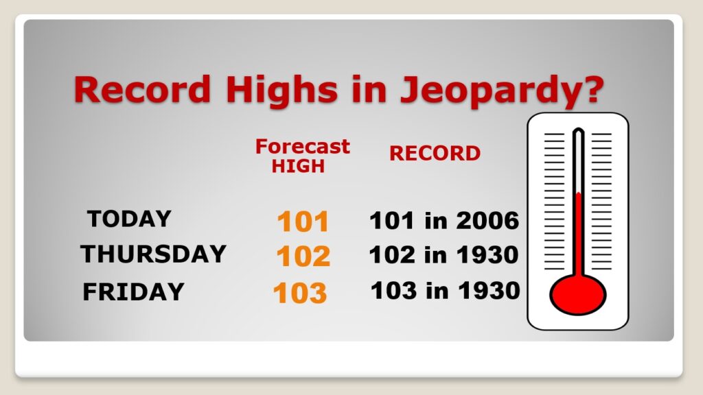
TODAY: HEAT ADVISORY in effect. Sunshine will dominate again today. Today dewpoints will be in the upper 60’s. High near 102. The record is 102 from 2006. The Heat Index will be near the 105 Danger zone. North wind at 5 to 10 mph. Mainly clear tonight. Low 71.
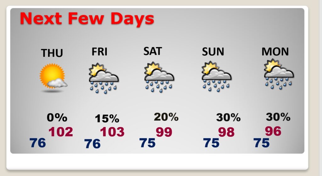
NEXT FEW DAYS: We should be dry through Thursday. We have a shot at record highs each day today through Friday. Near Low 100’s Thursday & Friday. Thursday Heat Index near 107. Widely scattered PM storms return to the forecast Friday and through the weekend. We have a shot at perhaps 103 on Friday, with higher humidity.
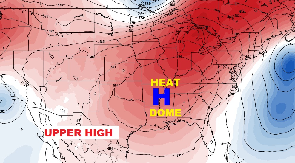
A huge Upper Level High will act as a heat dome, centered over the lower Mississippi valley.
Record Highs are in jeopardy for the rest of this week.
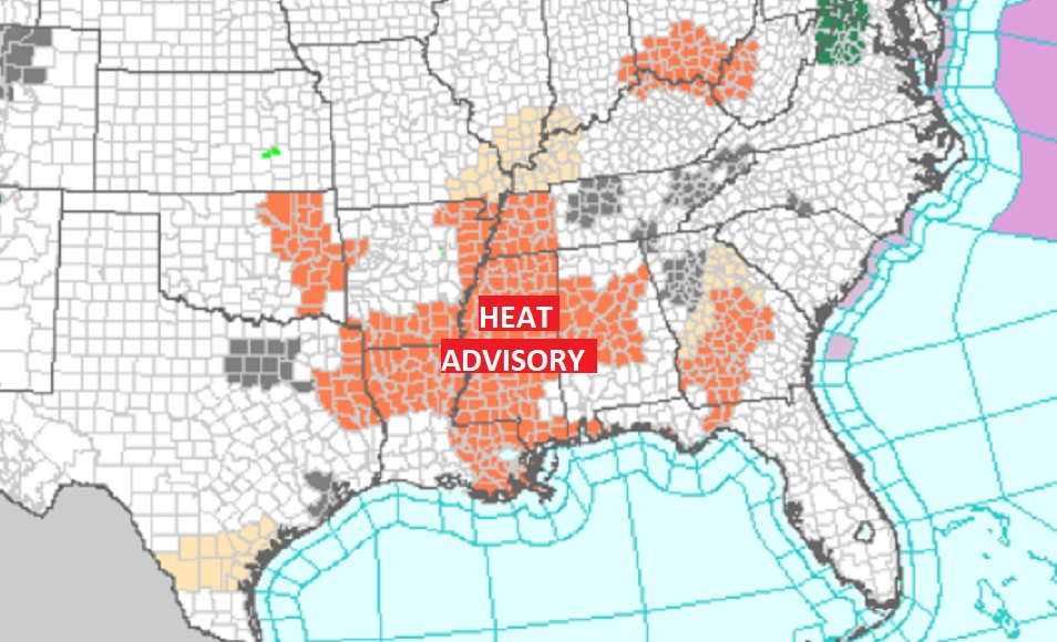
Record highs will be widespread across the South this week.
.
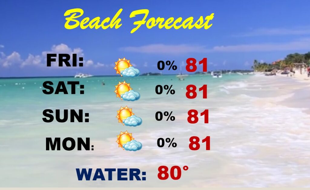
BEACH FORECAST: A tropical Low in the northeast Gulf will help enhance the risk of a few thunderstorms over the weekend. Highs mostly 89 to 93. Very humid. Gulf Water Temp. 86.
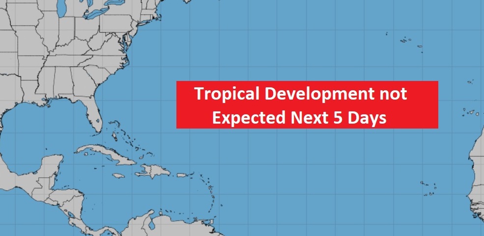
TROPICAL UPDATE: Tropics are quiet this morning.
PLANETARY ALIGNMENT: Look for a treat in the sky during the early morning hours, roughly 45 minutes before sunrise. All five bright planets fan out in order of their distance from the Sun across the dawn sky now through early July. One of the prettiest mornings to view them will be June 24th. Pretty cool!

—
Thanks for reading this Blog this morning! This morning we are LIVE on the radio from 6 to 9 on NewsTalk 93.1. Watch us on TV on CBS 8 and ABC 32. I’ll have another update for you in the morning. Have a nice day.
–Rich