
12:45 UPDATE:
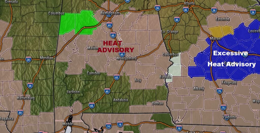
HEAT ADVISORY issued for much of central Alabama until 7PM. Heat index values up to 108. Take it easy! Stay Hydrated.
Good Morning! Here’s my brief video forecast discussion.
TODAY: Near record heat . Sunshine mixed with clouds mixed. I have the rain chance at about 10%. The record for today is 102 from 1930. We’ll be close to the record. The Heat index will be near the 105 danger range today.. Light wind.. Mainly clear tonight. Low 76.
NEXT FEW DAYS: Near record heat today. I have the rain chance at 20% or less through Friday. The record for today is 102 from 1930. The Heat index will be near the 105 danger range today. Widely scattered PM storms return to the forecast Friday and through the weekend. We have a shot at another record Friday. We’ll be close.
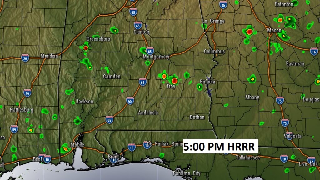
Here’s the high-res HRRR model at 5PM…printing out a few showers. I’m ignoring this. I have the rain chance at about 10%
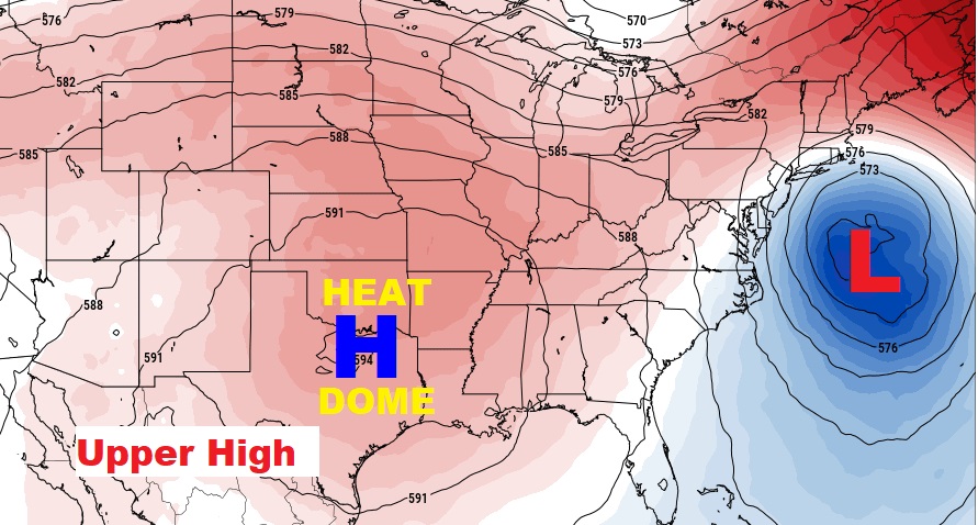
A huge heat dome Upper Level High will act as a heat dome is still in control.
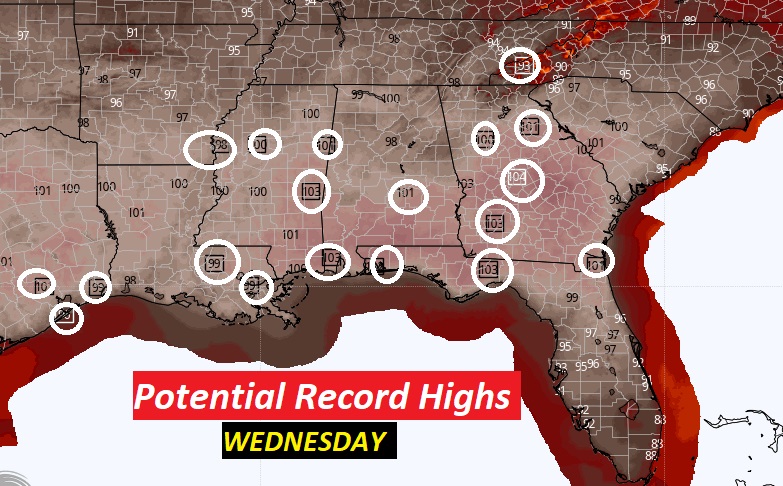
Record Highs are in jeopardy for the rest of this week.
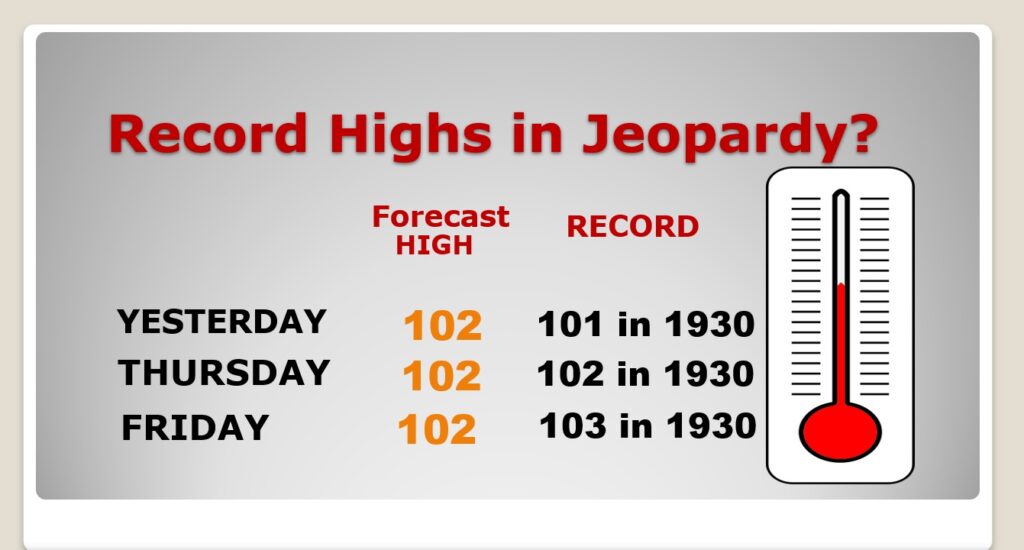
Record highs will be widespread across the South again today.
.
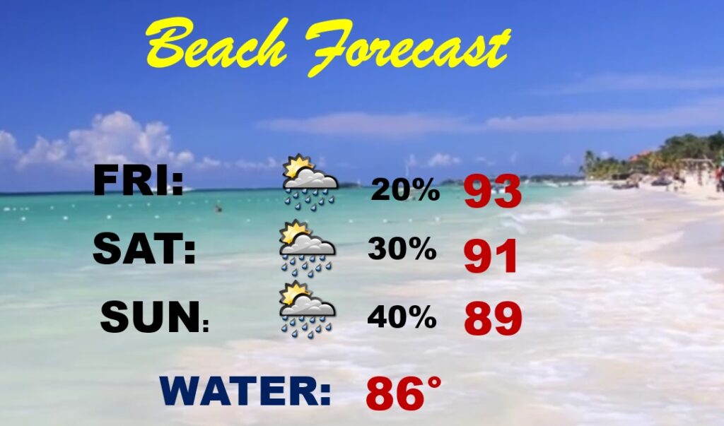
BEACH FORECAST: A tropical Low in the northeast Gulf will help enhance the risk of a few thunderstorms over the weekend. Highs mostly 89 to 93. Very humid. Gulf Water Temp. 86.
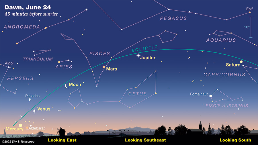
PLANETARY ALIGNMENT: Look for a treat in the sky during the early morning hours, roughly 45 minutes before sunrise. All five bright planets fan out in order of their distance from the Sun across the dawn sky now through early July. One of the prettiest mornings to view them will be, tomorrow morning. June 24th. Pretty cool!
—
Thanks for reading this Blog this morning! This morning we are LIVE on the radio from 6 to 9 on NewsTalk 93.1. Watch us on TV on CBS 8 and ABC 32. I’ll have another update for you in the morning. Have a nice day.
–Rich