
Good Morning! Yesterday we got to 102, again. Today we’ll be in the upper 90s with dangerous triple digit heat indices. Big heat can produce Big Storms. Radar will be quite active this afternoon. A westward moving tropical wave will help fuel the storm threat. There will be few severe thunderstorm warnings. Our Weather App will instantly alert you to warning for your location. Sunday will be more routine. But, the general pattern for the week ahead will feature better rain chances with highs mostly in the mid 90’s. The tropics are coming alive. We’re tracking Invest 94-L in the tropical Atlantic. And, there’s a new Area to Watch in the Gulf.
TODAY: Today we’ll be in the upper 90s with dangerous triple digit heat indices. Big heat can produce Big Storms. Radar will be quite active this afternoon. A westward moving tropical wave will help fuel the storm threat. There will be few severe thunderstorm warnings. The best chance of storms will be in the afternoon and evening. Storms will fade out tonight. Low 74.
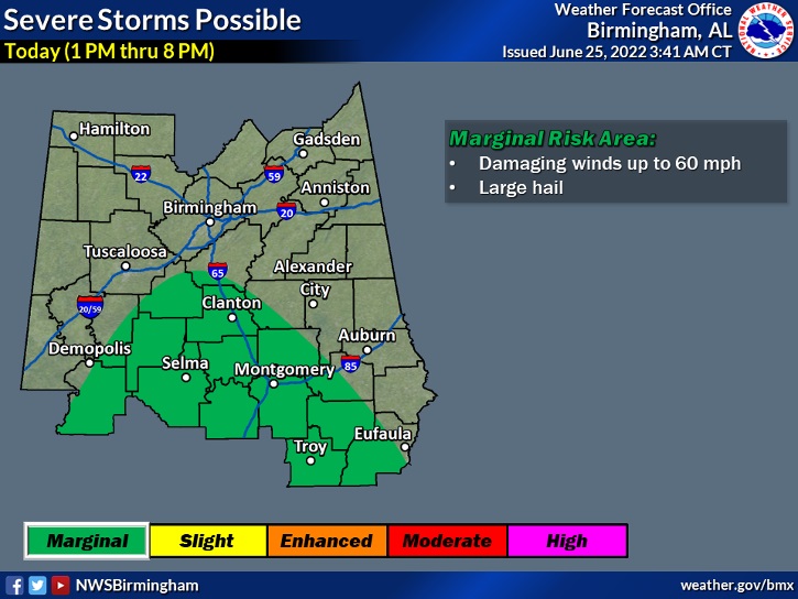
No surprise here.. NWS Birmingham has now included much of the area in a Marginal Severe Risk today. This is due to the westward moving disturbance which promoted warnings over Georgia yesterday. Damaging wind gusts are the main threat. 1:00 to 8:00 PM #alwx
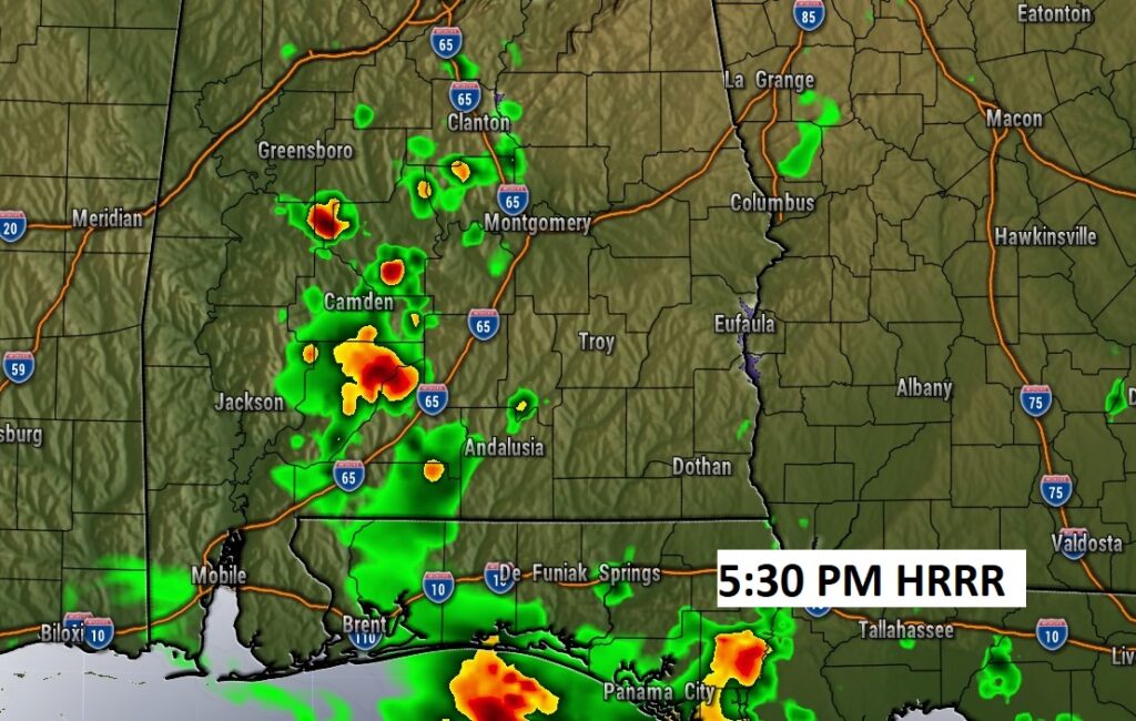
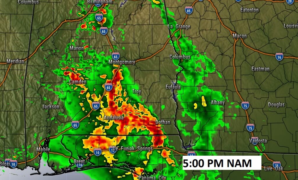
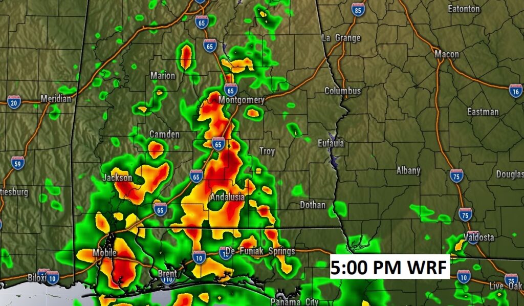
Here’s three Future Radar examples from 3 different models. You can see, it could be a rather stormy afternoon in spots.
NEXT FEW DAYS: The general pattern for the week ahead will feature better rain chances with highs mostly in the mid 90’s.

BEACH FORECAST: A little stormy at times, with a front parked near the coast. Showers and thunderstorms at times. Highs in the 80’s. Gulf water temperature 86. Moderate rip current risk through Monday, especially from Destin eastward.
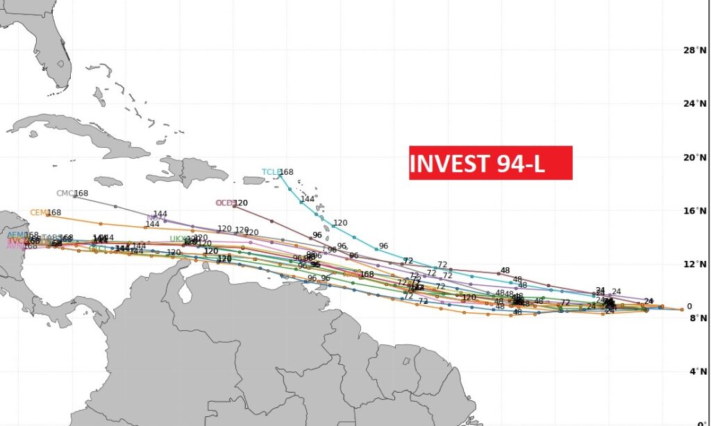
TROPICAL OUTLOOK: . We’re tracking Invest 94-L in the tropical Atlantic. And, there’s a new Area to Watch in the Gulf.
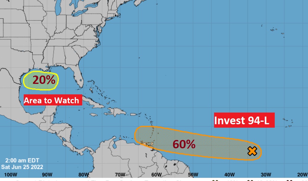
Invest 94- L could become BONNIE over the next few days as it moves westward in the Caribbean at a very low latitude.
.
—
.
I’ll have another Blog update in the morning. Have a nice weekend!
–Rich