
Good Morning! Here’s my brief video forecast discussion.
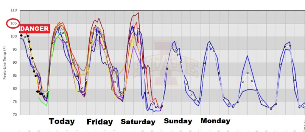
TODAY: Heat Advisory continues in effect. Today’s high mid to upper 90’s. Heat index 105+. Danger range. Random showers & thunderstorms will be few and far between, most numerous in the afternoon & evening hours. Most towns will stay dry. Very humid tonight. Low tonight 77.
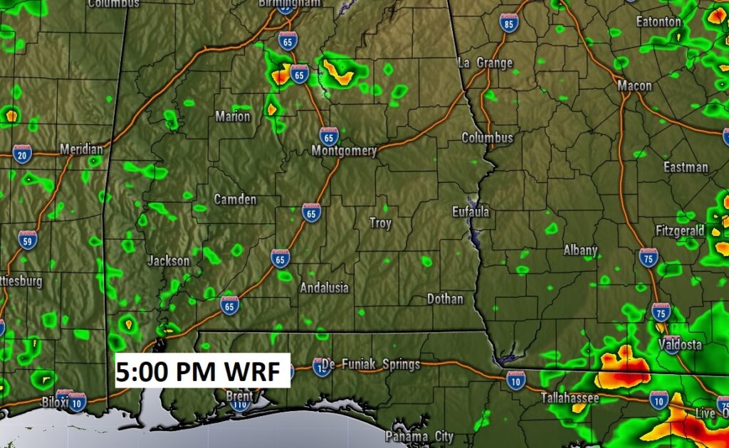
Small Rain chance for most of us today. Here’s a Future Radar example.
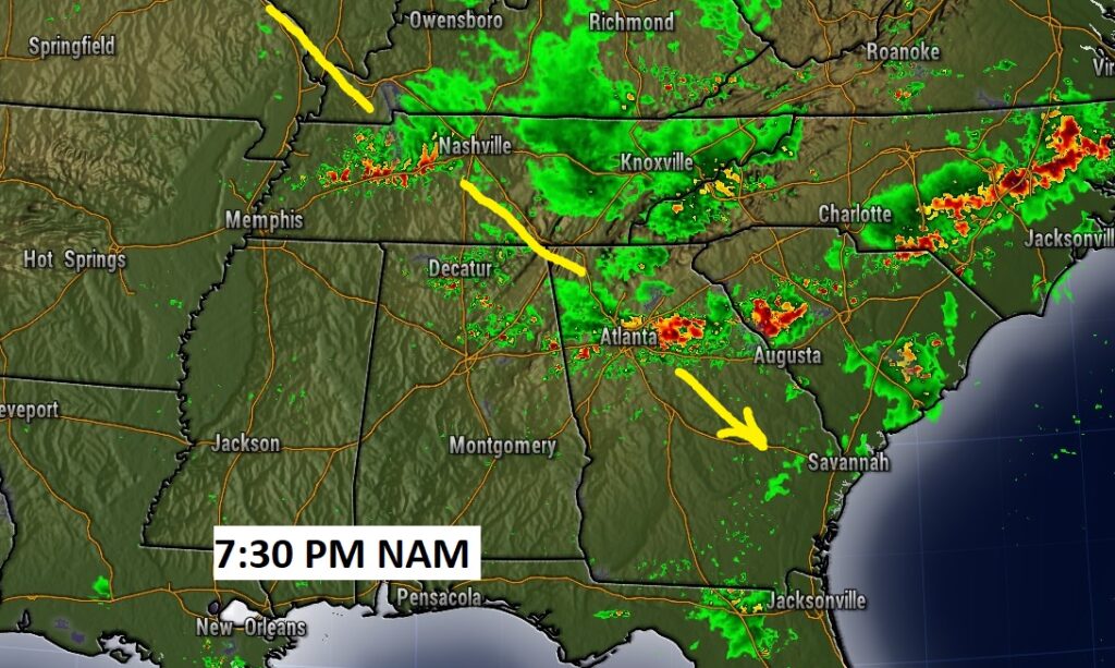
MEANWHILE, we’ll be watchful as clusters of storms slide southeastward just north of us today and tomorrow.
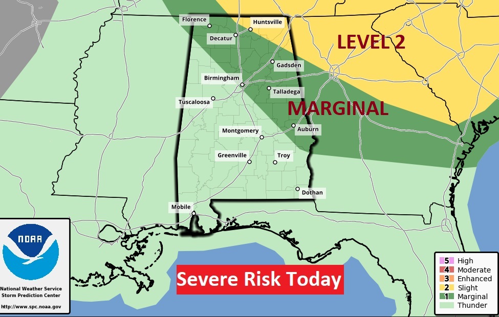
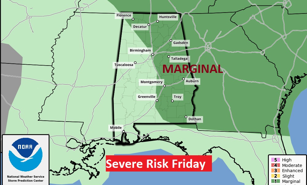
Parts of east and NE Alabama are in the Severe Weather Risk zone today and tomorrow.
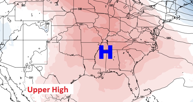
DANGEROUS HEAT: The big upper Level Heat Dome remains in place.
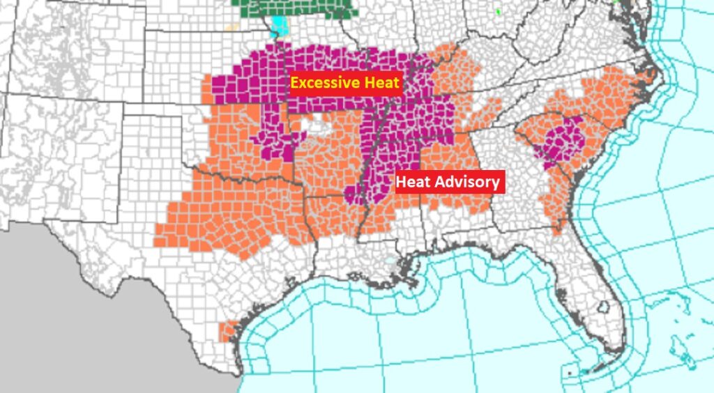
Heat Advisory continues in effect. In fact, the Heat Advisory covers a multi-state area. Some areas are under a Excessive heat Warning.
The Heat Index will be in the danger range today, but models suggest Friday and Saturday will have the highest Heat indices.
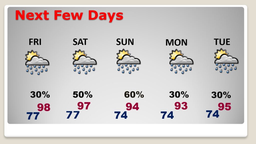
NEXT FEW DAYS: Extreme heat through Saturday. Highs in the upper 90’s. Heat index 105-110 danger range. Widely Scattered Random showers & thunderstorms, most numerous in the afternoon & evening hours. Still hot at night. Low mid to upper 70’s. Storms become more numerous by Saturday. And showers & storms are likely by Sunday. Scattered storms Monday & Tuesday, but not as hot.
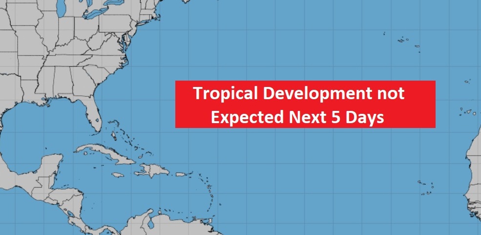
TROPICAL UPDATE: Happy to say…the Atlantic, Caribbean and Gulf of Mexico are quiet.
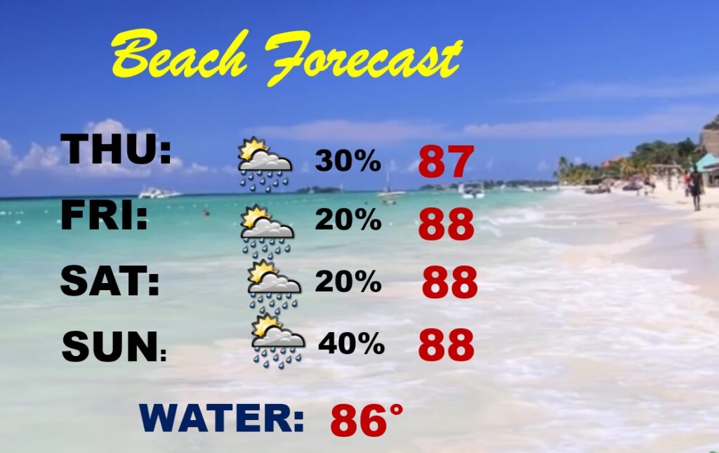
BEACH OUTLOOK: Widely scatteredShowers & storms will be through Saturday. Mainly in the afternoon & evening hours. Hot and humid. Highs in the upper 80’s Triple digit heat index. Gulf water temperature is 86.
—
Thanks for reading this Blog this morning! This morning we are LIVE on the radio from 6 to 9 on NewsTalk 93.1. Watch us on TV on CBS 8 and ABC 32. I’ll have another update for you in the morning. Have a nice day.
–Rich