
Good Morning! Here’s my brief video forecast discussion.
CLIMATE DATA: Yesterday’s high in Montgomery was 95, with a Heat Index as high as 105. Morning low 75. Normal High/Low 94 and 72. Rainfall: 0.0”. Sunrise at 5:59AM
TODAY: Hot & Humid, again. Today’s High near 95. Heat index 102 to 104. Radar will be more active today. Scattered random showers & thunderstorms mainly in the afternoon & evening. Not every town will get wet. Low tonight 75.
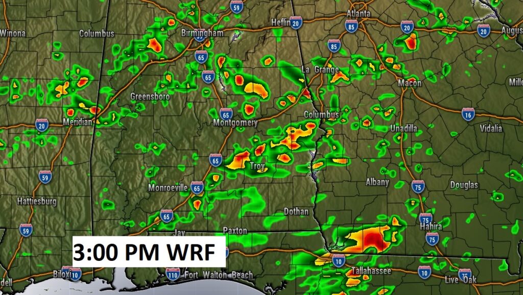
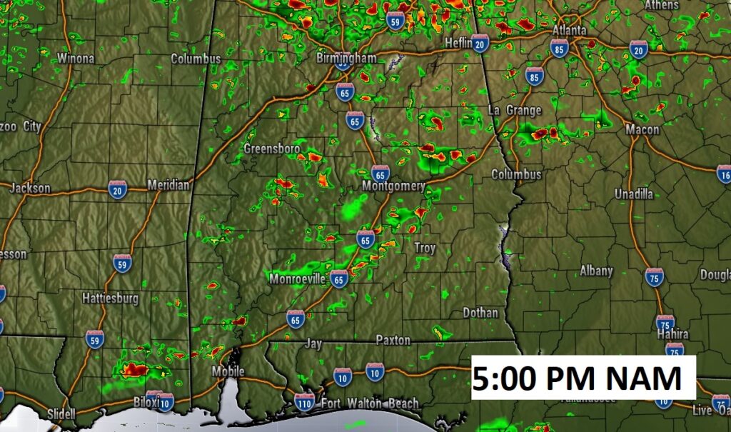
Here’s a couple Future Radar examples, showing that there will be an increase in activity today. Still “Hit or Miss”, but more storms to go around.
.
NEXT FEW DAYS: The somewhat better rain chances continue through Saturday. Scattered random afternoon & evening storms. Rain chances return to a more routine summertime normal Sunday through Tuesday, as July ends and August begins. Highs still in the mid 90’s. Triple digit heat indices. A slight uptick in the number of storms on Wednesday.

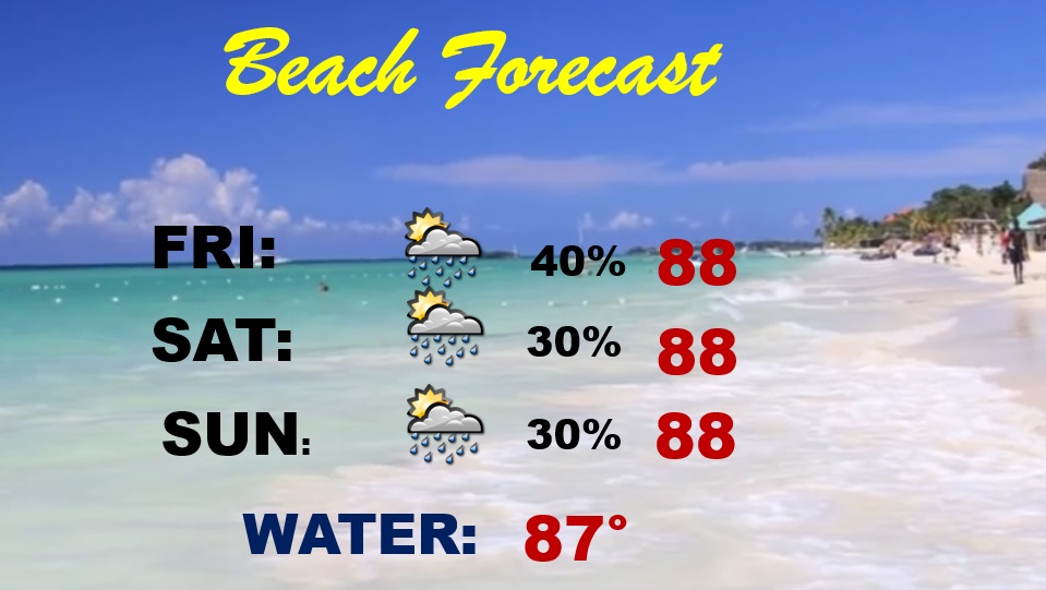
BEACH OUTLOOK: Pretty routine forecast continues. A good bit of sun. High in the upper 80’s. Scattered random storms each day. Gulf water temperature 87. Watch the flags on the Beach. High Rip Current risk…especially from Destin eastward.
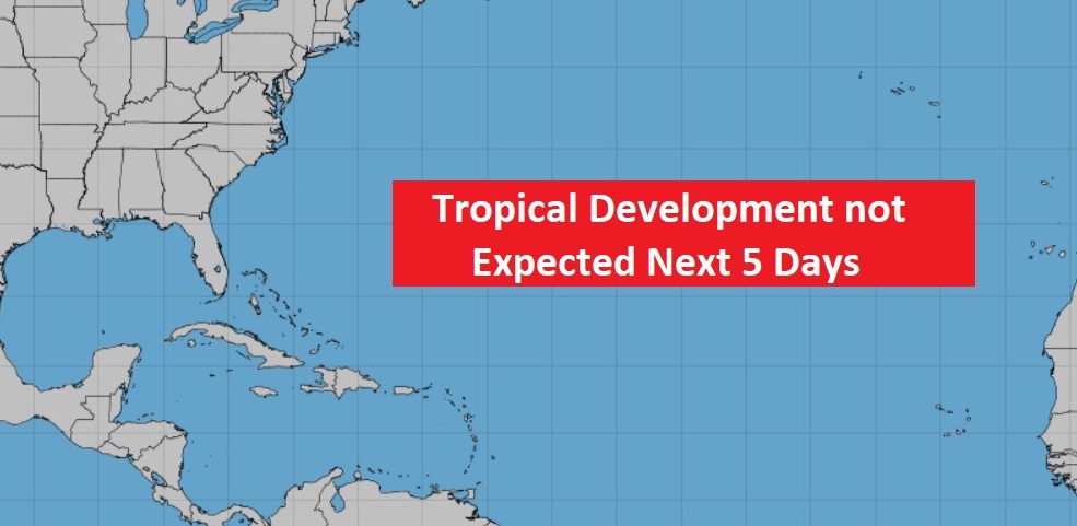
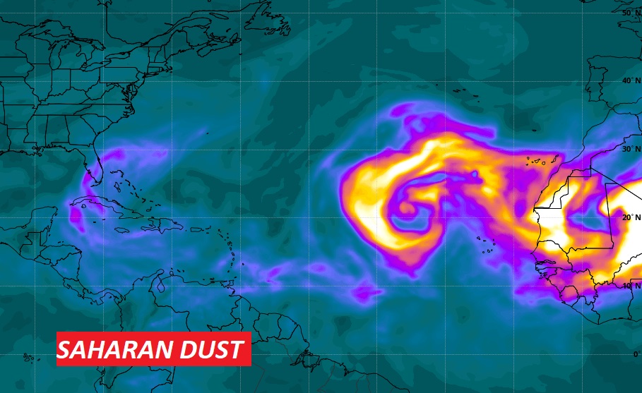
TROPICAL OUTLOOK : The tropics are STILL very quiet for now.
This image from NASA shows a plume of Saharan dust which is helping to stifle development in the Tropical Atlantic. .
—
Thanks for reading this Blog this morning! This morning we are LIVE on the radio from 6 to 9 on NewsTalk 93.1. Watch us on TV on CBS 8 and ABC 32. I’ll have another update for you in the morning. Have a nice day.
–Rich