
Good Morning! Yesterday radar was quite active. Showers and storms were numerous. Not every town got wet. But, many towns had heavy downpours. Today will be different. Today and Monday, the storms will start to “thin out” again. Fewer storms. Widely scattered, as July ends and August begins. Expect mid 90’s again today with a heat index near 105.
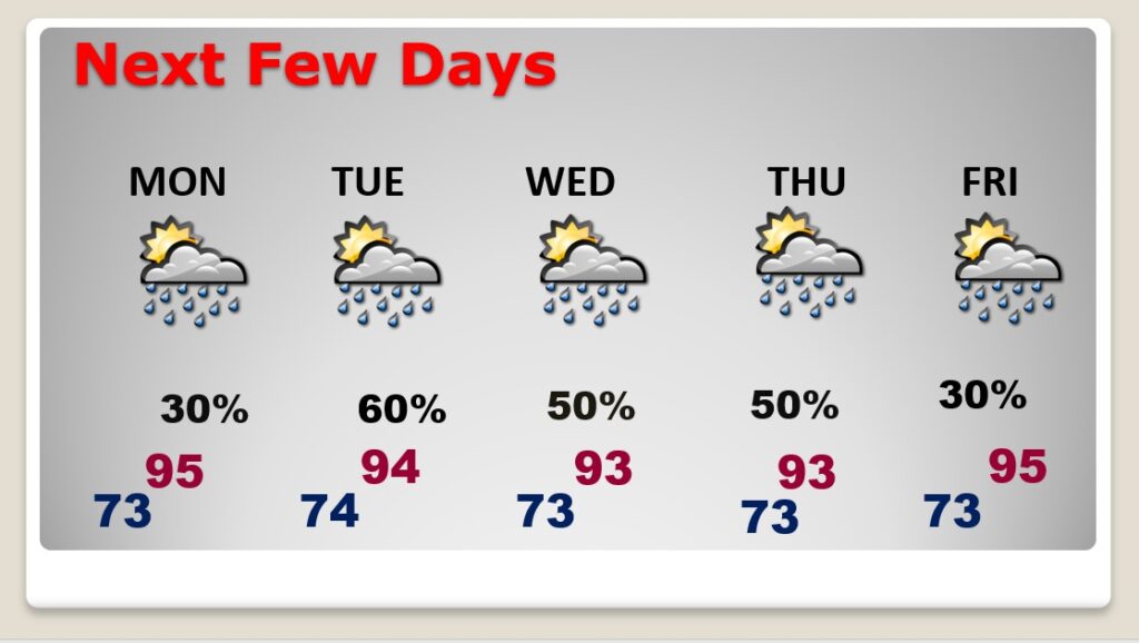
The number of storms will increase again by Tuesday. Storms will become scattered to numerous Tuesday through Thursday. Then, fewer storms, again by Friday. Otherwise no “big ticket” weather in on the menu. And, the tropics remain quiet.
CLIMATE DATA: Yesterday’s high in Montgomery was 96, with a Heat Index as high as 104. Morning low 76. Normal High/Low 94 and 72. Rainfall: 0.26”. Sunrise at 6:00 AM
TODAY: Hot & Humid. High 96. Heat index 102 to 105. Any random storms today will be few and far between by this afternoon and this evening. Low tonight 73.
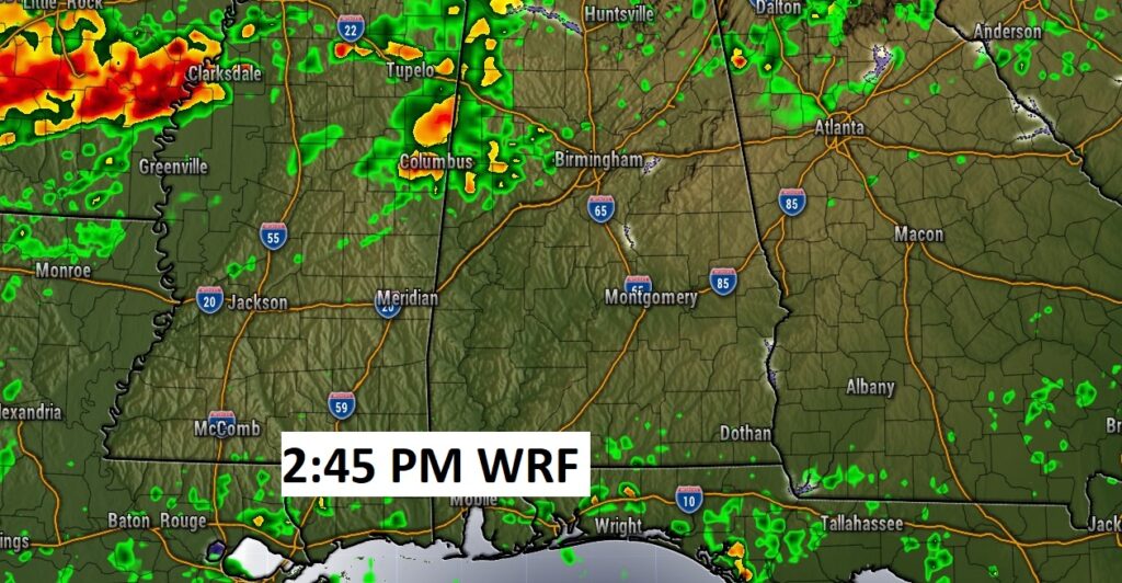
Here’s a Future Radar example this afternoon. Showers and storms will widely scattered.
NEXT FEW DAYS: Not much day-to-day change. Widely scattered storms Monday. The number of storms will increase again by Tuesday. Storms will become scattered to numerous Tuesday through Thursday. Then, fewer storms, again by Friday. Generally low to mid 90’s each day.
.
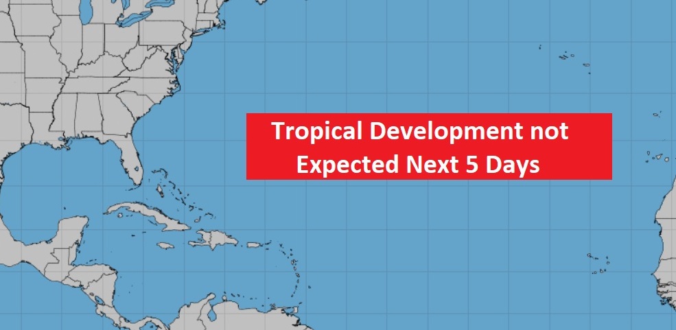
TROPICS: The Tropics are still quiet…for now.
.
I’ll have another update for you in the morning. Have a nice Sunday!
–Rich