
Good Morning! Here’s my brief video forecast discussion.
CLIMATE DATA: Yesterday’s high in Montgomery was 93, with a Heat Index as high as 102. Morning low 74. Normal High/Low 94 and 72. Rainfall: 0.23”. (East Montgomery Rainfall: 2.27”. Two day total 3.66”) Sunrise at 6:02 AM.
TODAY: Hot & Humid, again. Today’s High near 93. Heat index 100+. Scattered to numerous, but random showers & thunderstorms mainly in the afternoon & evening. Locally heavy downpours Low tonight 73.
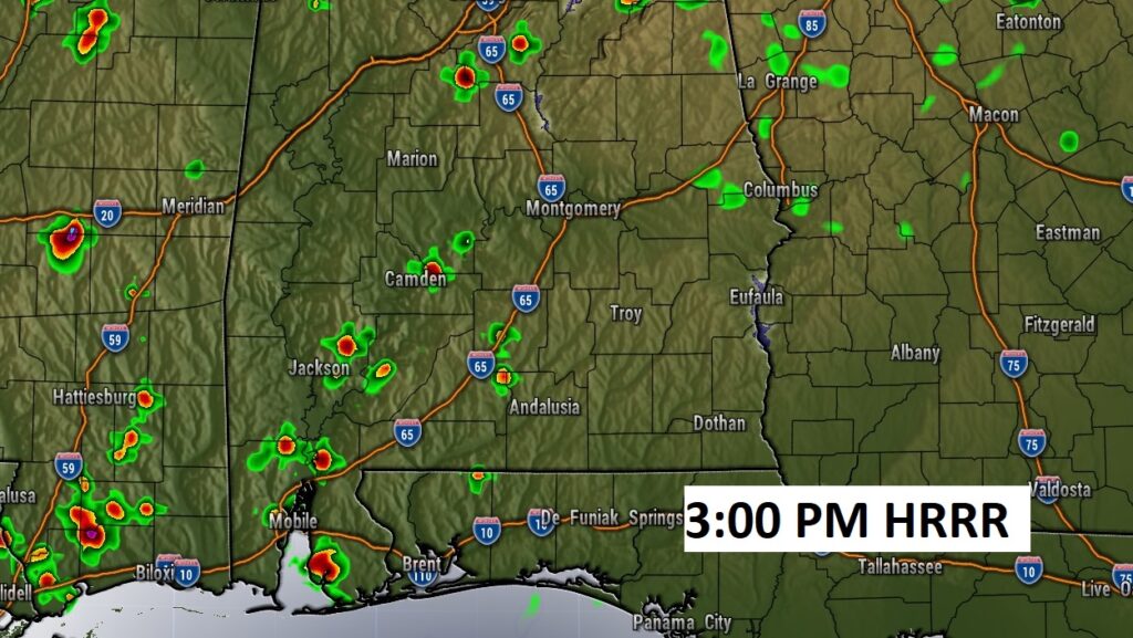
Future Radar examples is underdone. The models are struggling. Showers and storms will be much more numerous than this….again.
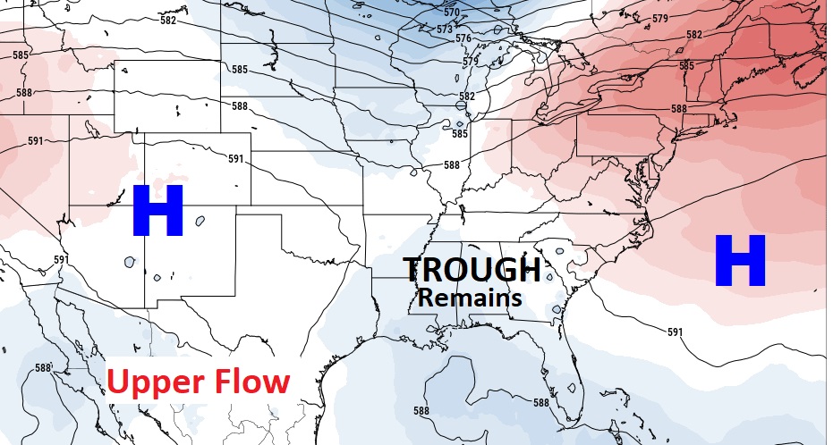
A weakness in the upper atmosphere will promote better than normal rain chances through Thursday, Storms thin out a bit Friday.
.
.
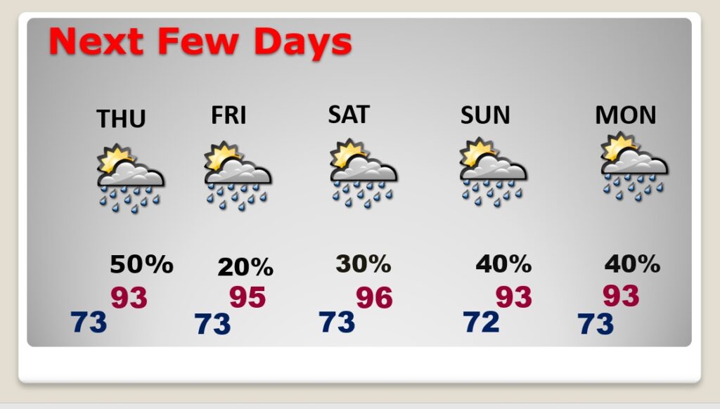
NEXT FEW DAYS: Better than normal Rain continue through Thursday. Scattered to numerous random afternoon & evening storms. Rain chances return to a more routine summertime normal Friday & Saturday. Highs in the low to mid 90’s. Triple digit heat indices. Lows at night in the low to mid 70’s. Rain coverage is a little better, again on Sunday and Monday.
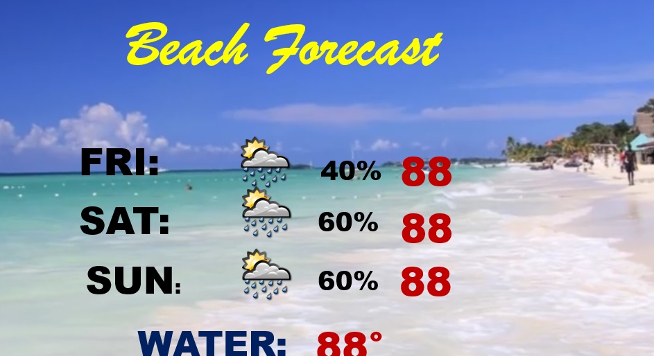
BEACH FORECAST: Elevated rain chance continues. Scattered to numerous storms especially Saturday & Sunday. High in the upper 80’s. Gulf water temperature 88.
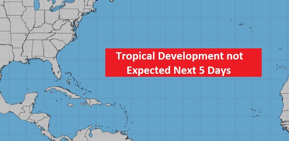
TROPICAL OUTLOOK : I’m happy to say….The tropics are STILL very quiet for now.
—
Thanks for reading this Blog this morning! This morning we are LIVE on the radio from 6 to 9 on NewsTalk 93.1. Watch us on TV on CBS 8 and ABC 32. I’ll have another update for you in the morning. Have a nice day.
–Rich