Good Morning! Here’s my brief video forecast discussion.
CLIMATE DATA: Yesterday’s high in Montgomery was 86, Morning low 73. Normal High/Low 94 and 72. Rainfall: 0.56. Sunrise at 6:12 AM. Sunset 7:27
TODAY: Radar will quite active again today. Limited sunshine. Mostly cloudy. Scattered to numerous showers & storms, just about anytime. High 86. Low tonight 72.
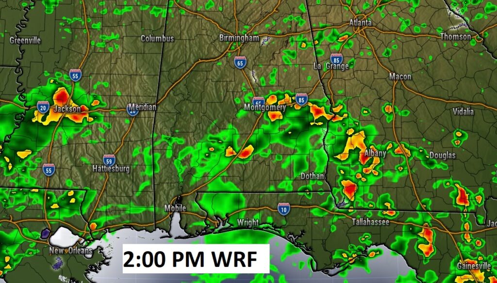
Here’s a Future Radar Example at mid afternoon. Very active across the entire Gulf South The action could begin late morning. A few stronger storms are possible.
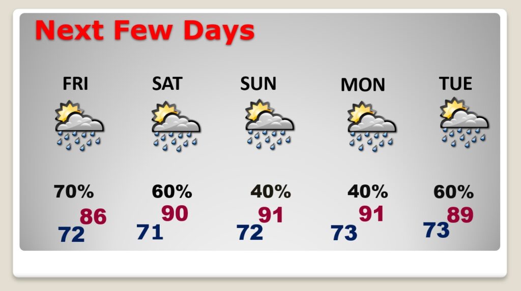
NEXT FEW DAYS: Scattered to numerous showers and storms will continue at least through Saturday. High temperatures will be down a notch by through Saturday, with increased showers & storms. Mid to Upper 80’s Thursday through Saturday. Lows at night in the low 70’s. Fewer storms Sunday and Monday.
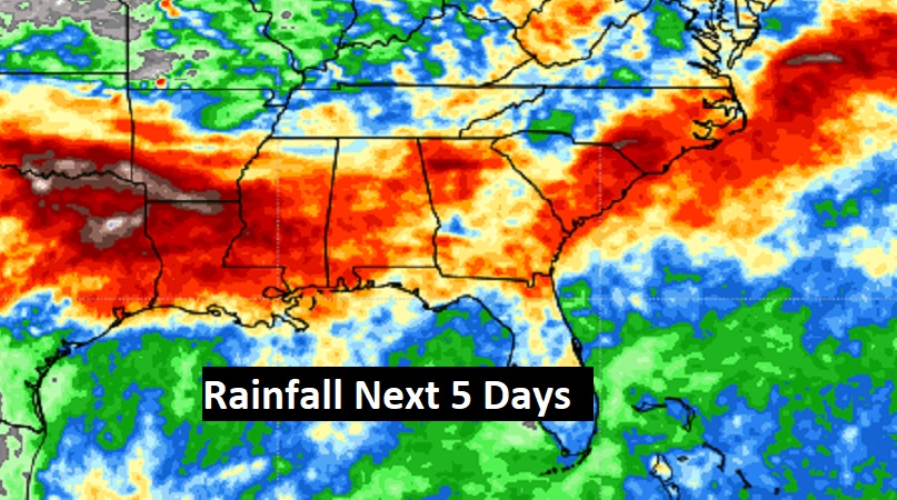
Potentially wet times across the Gulf South next few days.
.
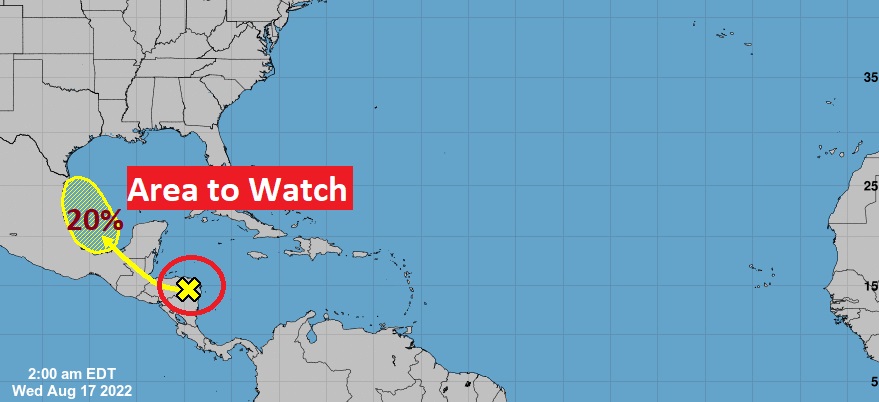
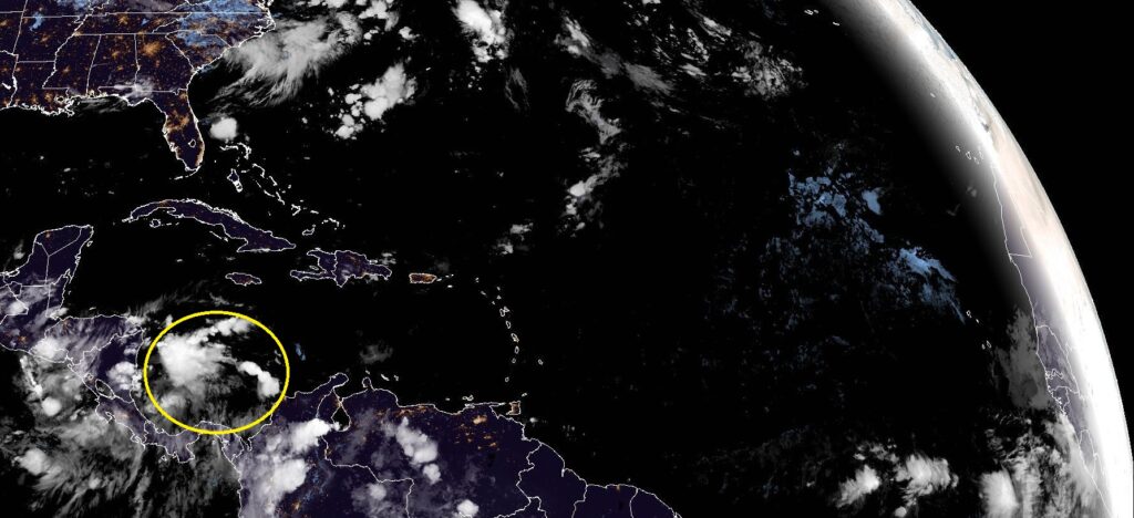
TROPICAL OUTLOOK: NHC is still monitoring a disturbed area near the coast of Costa Rica. They have outlined an area in the western SW Gulf with a 20% chance of development in the next 5 days. The rest of the Atlantic Basin is still quiet.
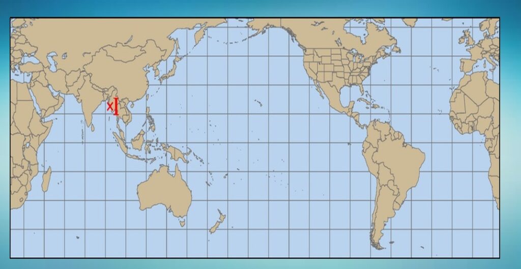
And once again, there are NO tropical cyclones anywhere in the world right now. Just one Invest in the Indian ocean. Amazing.
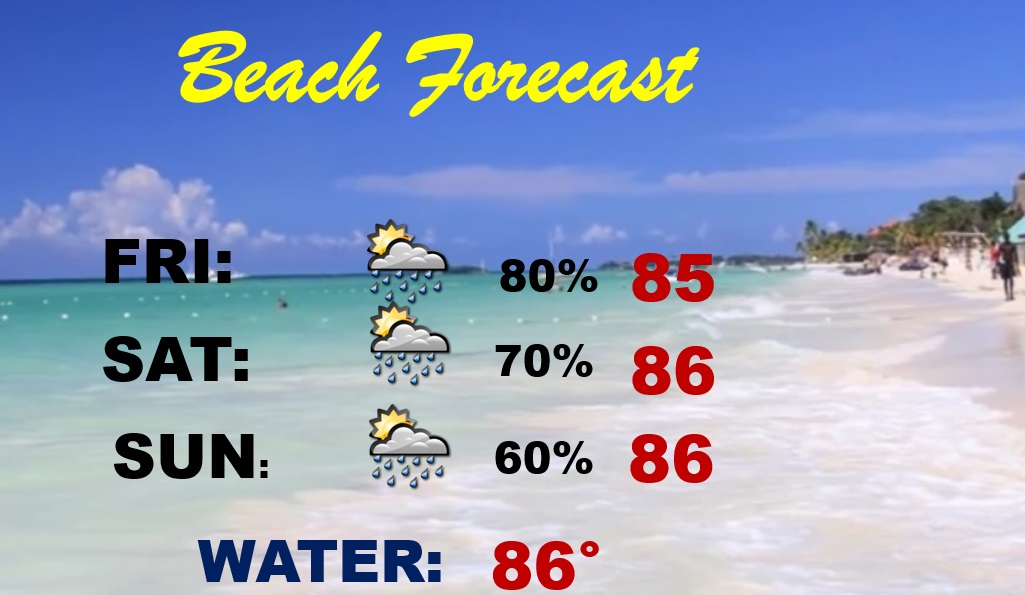
BEACH FORECAST: Once again this weekend, the rain chances are quite high, unfortunately. Scattered to numerous storms. Highs in the middle 80’s. Gulf Water temperature is still a warm 86.
Thanks for reading this Blog this morning! This morning we are LIVE on the radio from 6 to 9 on NewsTalk 93.1. Watch us on TV on CBS 8 and ABC 32. I’ll have another update for you in the morning. Have a nice day.
–Rich