
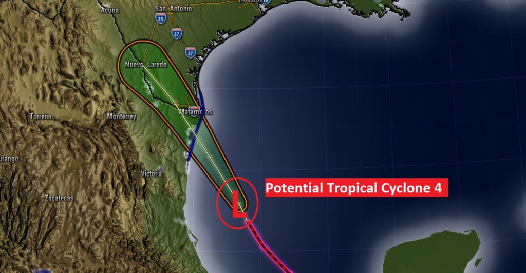
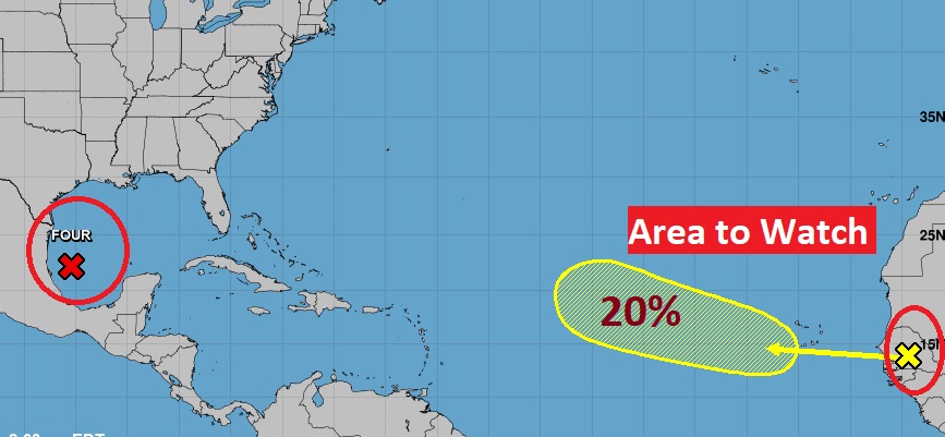
The Tropics are starting to come alive. In the southwest Gulf, Potential Tropical Storm Four is located 370 miles from the mouth of the Rio Grande, moving northwest 14 mph. Tropical storm Warning continues for the lower Texas coast.
CLIMATE DATA: Yesterday’s high in Montgomery was 85. Morning low 73. Normal High/Low 94 and 71. Rainfall: 0.01. Sunrise at 614 AM, Sunset 7:23.
TODAY: Limited sunshine. High upper 80’s to near 90. Again today, there will be a generous supply of showers and storms, just about anytime, but especially in the afternoon & evening. Some storms will get locally heavy downpours. Low tonight 72.
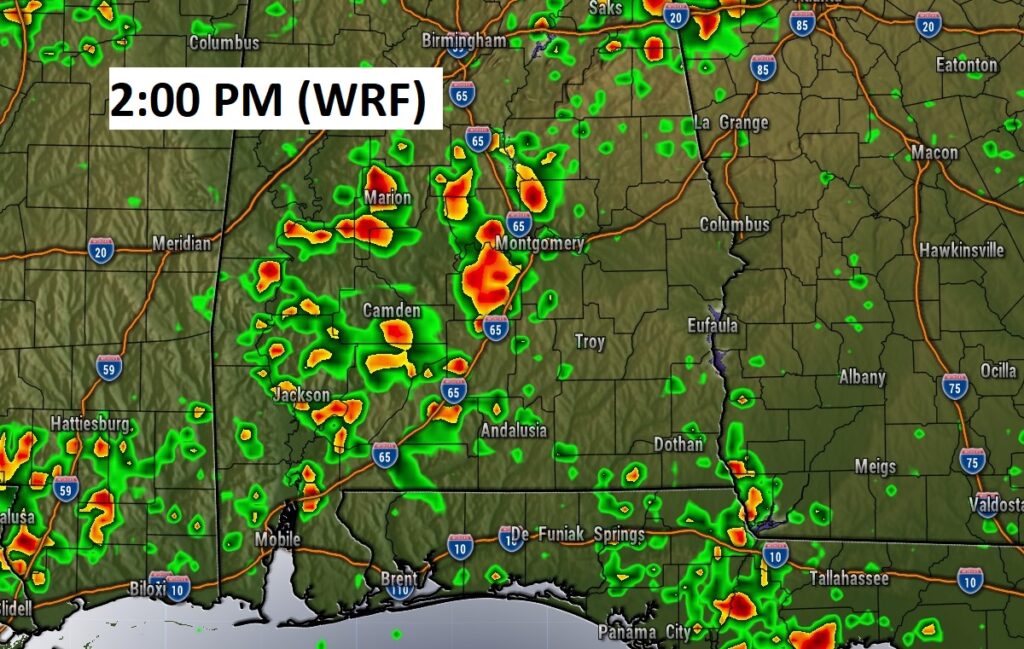
Future radar example shows a very active radar again today. Numerous showers & storms.
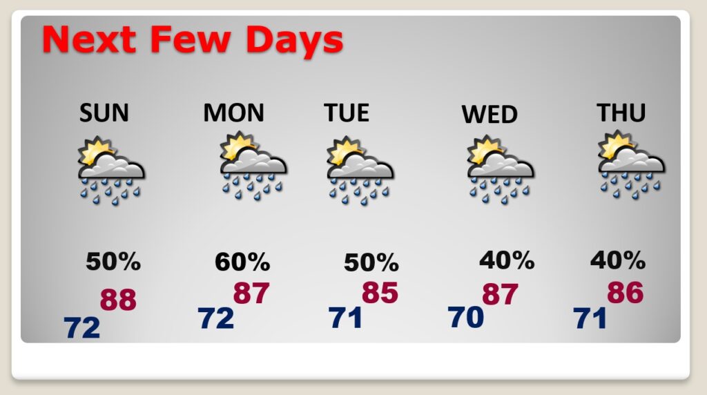
NEXT FEW DAYS: There is a generous chance of random showers & storms daily at least through Tuesday. Highs will be held down by clouds and showers to the 80’s. Lows in the low 70’s. Not quite as many storms by Wednesday & Thursday.
In the western Gulf … PTC 4 is bringing heavy rain to coastal Texas. Potential Tropical Storm Four is located 370 miles from the mouth of the Rio Grande, moving northwest 14 mph. Tropical storm Warning continues for the lower Texas coast. It is still uncertain whether the circulation will close before the system reaches the coast tonight & Sunday. If the circulation closes, the system will become a Tropical Depression or Tropical Storm Danielle. Air Force Recon will visit the system this morning.
Elsewhere in the tropics, a Tropical Wave is coming off the African coast. Area to Watch in the Tropical Atlantic with a 20% chance of development in the next 5 days.
—
I’ll have another Blog update in the morning from here in Pittsburgh at the National Weather Association Conference.

Have a nice weekend!
–Rich