
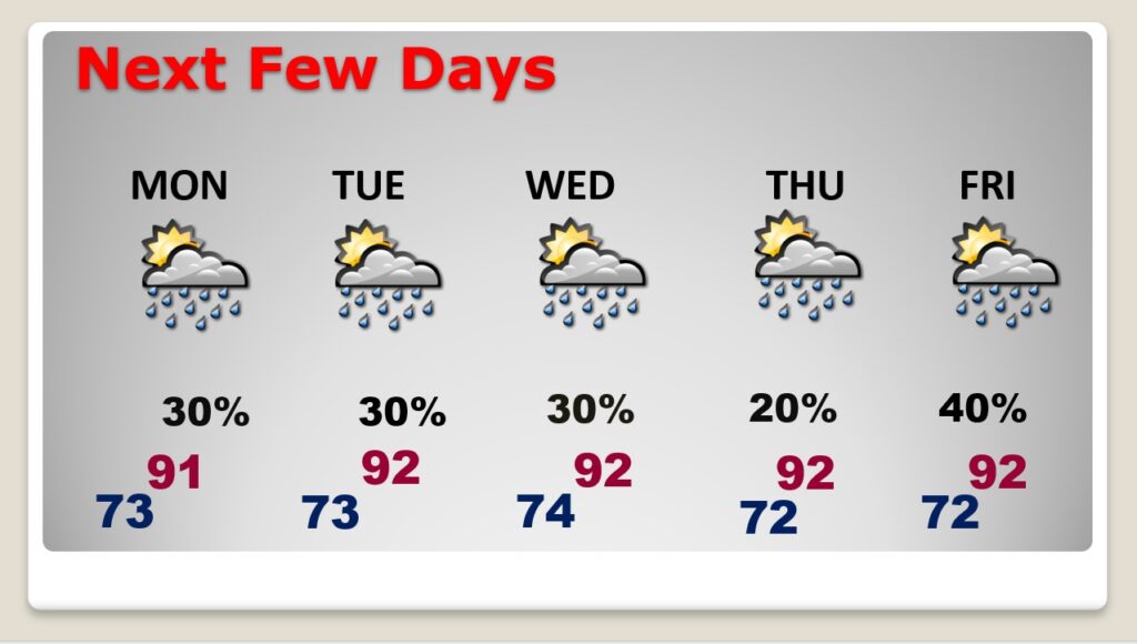
Good Morning! It’s been a wet week and an extremely wet August. Yesterday there was flooding rainfall amounts in the Montgomery area. Random showers and storms will continue in the forecast each of the next several days, but the probability of rain is coming down just a bit. Not as many storms on the radar. Highs will generally be in the lower 90’s.
Meanwhile the tropics are really starting to come alive. There are two Invests and two Area’s to Watch. Invest 91-L is the star of the show, with a 60% chance of development. We also have our eyes on that Area to Watch in the NW Caribbean could have Gulf of Mexico implications by Labor Day Weekend.
CLIMATE DATA: Yesterday’s high in Montgomery was 94. Morning low 72. Normal High/Low 93 and 71. Rainfall at the Airport: 0.92”. That takes the total rainfall for August to 10.08”. At my house in East Montgomery, I had 1.51” Saturday. My total for August is now 14.25”. Sunrise at 6:19 AM. Sunset 7:16 PM.
TODAY: Partial sunshine High near 90. Scattered random showers and storms will be most numerous in the afternoon & evening hours. Low tonight 72.
NEXT FEW DAYS: Random showers and storms will continue in the forecast each of the next several days. Daytime highs in the upper 80’s to near 90.. Lows in the low 70’s.
TROPICS: The tropics are really starting to come alive. There are two Invests and two Area’s to Watch.
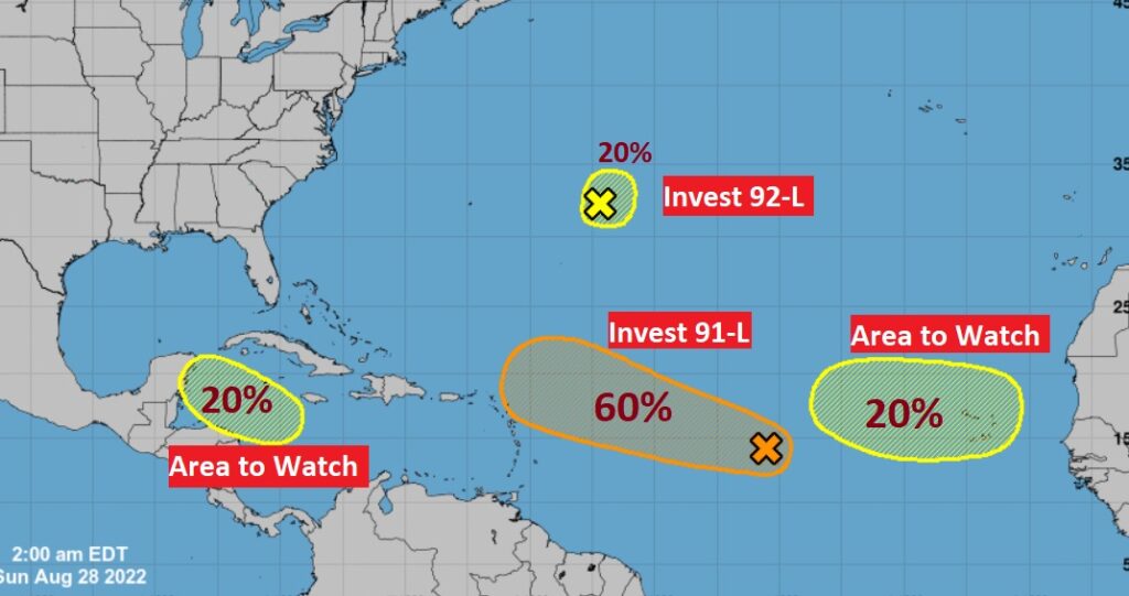
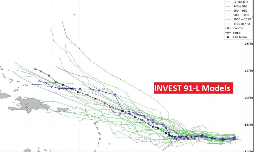
Invest 91-L is the star of the show, with a 60% chance of development. Could this system be a threat to the Bahamas in the next 6-8 days? Maybe. We’ll see.
We also have our eyes on that Area to Watch in the NW Caribbean could have Gulf of Mexico implications by Labor Day Weekend.
.
I’ll have another Blog update in the morning from here in Pittsburgh at the National Weather Association Conference. Have a nice weekend!
–Rich