
Good Morning! Here’s my brief video forecast discussion.
CLIMATE DATA: Montgomery had a high of 91 yesterday, after a morning low of 71. Normal Hi/Lo: 93 and 70. Airport rainfall: 0.00 The Montgomery Airport has now had 10.08” of rain in the month of August. Sunrise: 6:19, Sunset 7:12.
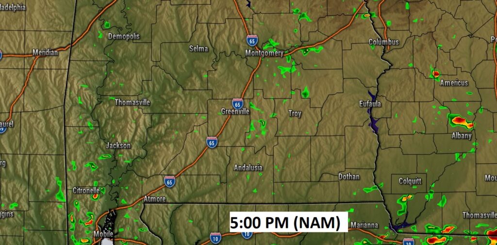
TODAY: Heat, humidity with “hit or miss” storms. That’s the main theme today. Random scattered showers & storms, especially in the afternoon & evening. Locally heavy downpours. High in the lower 90’s. Low tonight 72.
The Hi-res Future radar Models look underdone to me.
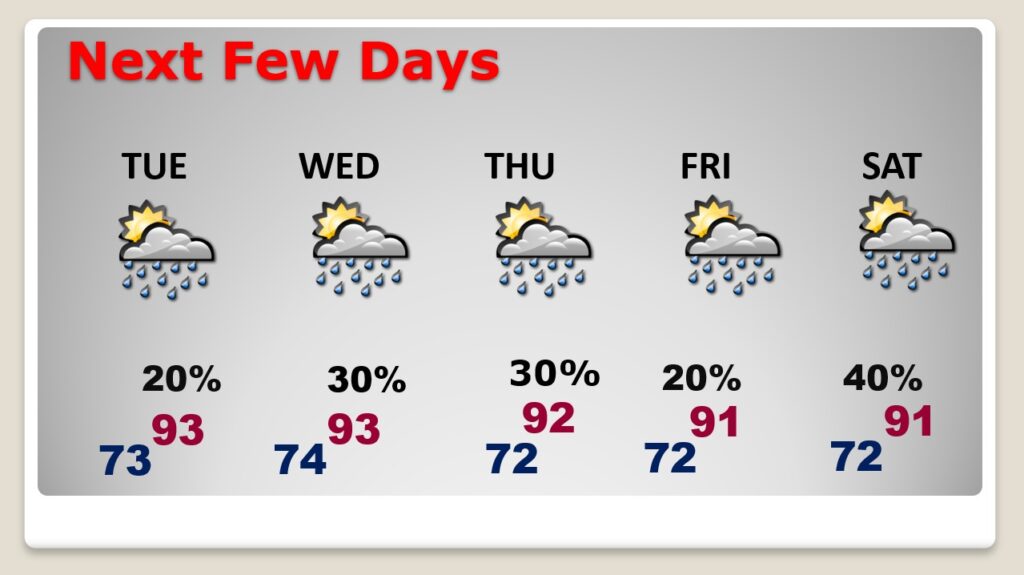
NEXT FEW DAYS: Routine forecast for the rest of the week as August ends and September begins. More scattered random storms will continue each. Little day to day change. Highs mainly in the lower 90’s through Thursday. Lows at night in the low 70’s.
.
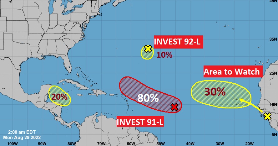
TROPICAL OUTLOOK: There are two INVESTS and two Area’s to Watch. The star of the show is Invest 91-L in the Tropical Atlantic. It now has an 80% chance of development. The next available name is Dannielle. Elsewhere, there is another Area to Watch in the Caribbean. It also currently has a 20% chance of development, in the next 5 days. This could have Gulf of Mexico implications over the next few days
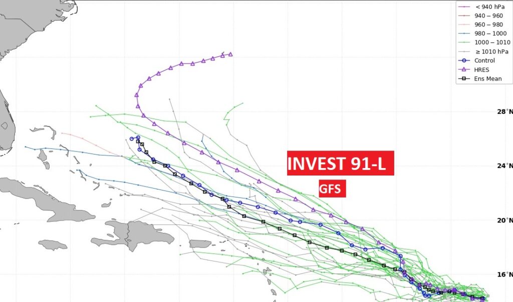
Here’s the GFS Ensembles spaghetti models on Invest 91-L. Some of the model members point this system toward the Bahamas and the SE US. Other models take this system out to sea. Stay tuned.
Thanks for reading this Blog this morning! This morning we are LIVE on the radio from 6 to 9 on NewsTalk 93.1. Watch us on TV on CBS 8 and ABC 32. I’ll have another update for you in the morning. Have a great day!
–Rich