
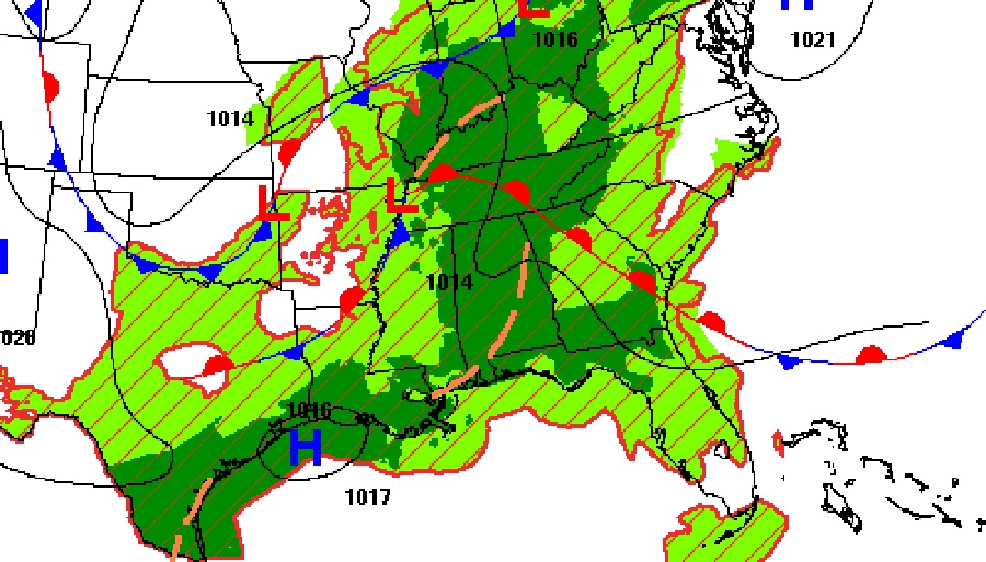
Good Morning! The atmosphere is primed for a generous supply of those random showers & storms today and on Labor Day Monday.
Here’s a brief hello and intro from my couch this morning!
CLIMATE DATA: Yesterday’s high in Montgomery was 90. Morning low 75. Normal High/Low 92 and 69. Rainfall at the Airport: TRACE. (East Montgomery .35”) Sunrise at 6:23 AM. Sunset 7:05 PM.
TODAY: Clouds will dominate much of the time. High near 88. Scattered to numerous random showers and storms will be most common in the afternoon & evening hours. Locally heavy downpours. Low tonight 73.
Radar will be quite colorful again today. Numerous but random storms. Here’s a couple of Future Radar examples.
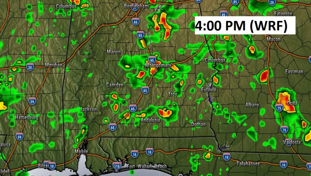
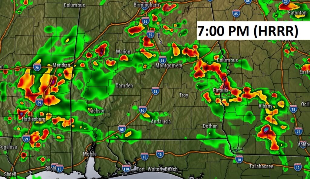
The “juicy” airmass with a better than normal chance of rain will stay in place through Monday.
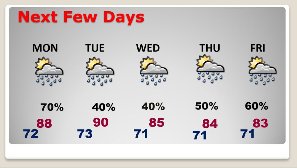
NEXT FEW DAYS: Random showers and storms will be quite numerous through Labor Day Monday. Storms will tend to “thin out in number” Tuesday through Thursday. Not as many storms. Daytime highs mostly in the 80’s. Lows in the low 70’s.
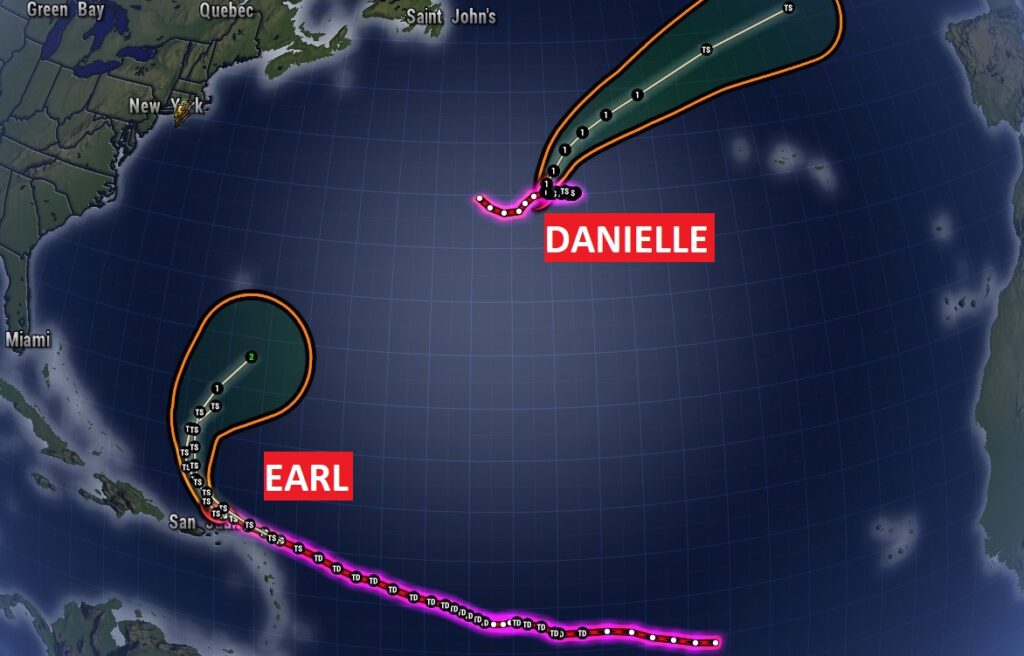
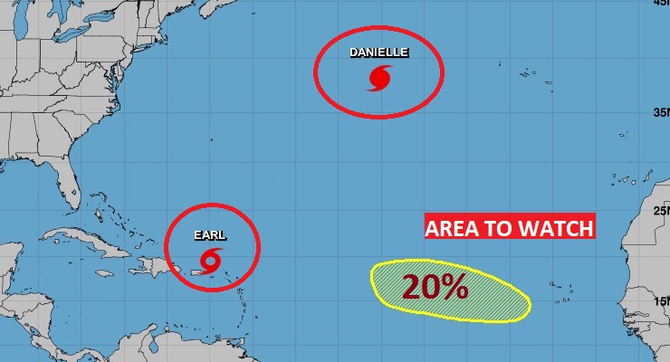
TROPICS: Danielle is a Hurricane in the far north Atlantic. In the Tropical Atlantic. Max winds now 75 MPH. Tropical Storm Earl, wind winds of 50 mph. It is expected to curve into the open Atlantic, and eventually become a hurricane. It will not affect North America.
There is also a new Area to Watch in the far eastern Atlantic with a small 20% chance of development.
.
I’ll have another Blog update in the morning. Have a nice Labor Day weekend!
–Rich