
Good Morning! Here’s my brief video forecast discussion.
CLIMATE DATA: Yesterday’s high in Montgomery was a nice, comfortable 88. Morning low 64. Normal high 90, low 67. Rainfall: 0.00”. Sunrise at 6:31. Sunset 6:49.
TODAY: Sunshine. A little higher on the humidity High upper 80’s to near 90. East wind 5 to 10 mph. Clear tonight. Low 65.
NEXT FEW DAYS: Sunny days will continue. The humidity is creeping up a bit. We should be dry through the week and weekend and well into next week. We’ll be in the low 90’s Sunday and Monday. Mid 90’s will return by next Tuesday & Wednesday. Overnight lows in the 60’s. Dry, storm-free for several days.

Dewpoint is key to our comfort. Dewpoints were in the 50’s Tuesday & Wednesday. That’s nice. Today and Saturday, dewpoints in the lower 60’s. And, probably upper 60’s Sunday. Summer is not done yet.

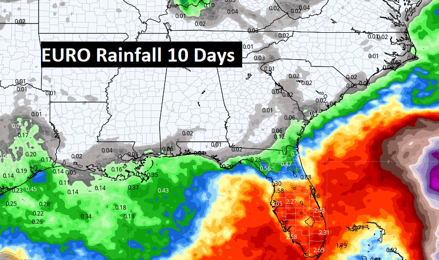
The EURO models still points to essentially dry forecast for about the next 10 days.
TROPICAL OUTLOOK:
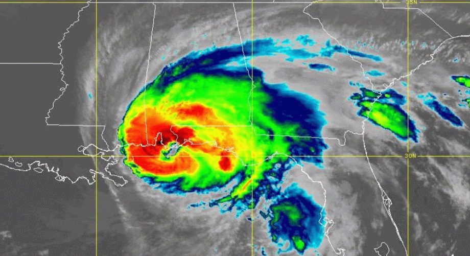
NHC is monitoring Tropical Storm Fiona in the tropical Atlantic with 50 mph. It’s moving west toward the northern Leeward islands. Elsewhere, there’s a new Area to Watch behind Fiona.
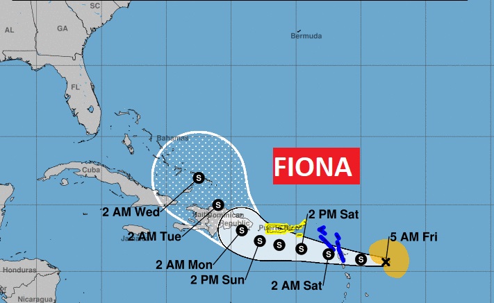
The models simply don’t know what to do with Fiona after 5 days. Some models keep the storm track in the Atlantic. But more and more models suggest a more westward track toward Florida and the Gulf. Stay tuned. Here’s The Euro Model 51 member Ensemble Tracks.

DOUBLE HURRICANE ANNIVERSARY: September 16th is a HUGE Hurricane Anniversary on the Alabama Gulf Coast, with two landfalling hurricanes coming ashore near Gulf Shores, 16 years apart.
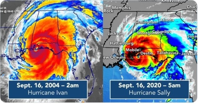
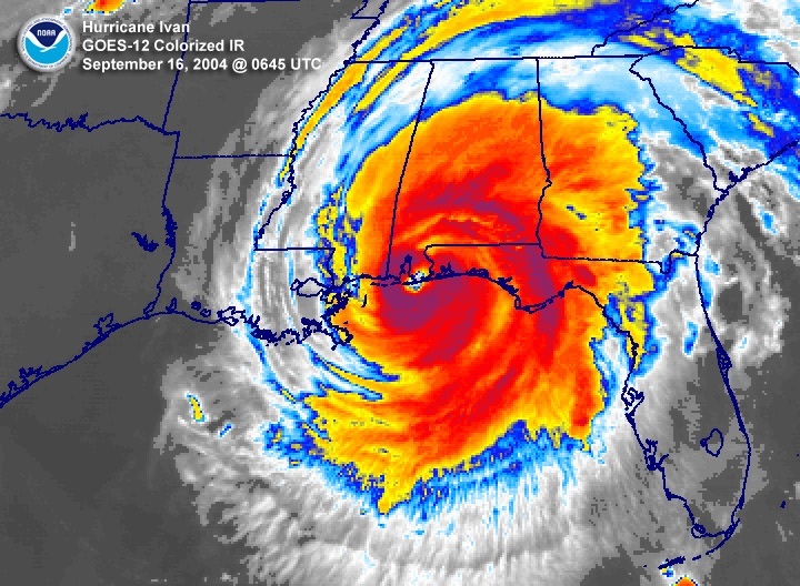
Hurricane Ivan made landfall near Gulf Shores September 16th, 2004. At 1:50 AM on 16 September 2004, powerful Hurricane Ivan made landfall just west of Gulf Shores, AL as a Category 3 Hurricane.
Ivan packed 120 mph sustained surface winds and a historic storm surge, the magnitude and extent of the damage and destruction over Baldwin County in Alabama and Escambia and Santa Rosa Counties in
northwest Florida exceeded that of both Hurricane Frederic (September 1979) and Hurricane Opal (October 1995).
Hurricane Sally made landfall early on the morning of September 16, 2020, near the same landfall point in Gulf Shores, Alabama as Ivan 14 years earlier. Sally went through a period of rapid intensification just before landfall. It came ashore with 105 MPH winds. (High end Category 2) The greatest damage impacts in portions of the western Florida Panhandle and southern Alabama. Heavy rain and widespread flooding was also a major problem.
Thanks for reading this Blog this morning! This morning we are LIVE on the radio from 6 to 9 on NewsTalk 93.1. Watch us on TV on CBS 8 and ABC 32. I’ll have another update for you in the morning. Have a great day!
–Rich