
Good Morning! Here’s my brief video forecast discussion.
TODAY: Sunshine. Hot & dry. But, not too humid. Rain chance 10% at best. High in the mid 90’s. North wind 5 to 10 mph. Mainly Clear tonight. Low 68.
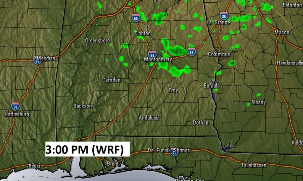
Even though a couple of Hi-res models pain a few showers on Future Radar, I’m ignoring the potential for showers. 10%…
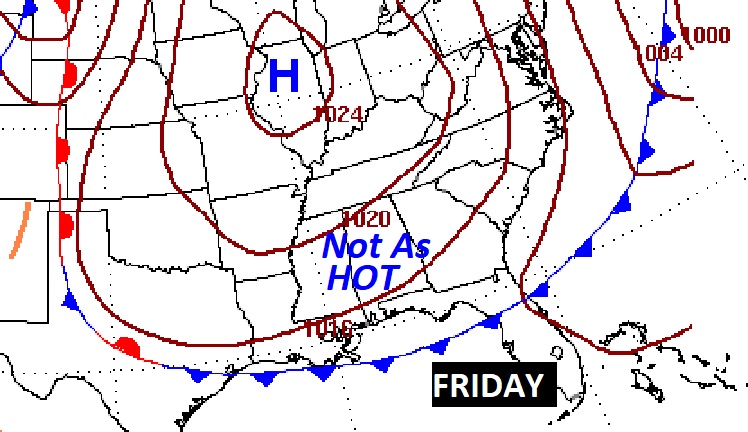
NEXT FEW DAYS: Sunny, warm dry days will continue. Gradually we will be hotter each day through Thursday. We should be dry through the week ahead. Expect mid 90s Wednesday and perhaps upper 90’s on the first day pf Fall, Thursday. Friday will be a little lower, upper 80’s to near 90. Overnight lows in the 60’s. Dry, storm-free for several days.

A late week “dry” front will slip southward through the state Thursday, reaching the coast on Friday AM. That may knock about degrees off the high temperature by Friday.

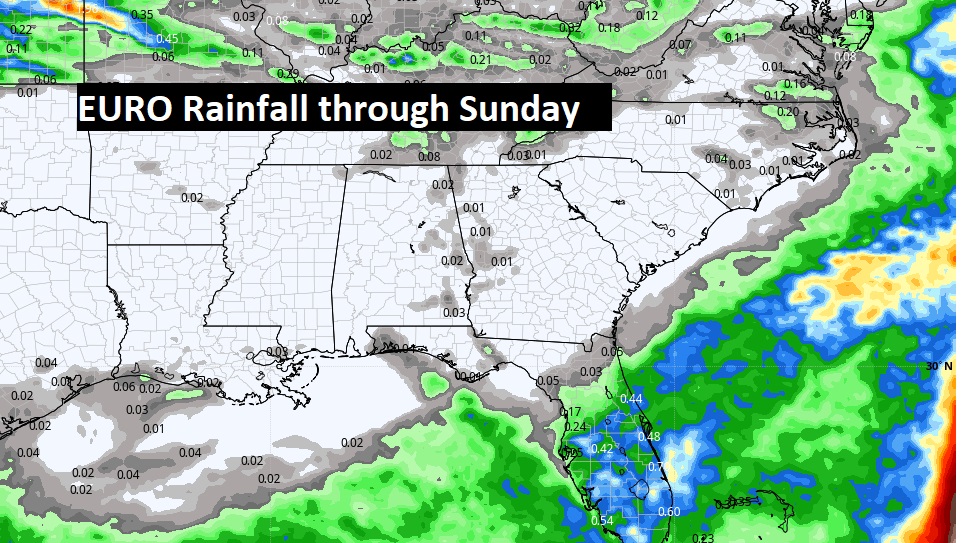
The EURO models still points to essentially a dry forecast for about the through next Sunday.
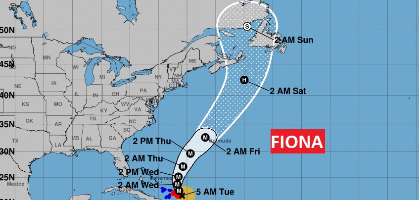
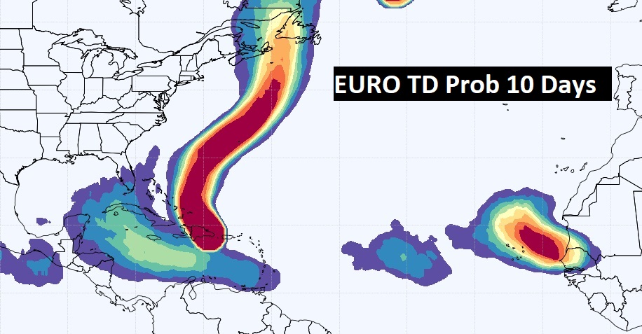
TROPICAL OUTLOOK: Winds in Hurricane Fiona are now up to 115 mph (Cat 3). Hurricane Warnings for the Turks and Caicos Islands. Fiona could have a major impact on Bermuda by Thursday night. It will be on the right side of a Cat 4 hurricane.
Elsewhere, NHC is tracking an Invest 97-L in the central Atlantic, with a moderate 40% probability of development in the next 5 days.
AND…something interesting, at a much lower latitude that we need to keep close tabs on. There is a new area to watch in the Caribbean, with potential Gulf of Mexico implications next week. This system really has my utmost attention.

FALL COUNTDOWN: Fall officially begins Thursday night at 8:04 PM. The Autumnal Equinox.

Thanks for reading this Blog this morning! This morning we are LIVE on the radio from 6 to 9 on NewsTalk 93.1. Watch us on TV on CBS 8 and ABC 32. I’ll have another update for you in the morning. Have a great day! –Rich