
Good Morning! Here’s my brief video forecast discussion, on the last day of Summer.
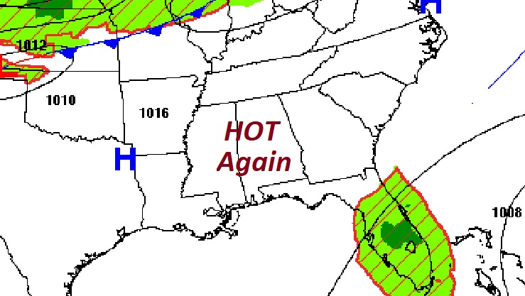
TODAY: Last day of Summer. Sunshine. Hot & dry. High in the mid 90’s. Heat index near or above 100 this afternoon. Northeast wind 5 to 10 mph. Mainly Clear tonight. Low near 70.
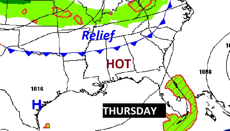
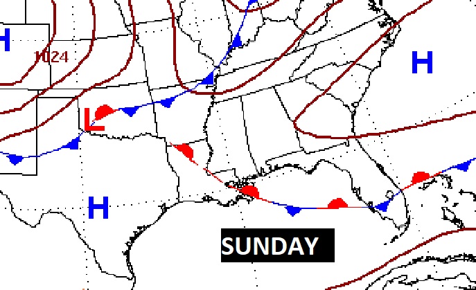
NEXT FEW DAYS: Thursday is the first day of Fall, but it will be nothing but another HOT summer day. High 97. A weak front will drift southward through the state. Behind the front, the high temperature Friday will be about 8-9 days cooler. Lower humidity. Saturday should be dry & warm. Spotty showers are possible Sunday ahead of the next weak front. Behind it, Monday will be much more comfortable.
A late week “dry” front will slip southward through the state Thursday, reaching the coast on Friday AM. Friday will be much more comfortable. Perhaps 8 or 9 degrees cooler than Thursday. Less humid. Nice breeze.
Another front will bring a small rain chance Sunday, followed by nice relief Monday.
TROPICAL OUTLOOK: There are FIVE features being tracked by NHC, including Major Hurricane Fiona, Tropical Storm Gaston, and two Areas to Watch. But, we are only going to focus on ONE disturbance. Invest 98-L in the Tropical Atlantic. It has a 90% chance of becoming a Tropical Depression or Tropical Storm Hermine in the next 5 days.
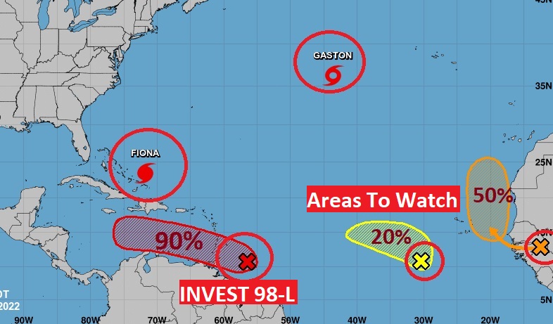
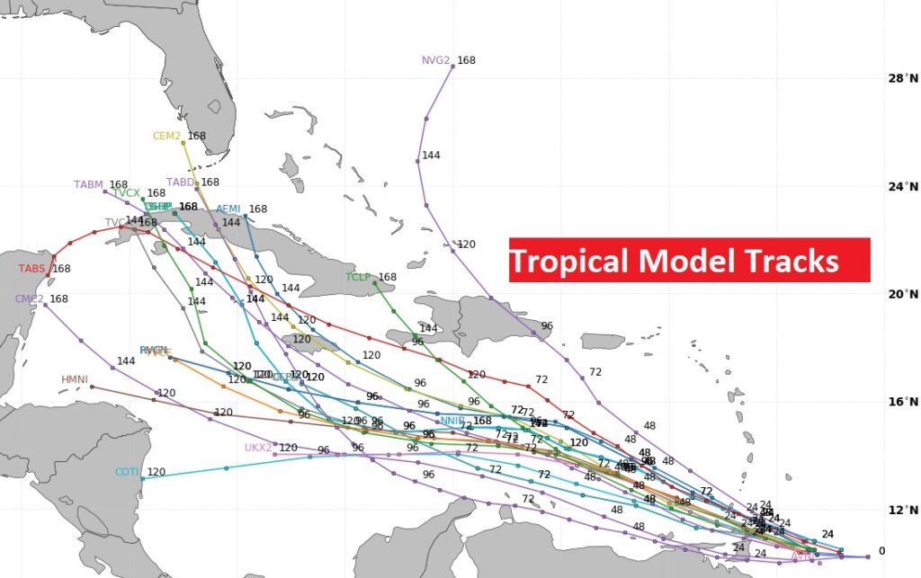
This system needs to be closely monitored. There is a very good chance this system is destined to be a problem in the Gulf of Mexico next week. Let’s check some of the Tropical Model plots, pointing toward the Gulf.
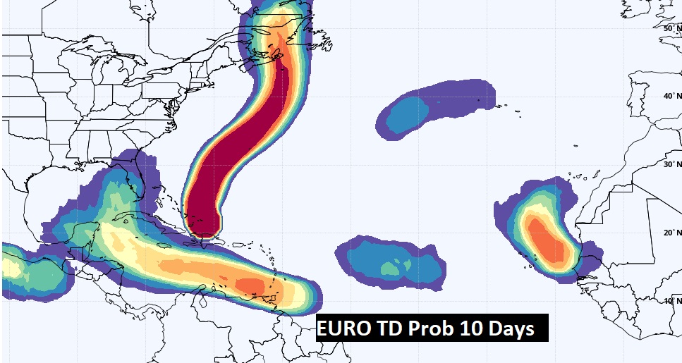
The EURO model also favors the Idea of 98-L reaching the Gulf.
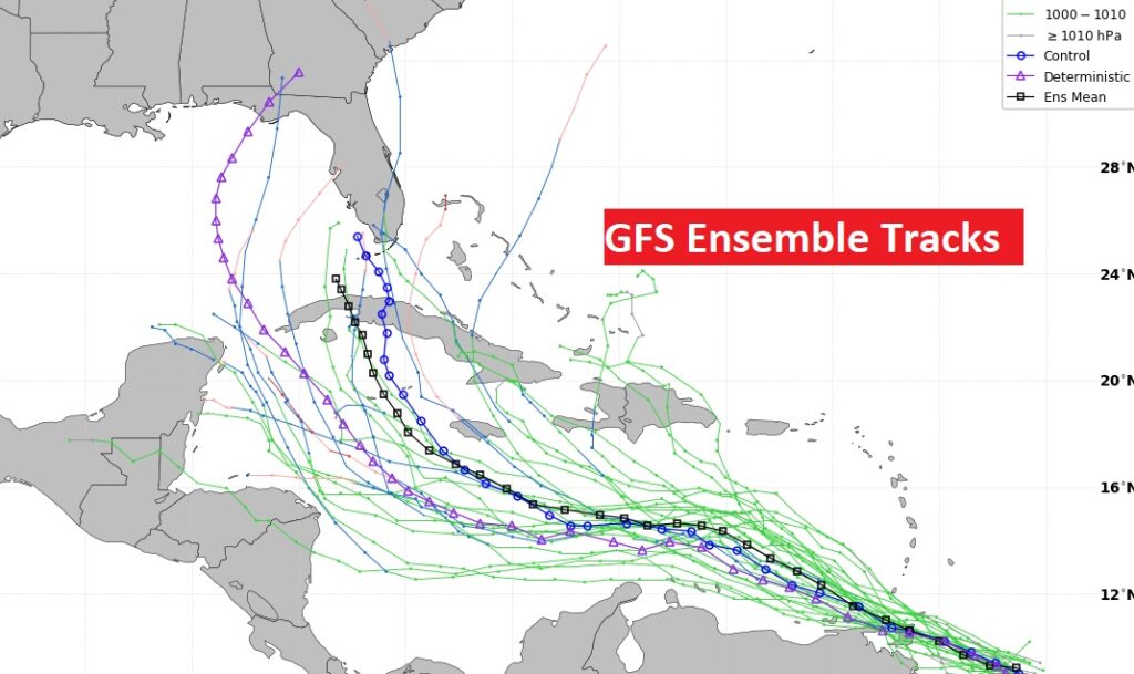
Now here’s the GFS Ensemble tracks. This is why we need to focus on the future of this system in the next 8-10 days.
Thanks for reading this Blog this morning! This morning we are LIVE on the radio from 6 to 9 on NewsTalk 93.1. Watch us on TV on CBS 8 and ABC 32. I’ll have another update for you in the morning. Have a great day!
–Rich