
Good Morning! Happy Sunday! It’s an abbreviate update this morning, because our weather is on cruise control. Our extended strong of very nice Fall Weather will continue.
CLIMATE DATA: Yesterday’s high was 83, after a chilly morning low of 49. Normal: 85/51. Rainfall: 0.00”. Sunrise 6:43, sunset 6:28.
TODAY: Beautiful day today, again. Abundant Sunshine. Nice breeze this afternoon. Comfortable. Low humidity. High in the lower 80’s. NW wind 10 to 15 mph. Clear and pleasantly cool again tonight. Low 56.
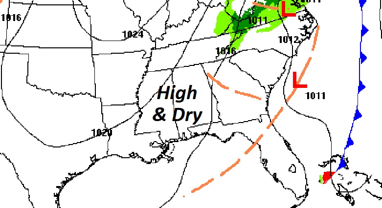
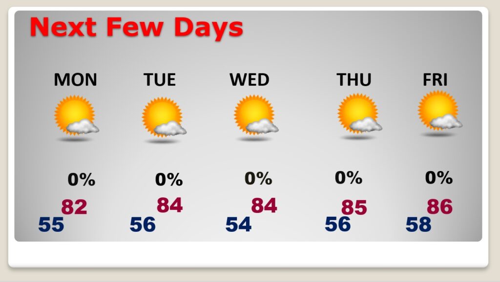
NEXT FEW DAYS: Our great fall Weather continues through for the next several days. We should stay dry and sunny through all of next week. storm-free pattern for us will continue through next week. High mostly in the lower 80’s. Nights will be pleasantly cool, mainly in the 50’s.
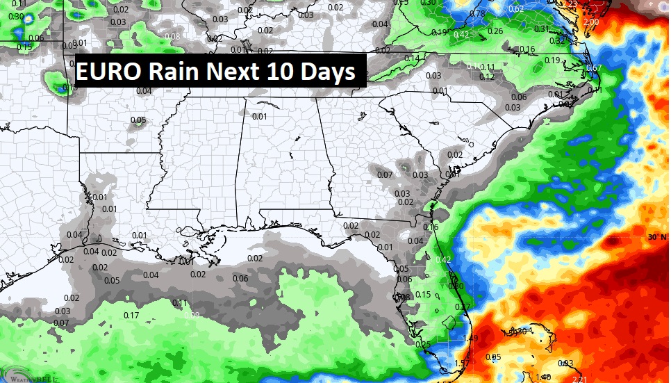
Don’t expect any rain. We should be dry for several more days. Here’s the Euro model through 10 days.
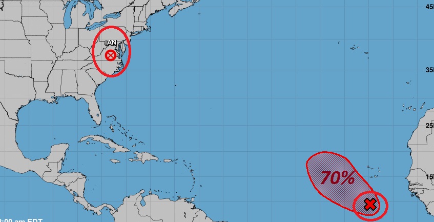
TROPICAL OUTLOOK: Ian is now a post-topical remnant Low over the Middle Atlantic states. It will continue to bring locally heavy rain for much of the northeastern states over the today.
Elsewhere in the Tropics, there is an Area to Watch in the far eastern Atlantic. It has a 70% chance of development in the next 5 days. The rest of the tropical Atlantic is very quiet for now.
Thanks for reading this Blog this morning! I’ll have another update for you in the morning. Have a nice day!
–Rich