
Good Morning! A cold front is sweeping through the state today. There could be a few isolated showers ahead of the front. Today’s high in the 70’s. But, get ready for a huge temperature plunge this week. Very Chilly air follows the front. In fact, we’ll be near record lows by Wednesday & Thursday. A freeze Watch is in effect. First freeze of the season is possible by Wednesday and Thursday mornings, weeks early. Here’s my brief forecast discussion.
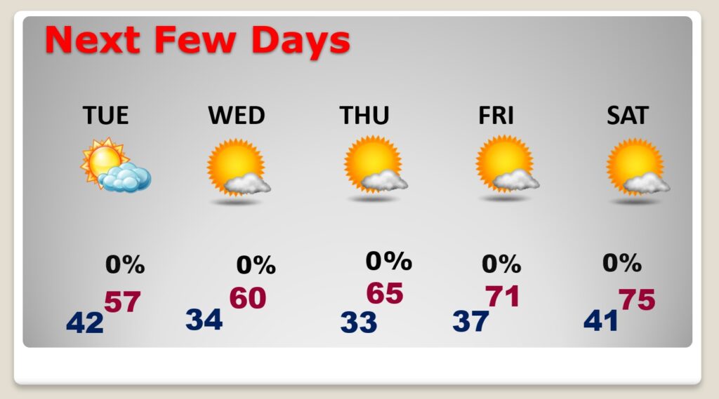
TODAY: A cloudy day. Slight chance of a shower, as the cold front moves through the state. Comfortable. High 75. Winds NW at 6 to 16 and gusty. Partly cloudy, much cooler tonight. Low 42.
NEXT FEW DAYS: Get ready for an early season shocker of a Cold Blast. Tuesday’s high temperature will probably be in the upper 50’s . (If we fail to reach 60 Tuesday, that will be a new record for coolest High) In fact, we’ll be near record lows by Wednesday & Thursday morning. A freeze Watch is in effect. We may be close to the freeze-mark by Wednesday and/or Thursday morning. We’ll start to warm back into the 70’s by Friday and Saturday.
Unusually chilly air is on the way. Kind of an early season shocker.
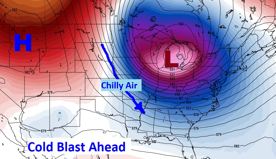
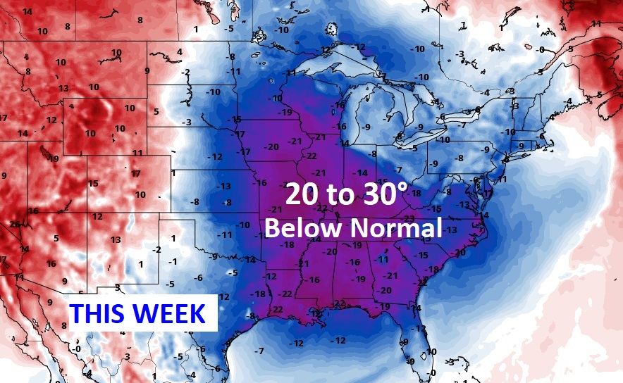
Here’s a sample of the potential lows on Wednesday & Thursday morning. First freeze of the season is likely for many towns. . Average first frost is November 8th. Average first Freeze is November 18th. This is pretty amazing air. Ready or not, here it comes.
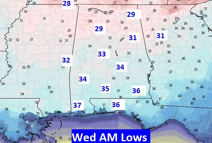
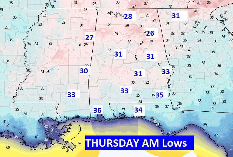
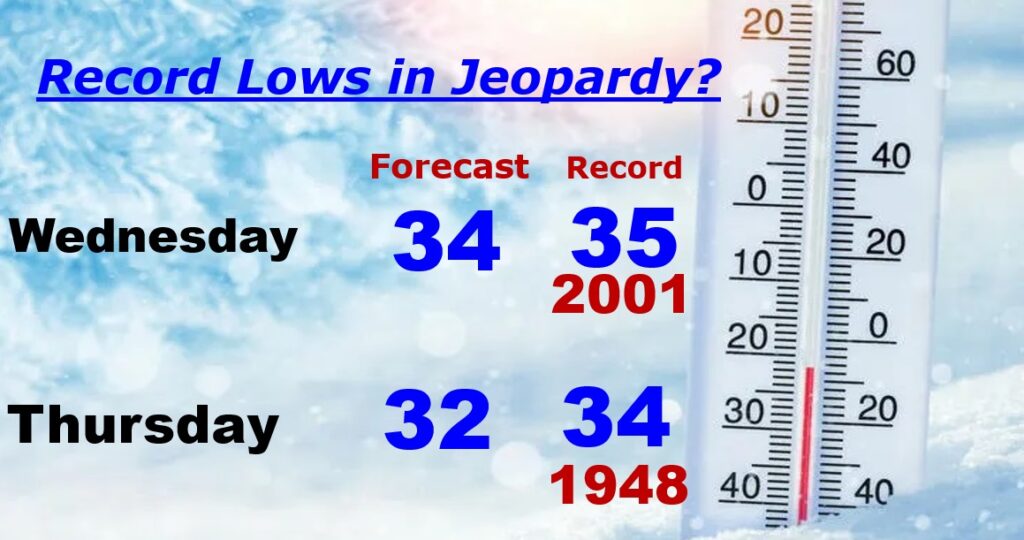
RECORD LOWS IN JEOPARDY: Wednesday’s Montgomery record low of 35 and Thursday’s record low of 34 are very much in jeopardy.
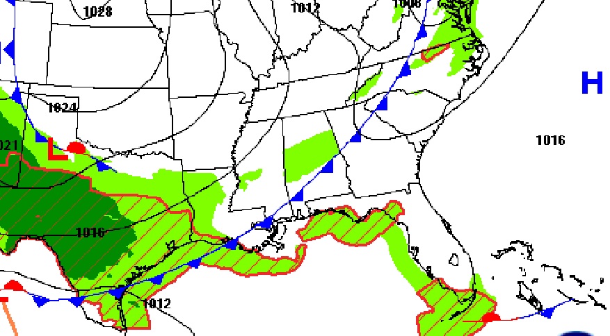
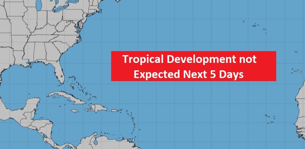
TROPICAL OUTLOOK: I’m happy to say the Tropics are completely quiet for now.
Thanks for reading this Blog this morning! I’ll have another update for you in the morning. Have a nice day!
–Rich