
Good Morning! A cold rain will make for a miserable morning commute. The rain should be mainly light, and mainly confined to the first half of the day. Meanwhile, there’s more very chilly air in our future. We should stay below normal for the next several days. But, there’s no severe weather concerns for the next week or so. Here’s my brief forecast discussion.
TODAY: A cold rain will make for a miserable morning commute. The rain should be mainly light, and generally during the first half of the day. We should see improvement this afternoon. East wind 6 to 12 mph. High today in the upper 50’s. Mostly cloudy tonight. Chilly. Low near 40.
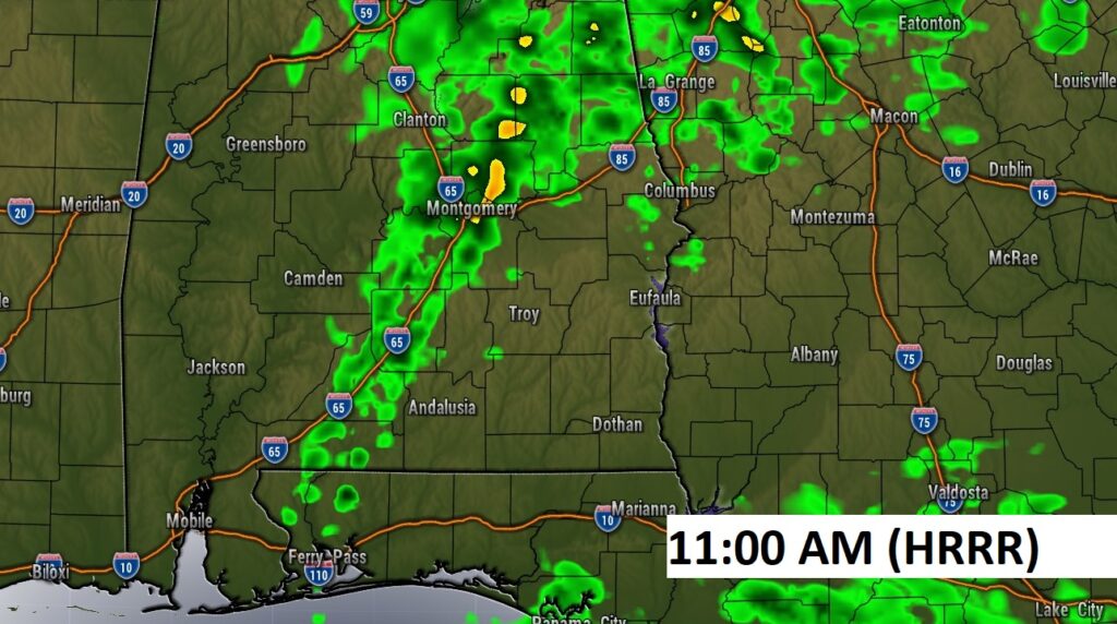
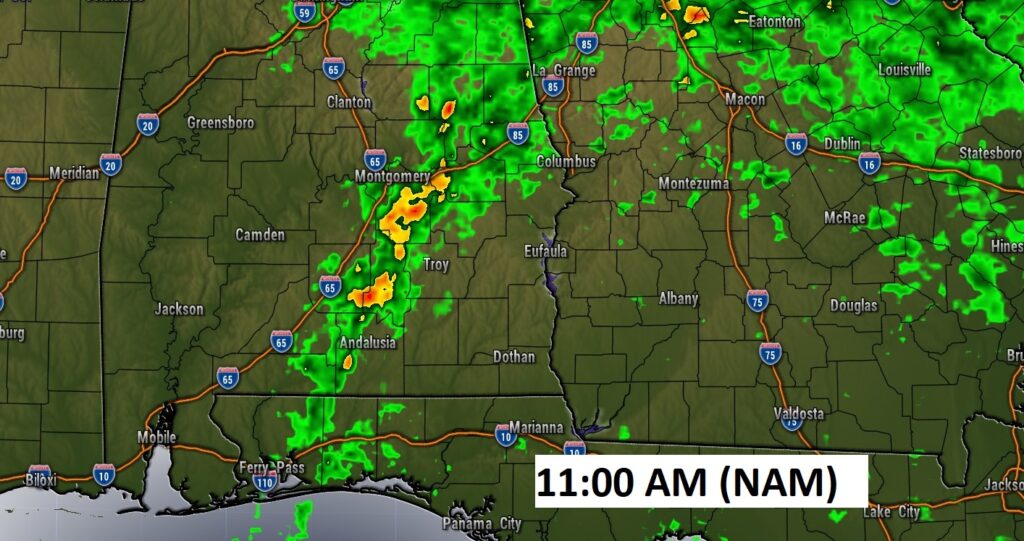
Here’s a couple of Future radar snapshots. Looks like the back edge of the rain will clear much of the area by Noon.
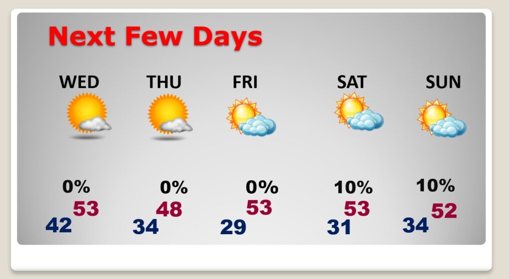
NEXT FEW DAYS: Wednesday through Saturday will be chilly. Low to mid 50’s Wednesday. Thursday’s high may not reach 50. Lows at night at or below freezing. The weekend should be dry. I have the rain chance about 10% both days.
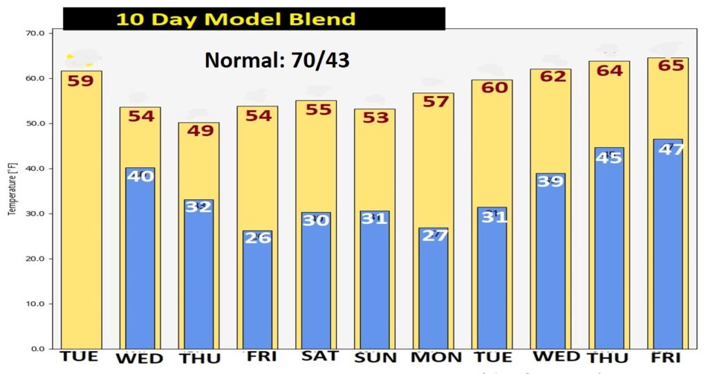
Here’s the model temperature blend for the next 10 days. Normal high 70. Normal Low 43. Temperatures will be a little more reasonable on Thanksgiving Week. But, still averaging below normal.
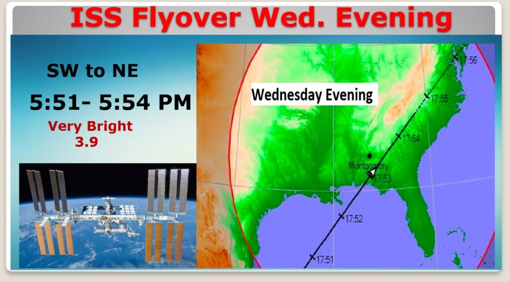
SPACE STATION FLYOVER WEDNESDAY: There will be an excellent Space Station (ISS) flyover Wednesday evening from the SW to the northeast, almost overhead. Look in the southwest sky around 5:51 PM. Should be very bright, 3.8 magnitude. Always worth your time.
Thanks for reading this Blog this morning! This morning we are LIVE on the radio from 6 to 9 on NewsTalk 93.1. Watch us on TV on CBS 8 and ABC 32. I’ll have another update for you in the morning. Have a nice day! –Rich